Some links on this page are affiliate links: if you buy through them we may earn a commission, at no extra cost to you.
Reliable satellite analysis starts by separating what the sensor actually observed from what clouds, shadows, snow, acquisition gaps, and processing artifacts hide. Mask cloudy and invalid pixels with per-pixel quality data, preserve NoData and observation counts, and create documented clear-pixel composites rather than averaging every scene. Fill gaps only when the scientific question permits estimation, label every filled value with its age and uncertainty, and compare equivalent seasonal windows after harmonizing sensors. This approach prevents a sparse, cloud-biased record from being mistaken for a real environmental trend.
What does cloud cover mean in a satellite time series?
Cloud cover is not just the percentage reported for an entire scene. For a pixel, ESA defines cloud-cover frequency as the number of cloudy observations divided by the total number of valid observations. That per-pixel frequency tells you whether a particular field, lake, forest, or urban block was repeatedly obscured, even when the scene-level percentage looks acceptable.

As an Amazon Associate I earn from qualifying purchases.
What’s actually slowing this PC down?
Pick the symptom - the matching free tool is one click away.
A scene can have a low overall cloud percentage while your area of interest is cloudy in every acquisition. Conversely, a scene with a high percentage can still contain a useful clear patch. Record both the scene metadata and pixel-level availability, but base pixel analysis on the quality mask and valid-observation count.
Why scene percentages can mislead
- Clouds are spatially clustered, so a clear scene average does not guarantee clear pixels where you need them.
- Cloud shadows may fall over a different part of the scene and remain dark enough to resemble water or vegetation.
- Thin clouds, haze, bright sand, snow, buildings, and beaches can confuse automated classifiers.
- Repeated acquisitions may be clear only during unusual weather, creating an observation bias in the time series.
There is no universal cloud-percentage cutoff that works for every sensor, biome, latitude, or objective. ESA describes the acceptable threshold as user-defined; it should be tied to the minimum number of valid observations and the temporal question you are asking.
#1 Best Overall

- [Ultra-Lightweight Ear Buds Designed for Small Ears] Each earbud weighs only 3.7g and features a compact, ergonomic in-ear design made especially for small ears. Secure, low-profile, and comfortable for workouts, all-day wear or overnight sleeping.The ultra-slim profile sits flush in your ear with no hard edges poking or rubbing, so you can even sleep on your side without discomfort.
- [Immersive Stereo Sound with TOZO OrigX Technology] TOZO OrigX tuning delivers clear vocals, balanced mids, and natural stereo sound for music, podcasts, and videos.
- [Long Battery Life for Daily Use] Get up to 7 hours of playtime on a single charge, with up to 32 hours total using the charging case—ideal for workdays, commuting, and extended listening sessions.
- [Bluetooth 5.3 & Stable Connection] Bluetooth 5.3 provides fast pairing, stable wireless performance, and reduced dropouts as you move around home or office.
- [Deep Bass with Clear Vocals] High-performance drivers produce punchy bass while keeping vocals clean and detailed for everyday listening.
How do I mask clouds and cloud shadows correctly?
Apply a per-pixel quality mask before calculating reflectance, indices, statistics, or trends. Start with the quality-assurance (QA) bands delivered with the analysis-ready product, then retain the mask as a separate layer so later users can see which observations were excluded.
Use confidence classes, not only a yes/no cloud flag
USGS CFMask supplies labels for cloud, cloud confidence, cloud shadow, and snow/ice. Confidence classes let you choose a conservative mask for high-stakes measurements or a less restrictive one when preserving temporal density matters more. Keep the original confidence values even after creating your analysis mask.
Quick wins for a faster PC:
Fix the driver behind crashes, sound loss and screen glitchesFind Drivers →Repair Windows errors before they cause bigger problemsFix Now →Scan for outdated or missing drivers - takes under a minuteDriver Scan →CFMask documentation warns: “Optically thin clouds will always be challenging to identify and have a higher probability of being omitted by the algorithm.” Bright targets such as snow, pale roofs, beaches, and dry sand can also produce false positives or false negatives. Inspect representative mask overlays over each major land-cover type instead of assuming the classifier behaves uniformly.
Build a complete exclusion mask
For each observation, exclude at least the classes relevant to your product and question:
- Cloud and cloud-confidence classes that fail your chosen confidence rule.
- Cloud shadow, which can distort both reflectance and temperature.
- Snow and ice when they are not the phenomenon being measured.
- Adjacent-cloud or adjacency flags where scattered light contaminates nearby pixels.
- High aerosol, saturation, or other product-specific quality flags.
- NoData and fill values, including edge artifacts around clouds and dark water or shadowed land.
Do not overwrite excluded pixels with zero. Keep them as NoData and maintain a separate valid-observation count. A zero is a measurement; NoData means no usable measurement was retained.
How should I treat NoData and fill values?
NoData is an absence of a valid observation, not a low reflectance or temperature value. Landsat Collection 2 documentation describes NoData artifacts around cloud edges and in dark water or shadowed land, including fill-value behavior in surface-reflectance products. If those values enter an average or trend model, they can create artificial darkening, cooling, or abrupt breaks.
Preserve masks through every operation
- Read the product’s documented fill value and QA encoding before converting data types.
- Convert fill values to an explicit NoData representation without changing valid measurements.
- Carry the NoData mask through reprojection, resampling, mosaicking, indexing, and aggregation.
- Calculate a valid-observation count alongside every composite or statistic.
- Store cloud frequency and the reason for exclusion as audit layers when the product supports them.
When aggregating pixels, calculate statistics only from valid members. If a monthly or seasonal window has no valid observations, report that period as missing rather than returning a numeric placeholder.
Rank #2

- 【IP68 Waterproof Multifunctinal Smart Watch】Torjalph fitness activity tracker smart watch is IP68 waterproof technology ,you can wear it when swimming,handwashing,it's rain-proof which means that you perform multiple exercise modes outside without worrying about sweat or rain corroding your fitness smart watch,and this watch equipped with a 230 mAh large capacity battery magnetic charging ,and this sports activity tracker watch can be used 5-7 days If fully charged.
- 【Larger 1.83'' Full Screen Watch & Multi-dial Selection】1.83 inch full HD color touch screen smart watch for men / women provides excellent 240*284 resolution image quality ,This Bluetooth smart watch offers a better touch experience and remarkable immersion and ,more than 200 watch faces for you to choose from App"Da Fit ", you can change the dial style according to your mood to wear keeping the world on your wrist
- 【Accurate Activity Tracker Smart Watch 】sports watch activity tracker uses sweat and dust resistant breathable silicone strap, our Fitness Tracker Smart Watch for Android iOS Phones supports 12 sports modes,walking,running,bicycle,swimming,badminton,basketball,football,rope skipping. This bluetooth calls smart watch for men women is lightweight and stylish, bringing more convenient and relaxing sports experience while also providing more protection.
- 【Your 24 Hour Personal Daily Health Monitor】Fitness watch for women men full touch screen IP67 waterproof bluetooth smartwatch for Android iOS Phones with heart rate blood pressure monitor multifunction Andriod smart watch with steps counter sleep monitor sports fitness watch, monitoring blood oxygen saturation allows you to understand your physical condition in real time to track fitness progress ,to know your health status in time.
- 【More Functions Bluetooth Call Smart Watch】This fitness activity smart watch full screen for iPhone and Android phones includes a bunch of new features including:The bluetooth smart watch can hang up the phone, receive and display WhatsAPP /Text /Facebook /Twitter /Messenger reminder.Support sedentary reminder, alarm clock, stopwatch, timer,weather information,music control, remote camera control compatible with Android 5.0 and above or iOS 9.0 and above smartphones.
How do I create a clear-pixel composite?
A clear-pixel composite combines the valid observations in a defined time window after masking. A band-wise median is a robust default because one unusually bright residual cloud or dark shadow has less influence than it would in a mean.
Choose the window from the environmental question
Use monthly windows when the signal changes quickly and enough clear observations exist. Use seasonal or annual windows when clouds persist, the revisit interval is long, or the target changes slowly. The window should also respect phenology, snow cover, latitude, and the timing of the process you are measuring.
ESA examples describe a nominal Sentinel-2 revisit of about five days at the equator, with higher sampling at many latitudes, and a 16-day Landsat revisit. Those are acquisition intervals, not guarantees of clear observations. Persistent cloud can force a broader window, while a broad window can mix different growth stages or snow conditions.
Free tools Windows power users keep installed
One-click scans. No signup required.
Set and publish a minimum-observation rule
Before producing a composite, define the minimum number of valid observations required for each pixel. The available data does not establish one universal number; select it from your uncertainty tolerance and temporal resolution. Pixels below the rule should remain missing or be flagged for a deliberate, documented widening of the window.
For each composite, save the start and end dates, statistic (such as median), valid-observation count, cloud frequency, and the mask classes used. A single composite value without those fields cannot show whether it came from many independent clear looks or one marginal observation.
Understand sensor-specific data loss
Historical data can contain gaps unrelated to clouds. ESA’s technical documentation reports that about 22% of Landsat-7 ETM+ pixels per scene were not scanned after the 2003 scan-line-corrector failure. Treat those stripes as missing observations and include them in availability diagnostics rather than interpreting them as surface change.
Can I interpolate cloudy pixels?
Yes, but interpolation is an estimate, not a recovered measurement. Gap filling is defensible when the gap is short relative to the process, the signal is smooth or structurally modeled, and the uncertainty is reported. It is risky when clouds coincide with abrupt events, when clear observations are sparse, or when the fill could be as large as the signal of interest.
The Tool Desk
Outbyte PC Repair FREERepair Windows errors before they cause bigger problemsFix Now →Outbyte Driver Updater FREEFix the driver behind crashes, sound loss and screen glitchesFind Drivers →Rank #3
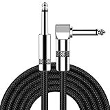
- [Low Noise High Fidelity] New bee guitar cord with 22AWG oxygen-free-copper center conductors provides enhanced signal transfer, the PVC insulation material and the high-density stranded copper double shield provide noise rejection for quiet operation
- [Ideal for Choice] New bee 1/4 straight and right angle metal connectors, ensures a secure connection in any instrument, pedal, or amp jack. L shape great fro on stage guitar stands
- [Wide Compatible] Suitable for mixer, power amplifier, microphone, effector, decoder, equalizer, electoronic organ, electric guitar, electric bass and other electronic equipments. Widely used in the installation of smart home, karaoke speaker, professional stage audio, etc
- [Easy Disassemble] Making incidental repairs quick and easy! Very nice, flexible cable
- [Dont Hesite to Order] 24 hours customer services and professional technology team are standing by
Choose a method that matches the gap
| Situation | Suitable approach | What to document |
|---|---|---|
| Short gap; gradual change; nearby valid observations | Linear or other local interpolation | Gap length, neighboring dates, interpolation formula, and whether the variable is expected to be smooth |
| Regular seasonal pattern with multiple cycles | Harmonic or other time-series model | Frequencies, training period, predictors, residual error, and extrapolation limits |
| Long or irregular gaps; structured environmental drivers | Model-based fill, possibly using auxiliary sensors or covariates | Inputs, calibration period, independent validation, and uncertainty by season and land cover |
| Insufficient evidence for a stable model | Leave the period missing or widen the composite window | Reason for non-estimation and the observation deficit |
NASA training describes time-series methods that fill cloud- or shadow-masked observations while preserving temporal consistency. In a 2023 USGS report, linear harmonic least absolute shrinkage and selection operator (LASSO) regression was used to fill Landsat surface-temperature gaps caused by clouds, shadows, and coarse revisit, improving annual, seasonal, and monthly monitoring. That result supports the method for the studied application; it is not a universal guarantee for every variable or landscape.
Mark every estimated value
Add fields that distinguish observed from modeled pixels. At minimum, retain the fill method, gap length, age since the nearest clear observation, model version, and an uncertainty estimate. Do not merge filled and observed values into one unlabelled raster or time series.
A 2024 continuity framework warns that proxy or model fills can introduce uncertainty as large as the signal being studied. Treat that as a design constraint: if the uncertainty interval overlaps the management threshold or trend you care about, report the result as inconclusive rather than presenting the fill as a precise observation.
How do I compare satellite data across seasons?
Compare equivalent seasonal windows and separate genuine environmental change from changes in when clear observations were available. A trend that appears only in periods with unusually sparse clear pixels may be an acquisition artifact.
Align the biological or climatic season
Define seasons using the process being measured: crop phenology, snow season, wet and dry periods, fire season, or a climate-based calendar. Apply the same definition to every year. If low solar elevation, snow, or persistent cloud changes availability, record that explicitly rather than silently shifting the window.
Inspect availability with the value
Plot or map the estimate together with valid-observation count and cloud frequency. Compare years with similar observation support before interpreting a difference. If one year has many clear looks and another has one marginal look, the confidence in their apparent change is not equivalent.
Use sensitivity tests
- Recalculate the result with a narrower and a wider window.
- Compare median composites with another robust statistic where justified.
- Repeat the analysis after stricter and less-strict confidence masks.
- Separate observed-only results from results that include fills.
- Check whether conclusions change after removing periods with low observation counts.
If the direction or significance changes under reasonable choices, report the result as sensitive to observation availability instead of selecting the most favorable configuration.
Rank #4

- Digital Family Calendar: BSIMB digital calendar wall touch screen puts an end to your chaotic life. Designed for busy families, the digital calendar keeps you organised and in step with your family. Assign different colours and tasks to each family member to make family scheduling easier and more intuitive.
- Easy Setup and Auto-Sync: Plug in, connect to WLAN and auto-syn your electric calendar in minutes. Digital wall calendar compatible with Google calendar, iCloud calendar, Outlook calendar, Cozi calendar and Yahoo calendar. Add events directly on the device or through the ecalendar app. Electronic calendar stays current whether you're at work or traveling—no manual updates needed.
- All-In-One Home Assistant: Smart calendar builds habits and encourage independence with personalised chores. Display daily meal plan to reduce the daily ‘What's for dinner?’ stress. To-do lists keep track of everything you want. Turning chores into valuable achievements with stars and rewards, making life easier and more enjoyable.
- Manage Anytime Anywhere: BSIMB electronic calendar for family stay connected with the powerful ecalendar app. Access and manage your digital wall calendar anytime, anywhere with free features like stars & rewards, photo screensaver, chore charts, meals plans, to-do lists etc. Electronic planner paid features like Magic Import tailor advanced tools for users with special needs.
- Stay in Touch with Loved Ones: Share photos or videos from your phone to electronic wall calendar with app, instantly update your life moment, and keep in touch with your family, especially those who are far away; you can also surprise your smart calendar digital wall by sending him a wish card; it's also great for keeping tech-illiterate elders in touch with the youngsters.
How do I combine different satellite sensors?
Do not average raw digital numbers from different missions. Sensors differ in spectral response, calibration, atmospheric effects, viewing geometry, and grid. Harmonize them before pooling, or analyze each mission separately and compare after normalization.
Use a harmonized analysis-ready product when appropriate
NASA’s Harmonized Landsat and Sentinel-2 (HLS) processing applies atmospheric correction, cloud and cloud-shadow masking, BRDF normalization, spectral-band adjustment, and common gridding. Its QA band records cloud, shadow, snow/ice, water, adjacency, and aerosol classes. These steps make cross-sensor time series more consistent, but they do not remove the need to inspect QA and validate the result for your site.
Keep sensor provenance
Record the mission, product collection, processing version, acquisition time, geometry, and QA interpretation for every input. A harmonized value should still be traceable to its contributing observations. When a sensor transition coincides with an apparent trend break, test the overlap period or compare independent measurements before attributing the break to the surface.
What is a defensible end-to-end workflow?
Use the following sequence for a reproducible cloud, gap, and season treatment.
- Start with analysis-ready data. Prefer surface-reflectance or another product designed for quantitative analysis. Record sensor, processing version, acquisition time, geometry, and available QA bands.
- Decode quality information. Identify cloud, confidence, shadow, snow/ice, adjacency, aerosol, saturation, and NoData classes. Write the exact inclusion rule in project documentation.
- Create masks and diagnostics. Apply the exclusions, then calculate valid-observation count and per-pixel cloud frequency. Preserve the original QA layers.
- Harmonize before pooling. Use a documented harmonized product or apply a validated cross-sensor normalization. Never combine raw digital numbers from unlike missions.
- Build clear composites. Use a defined monthly, seasonal, or annual window and a robust statistic such as the median. Enforce a minimum valid-observation rule.
- Decide whether a gap may be estimated. Leave unsupported periods missing. For allowable gaps, choose local interpolation for short smooth gaps or a harmonic/model-based method for structured signals.
- Attach provenance to fills. Store observed-versus-estimated status, gap length, observation age, method, model version, and uncertainty.
- Validate. Hide known clear observations, predict them, inspect residuals by season and land-cover class, and compare with independent sensors or field data where available.
- Test sensitivity. Re-run with alternate windows, mask strictness, and observed-only data to see whether the conclusion depends on a processing choice.
- Publish evidence with the estimate. Include valid-observation count, cloud frequency, gap length, fill method, uncertainty, and the temporal-window assumptions in the data or report.
How do I validate cloud masks and gap fills?
Validation should test both classification and downstream usefulness. For masks, inspect known clear and cloudy examples across bright surfaces, water, vegetation, snow, and urban areas. For fills, deliberately mask observations that were originally clear, predict them using only the remaining record, and compare predictions with the withheld values.
Recommended Free Tools
Break errors down by conditions
- Report residuals separately for each season or climate period.
- Stratify by land-cover class and brightness, since bright targets and dark water stress masks differently.
- Check short, medium, and long gaps independently.
- Compare performance near clouds and scene edges with interior pixels.
- Use independent sensors or field measurements when they measure a comparable quantity.
A single overall error can hide a failure during the season that matters most. Keep the observed-only baseline beside the filled result so readers can see how much of the apparent continuity comes from estimation.
What should I report so another analyst can reproduce the result?
A methods section or data record should let someone reconstruct both what was measured and what was inferred. Include:
- Sensor names, product collections, processing versions, dates, projection, and spatial resolution.
- QA classes included or excluded, confidence thresholds, and treatment of snow, water, aerosol, adjacency, and saturation.
- The NoData and fill-value rules and how masks were propagated through resampling and aggregation.
- Composite statistic, temporal window, minimum valid-observation count, and any deliberate window widening.
- Per-pixel cloud frequency and valid-observation count, not only a scene-level cloud percentage.
- Whether each value is observed, interpolated, or model-based; for estimates, method, gap length, observation age, and uncertainty.
- Validation design, withheld-observation results, independent comparisons, and sensitivity tests.
- Known limitations, including thin-cloud omissions, sensor transitions, scan-line gaps, snow or low-sun effects, and periods with no valid observations.
What are the most common failure modes?
| Failure | Why it happens | Correction |
|---|---|---|
| Filtering scenes only by their cloud percentage | Clouds are unevenly distributed and the area of interest may remain obscured | Use per-pixel QA, cloud frequency, and valid-observation counts |
| Using a binary cloud flag without confidence or shadows | Thin clouds and shadows can survive the mask | Inspect confidence classes and include shadow and product-specific quality flags |
| Turning NoData into zero | Fill values are mistaken for measurements | Preserve explicit NoData and propagate the mask |
| Averaging raw values from unlike sensors | Spectral and calibration differences appear as false trends | Harmonize first or analyze missions separately |
| Filling every cloudy pixel | Some gaps contain abrupt events or too little evidence | Match the method to gap length and signal structure; leave unsupported periods missing |
| Hiding estimates among observations | Readers cannot judge evidence or uncertainty | Label fills, record age and gap length, and publish uncertainty |
| Changing seasonal windows year by year | Window shifts mix phenology with weather and availability | Use equivalent process-based windows and document exceptions |
How should I choose among masking, compositing, and gap filling?
Use the least inferential method that answers the question. The following decision framework keeps computational effort and uncertainty proportional to the evidence.
| Your situation | Preferred treatment | Do not claim |
|---|---|---|
| Many clear observations in a stable window | QA mask plus clear-pixel median and count layers | That the composite represents every day in the window |
| Persistent cloud but enough observations after widening the window | Documented broader composite with seasonal or phenological checks | Fine-date change that the broader window cannot resolve |
| Short, smooth gap in a dense time series | Validated local interpolation with age and uncertainty | That the interpolated point was directly observed |
| Long gap or structured seasonal signal | Validated harmonic or model-based fill, preferably with independent data | Precision beyond validation error |
| Sparse observations and no defensible model | Report missingness and its effect on the analysis | A continuous trend created by unsupported estimates |
Frequently Asked Questions
What cloud percentage should I allow for a satellite scene?
There is no sensor-independent cutoff. Set a threshold from the minimum valid observations your analysis needs, then verify availability inside the area of interest with per-pixel cloud frequency rather than relying on the scene summary.
Do these 3 things before closing this tab:
1Fix the driver behind crashes, sound loss and screen glitches2Clear out junk files and repair common Windows errors3Scan for outdated or missing drivers - takes under a minuteHow can I tell whether a dark pixel is a cloud shadow or water?
Use the product’s cloud-shadow QA class and inspect neighboring bands, geometry, and repeated dates. Dark water and shadowed land are also places where NoData artifacts can occur, so check the fill-value and validity flags before classifying the surface.
Should I use a mean or median for a satellite composite?
A band-wise median is generally a robust starting point after masking because residual bright or dark contamination has less influence. Choose another statistic only when you can explain its behavior for your variable and validate it against clear observations.
How do I show readers which parts of a map were estimated?
Publish an observed-versus-filled indicator together with observation age, gap length, valid-observation count, and uncertainty. A separate layer or attribute table is clearer than encoding estimates only through a color ramp.
Can a harmonized product eliminate all differences between sensors?
No. Harmonization corrects documented atmospheric, geometric, spectral, and gridding differences, but residual biases and QA errors remain possible. Check overlap periods and validate the harmonized series for the land covers and seasons in your study.
Quick Recap
Product prices and availability are accurate as of the date/time indicated and are subject to change. Any price and availability information displayed on Amazon at the time of purchase will apply.

