Recommended Free Tools
Some links on this page are affiliate links: if you buy through them we may earn a commission, at no extra cost to you.
FEMA flood maps show mapped flood hazards for a location; AI flood predictions estimate whether certain kinds of flooding may occur soon. They answer different questions, so homeowners should use a current effective FEMA map to understand mapped hazard status and consult current forecasts and official alerts when conditions are changing. Neither is a guarantee that a particular home will or will not flood.
What is the difference between a FEMA flood map and an AI flood prediction?
A FEMA map is a hazard-mapping product, not a forecast for a particular storm. An AI prediction is a model-based estimate for a coming period, not a replacement for the official map used in flood-insurance and floodplain-management contexts.
As an Amazon Associate I earn from qualifying purchases.
What’s actually slowing this PC down?
Pick the symptom - the matching free tool is one click away.
| Question | FEMA effective flood map | AI flood prediction |
|---|---|---|
| What does it answer? | What flood hazards are mapped for this location? | What flooding might occur in a forecast period, for a hazard type and area the model covers? |
| Time frame | A mapped hazard product; it is not tied to a specific upcoming event. | A forecast for a stated future period; it changes as forecast inputs and time horizons change. |
| Typical use | Understanding mapped risk and supporting National Flood Insurance Program and floodplain-management uses. | Following possible near-term conditions and potential lead time. |
| What to verify | That the product is effective, current, and relevant to the location. | Coverage, forecast date, hazard type, spatial detail, and stated confidence or limitations. |
The distinction matters in both directions: a map does not tell you whether a flood is about to happen, and a forecast does not establish a home’s official mapped status. A map is generally the starting point for a planning, insurance, or permitting question. A forecast becomes useful when weather, river levels, or other conditions are changing and you need to know what may happen during a defined period.
For broader flood information, the U.S. Geological Survey describes complementary agency roles: FEMA is the official public source for flood maps for insurance purposes; NOAA produces forecast maps combining precipitation data with USGS streamflow data; and USGS provides flood information, historical event data, and inundation mapping for some areas. The word “map” therefore does not identify one universal product. The agency, data type, update status, and intended use all matter.
#1 Best Overall

- [Ultra-Lightweight Ear Buds Designed for Small Ears] Each earbud weighs only 3.7g and features a compact, ergonomic in-ear design made especially for small ears. Secure, low-profile, and comfortable for workouts, all-day wear or overnight sleeping.The ultra-slim profile sits flush in your ear with no hard edges poking or rubbing, so you can even sleep on your side without discomfort.
- [Immersive Stereo Sound with TOZO OrigX Technology] TOZO OrigX tuning delivers clear vocals, balanced mids, and natural stereo sound for music, podcasts, and videos.
- [Long Battery Life for Daily Use] Get up to 7 hours of playtime on a single charge, with up to 32 hours total using the charging case—ideal for workdays, commuting, and extended listening sessions.
- [Bluetooth 5.3 & Stable Connection] Bluetooth 5.3 provides fast pairing, stable wireless performance, and reduced dropouts as you move around home or office.
- [Deep Bass with Clear Vocals] High-performance drivers produce punchy bass while keeping vocals clean and detailed for everyday listening.
What does a FEMA flood map show?
FEMA’s Flood Map Service Center is the official source for National Flood Insurance Program flood-hazard information. The National Flood Hazard Layer is a geospatial database of effective flood maps. Depending on the location and map products available, mapped information can include Special Flood Hazard Areas, base flood elevations or average depths, flood-insurance risk zones, and areas subject to 1-percent and 0.2-percent annual-chance flooding.
Those layers are not all interchangeable. A zone designation communicates a mapped risk category, while a base flood elevation or average depth supplies additional physical context where that information has been studied and published. A map may show some of these items but not all of them for every community. Read the legend, panel information, and associated study materials instead of assuming that one color or label answers every question about the structure.
What is a Special Flood Hazard Area?
FEMA training defines a Special Flood Hazard Area (SFHA) as an area subject to inundation by a flood with at least a 1-percent chance of being equaled or exceeded in any given year. This probability is often described with the shorthand “100-year flood,” but that phrase does not mean a flood is scheduled to happen only once every century.
FEMA gives a useful mortgage-horizon perspective: a flood with a 1-percent annual chance has a 26% chance of occurring at least once over 30 years. FEMA’s Emergency Management Institute provides that figure; the publication year is not stated on the accessed page. The annual probability is not a countdown: one such flood does not make another impossible the next year, and several qualifying floods can occur close together.
What does a 0.2-percent annual-chance area mean?
FEMA map products can also identify areas subject to a 0.2-percent annual-chance flood. That is a different mapped probability category from the 1-percent annual-chance flood. Read the map legend and the associated study materials for the location rather than assuming that a single zone label describes every flood hazard or the full risk to a home.
The annual-chance wording is important. It expresses probability for each year, not the expected interval between events at one address. It also describes the flood probability represented by the map’s study and modeling, not a promise that all future storms will behave exactly as modeled.
Free tools Windows power users keep installed
One-click scans. No signup required.
How do I check whether my house is in a FEMA flood zone?
Use FEMA’s Map Service Center to search the property location and inspect the current effective map and panel. If you need more context about mapped elevations or the analysis behind the map, consult the related Flood Insurance Study materials or ask the local floodplain administrator.
- Open FEMA’s Flood Map Service Center and search for the property’s location.
- Identify the relevant map panel and check that the information you are viewing is the effective map, not only preliminary data.
- Read the map legend and any displayed flood zone, elevation, or depth information. Note that the map describes mapped hazards, not a guarantee about an individual structure.
- Review related Flood Insurance Study materials if the map alone does not answer your question.
- For a parcel-specific insurance, permitting, or elevation determination, contact the local floodplain administrator, insurer, or a qualified professional.
Use the property’s actual location and the map panel that covers it, rather than relying on a screenshot or a generalized community map. If a search produces more than one map product, verify which one FEMA identifies as effective. Keep in mind that a saved printout may no longer reflect current map status. FEMA says effective map information can change or be superseded as maps are updated, so check the Map Service Center when you need the current official mapping information.
What is the difference between an effective FEMA map and a preliminary map?
An effective map is the current official mapping product for its applicable purposes. Preliminary flood-hazard data is an early look at projected risk and may include proposed or revised Flood Insurance Rate Maps, Flood Insurance Study reports, and databases.
Rank #2

- 【IP68 Waterproof Multifunctinal Smart Watch】Torjalph fitness activity tracker smart watch is IP68 waterproof technology ,you can wear it when swimming,handwashing,it's rain-proof which means that you perform multiple exercise modes outside without worrying about sweat or rain corroding your fitness smart watch,and this watch equipped with a 230 mAh large capacity battery magnetic charging ,and this sports activity tracker watch can be used 5-7 days If fully charged.
- 【Larger 1.83'' Full Screen Watch & Multi-dial Selection】1.83 inch full HD color touch screen smart watch for men / women provides excellent 240*284 resolution image quality ,This Bluetooth smart watch offers a better touch experience and remarkable immersion and ,more than 200 watch faces for you to choose from App"Da Fit ", you can change the dial style according to your mood to wear keeping the world on your wrist
- 【Accurate Activity Tracker Smart Watch 】sports watch activity tracker uses sweat and dust resistant breathable silicone strap, our Fitness Tracker Smart Watch for Android iOS Phones supports 12 sports modes,walking,running,bicycle,swimming,badminton,basketball,football,rope skipping. This bluetooth calls smart watch for men women is lightweight and stylish, bringing more convenient and relaxing sports experience while also providing more protection.
- 【Your 24 Hour Personal Daily Health Monitor】Fitness watch for women men full touch screen IP67 waterproof bluetooth smartwatch for Android iOS Phones with heart rate blood pressure monitor multifunction Andriod smart watch with steps counter sleep monitor sports fitness watch, monitoring blood oxygen saturation allows you to understand your physical condition in real time to track fitness progress ,to know your health status in time.
- 【More Functions Bluetooth Call Smart Watch】This fitness activity smart watch full screen for iPhone and Android phones includes a bunch of new features including:The bluetooth smart watch can hang up the phone, receive and display WhatsAPP /Text /Facebook /Twitter /Messenger reminder.Support sedentary reminder, alarm clock, stopwatch, timer,weather information,music control, remote camera control compatible with Android 5.0 and above or iOS 9.0 and above smartphones.
Do not treat preliminary data and the effective map as interchangeable. If you see preliminary information, check the effective status separately in the Map Service Center. FEMA’s training notes that effective map information may change or be superseded as mapping is updated; a preliminary product signals proposed or projected information, not by itself a change to the effective map.
Do these 3 things before closing this tab:
1Scan for outdated or missing drivers - takes under a minute2Repair Windows errors before they cause bigger problems3Fix the driver behind crashes, sound loss and screen glitchesThis distinction prevents two common errors. A homeowner might mistake a proposed revision for the map currently used for an official determination, or might continue using an old effective panel after a newer one has superseded it. The status shown by FEMA and the date or identifier of the map panel are therefore part of the answer, not administrative details to skip.
What can AI flood predictions tell homeowners?
AI forecasts can add a near-term view that an effective hazard map does not provide, but their usefulness depends on where they cover, which flood mechanisms they model, and how much geographic detail they offer. “AI flood prediction” is not one uniform product: different systems can use different inputs, time horizons, and hazard definitions.
A forecast may estimate the probability of a river rising, the chance of inundation, or the likelihood of a flash flood during a stated window. Those are different outputs. Before interpreting a result, identify whether it is a probability, a water-level estimate, an inundation visualization, or another indicator, and check the period to which it applies. A current forecast can change when new meteorological or hydrologic inputs arrive.
Google Flood Hub riverine forecasts
Google describes Flood Hub as providing riverine forecasts up to seven days ahead, with daily updates and coverage in more than 150 countries. Those are Google’s product-wide statements, not a promise that a particular address is covered or that an address-level inundation map is available. Depending on the place, Flood Hub may show hydrologic information without a corresponding inundation map. Check the location and the product’s coverage view rather than inferring local detail from worldwide coverage.
“Up to seven days” is a maximum forecast horizon, not a guarantee that every location has seven days of useful warning or that every forecast is equally certain throughout that period. Daily updates also mean that a result seen yesterday may not be the current result. Record the forecast date and the location you selected when comparing information over time.
Google’s separate flash-flood feature
Google also documents a distinct AI feature that estimates the probability of a flash flood within 24 hours. Google says this model uses historical and forecast meteorological inputs and operates at 20 km by 20 km spatial resolution; the year is not stated on the accessed help page. That is regional-scale information, not a property-line determination.
At 20 km by 20 km, a grid cell can cover many neighborhoods and different local drainage conditions. A positive probability for a cell does not identify which street, lot, or structure will flood, and a result for a neighboring cell should not be treated as an address-specific reading. Use the displayed scale and any accompanying explanation to understand what the model is actually resolving.
Google says the flash-flood model initially focuses on urban areas and some rural areas with prior flooding. Its documentation describes weather-caused flash floods, not floods caused by dam or levee failures or glacial melts. Do not assume that a forecast feature labeled “flood” covers every possible cause of flooding. A riverine forecast and a flash-flood probability are separate products with separate scopes.
Outdated Drivers Are Slowing You Down
One free scan finds every outdated or missing driver and matches the right update for your exact hardware.Free scan · exact hardware matchWindows Errors? Fix Them Before They Spread
Repair common Windows errors and clear accumulated junk for a smoother, more stable PC - no reinstall needed.Free scan · no reinstallRank #3
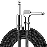
- [Low Noise High Fidelity] New bee guitar cord with 22AWG oxygen-free-copper center conductors provides enhanced signal transfer, the PVC insulation material and the high-density stranded copper double shield provide noise rejection for quiet operation
- [Ideal for Choice] New bee 1/4 straight and right angle metal connectors, ensures a secure connection in any instrument, pedal, or amp jack. L shape great fro on stage guitar stands
- [Wide Compatible] Suitable for mixer, power amplifier, microphone, effector, decoder, equalizer, electoronic organ, electric guitar, electric bass and other electronic equipments. Widely used in the installation of smart home, karaoke speaker, professional stage audio, etc
- [Easy Disassemble] Making incidental repairs quick and easy! Very nice, flexible cable
- [Dont Hesite to Order] 24 hours customer services and professional technology team are standing by
What are the main limitations of AI flood forecasts?
Coverage is the first limitation. A platform can report broad country or worldwide availability while offering no forecast or no inundation map for a particular address. Look for the actual location in the product, not just the headline coverage figure.
Hazard type is the second. A river forecast does not automatically answer a question about coastal surge, urban drainage, a dam or levee failure, or a glacial-melt event. The flash-flood documentation specifically excludes dam and levee failures and glacial melts. Identify the mechanism before relying on the result.
Scale is the third. A river gauge or model grid represents a geographic area, while a home occupies one parcel. Google documents a 20 km by 20 km grid for its flash-flood probability feature, so that output cannot establish a property-line outcome. Even an inundation visualization should be read with its legend and documentation.
Finally, forecasts are estimates and can change. Google states that its forecasts are still a work in progress and are for informational purposes only. That statement is a reason to use them as one input alongside government, weather-service, and local information—not as a substitute for those sources.
The Tool Desk
Outbyte PC Repair FREERepair Windows errors before they cause bigger problemsFix Now →Outbyte Driver Updater FREEFix the driver behind crashes, sound loss and screen glitchesFind Drivers →Should I trust an AI flood forecast over FEMA’s map?
No. The tools serve different purposes, and neither should override the other for a question it does not answer. Use FEMA’s current effective map for mapped hazard status; use a forecast to follow possible near-term conditions in an area and for a hazard the forecast actually covers.
Google cautions that its riverine forecasts are informational and should not be used as the sole source during an emergency. Google also describes its forecasts as a work in progress. When flooding may be imminent, follow government alerts and local emergency instructions; a forecast platform is one source of information, not the authority directing local response.
The practical answer is to use them together when appropriate. A map can inform longer-term questions about the property’s mapped status. A forecast can show that conditions may be worsening now or over the next several days. If they appear to conflict, first check whether they are describing the same hazard, location, time period, and geographic scale. Often the apparent conflict is a comparison of unlike products rather than a disagreement about the same measurement.
How should I compare a map with a forecast?
Before drawing a conclusion, compare the product’s purpose, time frame, flood type, scale, coverage, and status. A map zone, a regional probability grid, and an event forecast are not equivalent measurements.
- Purpose: Is the product mapping longer-term hazard, estimating an upcoming event, or reporting observed or forecast water conditions?
- Time: Is the information an effective mapped product or a forecast for a dated period? Forecasts change as inputs and forecast windows change.
- Flood type: Does it cover riverine, flash, coastal, or another form of flooding? Verify the product’s scope rather than assuming it includes every source.
- Scale: Is the information at a map-zone, regional-grid, or more localized scale? Neither a mapped zone nor Google’s 20 km by 20 km flash-flood grid is a property-level guarantee.
- Coverage: Does the tool actually provide data for the location? A broad country or global coverage statement does not establish that a home’s address has a forecast or inundation map.
- Status and limitations: For FEMA data, distinguish effective from preliminary information. For forecasts, check the date and any missing-map, confidence, or model-scope caveats shown by the provider.
Also check whether the displayed product is a forecast or an observation. NOAA and USGS may provide different kinds of information, and a platform may show hydrologic data even where it does not offer an inundation map. Labeling the source and the product type in your notes can prevent an observed water level from being mistaken for a prediction or a mapped zone from being mistaken for an evacuation warning.
Rank #4

- Digital Family Calendar: BSIMB digital calendar wall touch screen puts an end to your chaotic life. Designed for busy families, the digital calendar keeps you organised and in step with your family. Assign different colours and tasks to each family member to make family scheduling easier and more intuitive.
- Easy Setup and Auto-Sync: Plug in, connect to WLAN and auto-syn your electric calendar in minutes. Digital wall calendar compatible with Google calendar, iCloud calendar, Outlook calendar, Cozi calendar and Yahoo calendar. Add events directly on the device or through the ecalendar app. Electronic calendar stays current whether you're at work or traveling—no manual updates needed.
- All-In-One Home Assistant: Smart calendar builds habits and encourage independence with personalised chores. Display daily meal plan to reduce the daily ‘What's for dinner?’ stress. To-do lists keep track of everything you want. Turning chores into valuable achievements with stars and rewards, making life easier and more enjoyable.
- Manage Anytime Anywhere: BSIMB electronic calendar for family stay connected with the powerful ecalendar app. Access and manage your digital wall calendar anytime, anywhere with free features like stars & rewards, photo screensaver, chore charts, meals plans, to-do lists etc. Electronic planner paid features like Magic Import tailor advanced tools for users with special needs.
- Stay in Touch with Loved Ones: Share photos or videos from your phone to electronic wall calendar with app, instantly update your life moment, and keep in touch with your family, especially those who are far away; you can also surprise your smart calendar digital wall by sending him a wish card; it's also great for keeping tech-illiterate elders in touch with the youngsters.
Where can I check the current flood forecast for my area?
For current river conditions, NOAA’s National Water Prediction Service and local official alerts are useful sources; USGS identifies NOAA as a forecast source and describes its own role in flood information and related mapping. The right source depends on the flood mechanism and location, so also check instructions from local emergency officials.
- Check local government and emergency-management alerts for warnings and instructions affecting your area.
- For river conditions, consult NOAA’s National Water Prediction Service and the relevant local or USGS information where available.
- If using an AI forecast such as Flood Hub, check the forecast date, location coverage, hazard type, and whether an inundation map is available for that place.
- Use forecast information as one input alongside official alerts and local instructions, not as the sole basis for emergency decisions.
When conditions are changing, revisit the sources rather than relying on a single earlier screen. Forecast windows, river information, and map displays can be updated. If local officials issue an instruction that differs from your interpretation of an online forecast, follow the official instruction.
What should homeowners do with these tools?
Use the map and forecast at the stage when each is useful: check mapped status for planning and property questions, then monitor current conditions and official alerts when an event threatens. For decisions tied to a specific parcel, a national map or forecast does not determine the home’s full risk.
Quick wins for a faster PC:
Repair Windows errors before they cause bigger problemsFix Now →Scan for outdated or missing drivers - takes under a minuteDriver Scan →Clear out junk files and repair common Windows errorsFree Scan →- For mapped hazard and NFIP-related context, verify the effective map in FEMA’s Map Service Center.
- For near-term conditions, use forecasts whose hazard type and coverage match the situation, and check when they were updated.
- For insurance, permitting, or elevation questions specific to a parcel, contact the local floodplain administrator, insurer, or a qualified professional.
- During an emergency, act on official government alerts and local emergency instructions.
There is no single purchase required to understand this comparison. The key steps are checking the correct official map, identifying whether FEMA data is effective or preliminary, confirming that a forecast covers the relevant hazard and location, and recognizing the difference between regional model output and a property’s actual conditions.
Common homeowner questions
Is my house in a FEMA flood zone?
Search the address or location in FEMA’s Map Service Center, identify the effective map panel, and read the legend and displayed zone information. If the result is unclear or you need a parcel-specific determination, ask the local floodplain administrator, insurer, or a qualified professional.
What does a 1-percent annual-chance flood mean?
It means the mapped flood has at least a 1-percent chance of being equaled or exceeded in any given year for the relevant area and study. FEMA gives a 26% chance over a 30-year period. It does not mean the flood occurs once every 100 years.
Is a 100-year flood really once every 100 years?
No. “100-year” is shorthand for a 1-percent annual chance, not a calendar schedule. A qualifying flood can occur in consecutive years or more than once during a 30-year period.
Can AI predict whether my house will flood?
AI products can estimate the probability or possible extent of certain flooding over a stated period and area. They generally do not provide a guaranteed property-level answer. Check the model’s hazard type, coverage, spatial resolution, forecast date, and limitations.
Does a FEMA flood map show every way a home could flood?
No single map label should be read as a complete inventory of every possible source of flooding at a particular structure. FEMA map products show mapped hazards and may include different information by location; for a parcel-specific assessment, consult the local floodplain administrator or a qualified professional.
Can a preliminary FEMA map change the current map status?
A preliminary product is an early look at projected risk, and may contain proposed or revised maps or study materials. Check the Map Service Center for the effective map status rather than treating a preliminary product alone as the current official map.
Does Google’s flash-flood feature cover dam failures?
Google’s documentation describes the feature as predicting weather-caused flash floods. It says the model does not cover floods caused by dam or levee failures or glacial melts.
Should I use an AI forecast as my only emergency source?
No. Google says its forecasts are informational, still a work in progress, and should not be the sole source of data during an emergency. Use government alerts, weather services, NOAA or USGS information where relevant, and local emergency instructions.
Why might an AI platform show a forecast but no flood map?
Google says some locations may have hydrologic information without a corresponding inundation map. Availability varies by place and product, so the presence of one display does not imply that every type of forecast or map exists for the address.
Frequently Asked Questions
Does a FEMA flood map show every way a home could flood?
No single map label should be read as a complete inventory of every possible source of flooding at a particular structure. FEMA map products show mapped hazards and may include different information by location; for a parcel-specific assessment, consult the local floodplain administrator or a qualified professional.
Can a preliminary FEMA map change the current map status?
A preliminary product is an early look at projected risk, and may contain proposed or revised maps or study materials. Check the Map Service Center for the effective map status rather than treating a preliminary product alone as the current official map.
Does Google’s flash-flood feature cover dam failures?
Google’s documentation describes the feature as predicting weather-caused flash floods. It says the model does not cover floods caused by dam or levee failures or glacial melts.
What does a 1-percent annual-chance flood mean over a mortgage term?
FEMA gives a 26% chance that a 1-percent annual-chance flood will occur at least once over 30 years. The figure describes cumulative probability, not a schedule.
Can an AI forecast tell me exactly whether my parcel will flood?
No. Forecast coverage, hazard type, update time, confidence, and spatial resolution vary. Google’s flash-flood feature is documented at 20 km by 20 km resolution, which is regional rather than property-line detail.
Where should I look during an imminent flood?
Follow local government and emergency-management alerts and instructions. Use NOAA’s National Water Prediction Service, relevant USGS information, and AI forecasts as additional information when their coverage and hazard type match the situation.
Free tools Windows power users keep installed
One-click scans. No signup required.
The Bottom Line
Use FEMA’s effective map to understand mapped flood-hazard status and use AI, NOAA, USGS, and local official information to monitor possible near-term conditions. Check the hazard type, location, scale, update date, and effective or preliminary status every time. AI forecasts can add lead time, but they are not property-level guarantees and should never replace official emergency instructions.
Quick Recap
Product prices and availability are accurate as of the date/time indicated and are subject to change. Any price and availability information displayed on Amazon at the time of purchase will apply.

