What’s actually slowing this PC down?
Pick the symptom - the matching free tool is one click away.
Satellite laser ranging (SLR) measures the distance between a ground station and a satellite by timing a laser pulse’s round trip to a retroreflector and back. A station divides the light’s total travel distance by two to derive the one-way range. Repeated measurements help scientists determine satellite orbits and track the positions and motion of ground stations relative to Earth’s center of mass.
How satellite laser ranging works
- A ground station aims a telescope and sends a short laser pulse toward a satellite equipped with retroreflectors.
- The satellite’s cube-corner reflectors return some of the incoming light toward its source. The satellite does not generate the returning pulse; the station supplies the light and detects its return.
- The station’s optical receiver detects the returning photons, and timing electronics record the elapsed round-trip time.
- Because the pulse travels to the satellite and back, the station derives range from half the total distance traveled by the light. In simplified form, range = speed of light × round-trip time ÷ 2.
SLR is an active measurement: the station transmits light and measures its return. Laser-ranging systems can also support one-way ranging to remote optical receivers and precise time transfer, but these are distinct configurations from standard satellite retroreflector ranging. The International Laser Ranging Service’s technique overview describes these capabilities.
As an Amazon Associate I earn from qualifying purchases.
What the measurements tell scientists
The direct observation is a round-trip time, from which the station derives a range. A single range is not itself a complete orbit or a measurement of tectonic motion. Scientists combine repeated observations with models to estimate satellite orbits and station coordinates, then use those results in broader studies.
- Orbit determination: Ranges help establish and refine the orbits of satellites equipped with retroreflectors.
- Earth’s reference frame: SLR helps determine station positions relative to Earth’s center of mass. Those positions contribute to maintaining the International Terrestrial Reference Frame.
- Geophysics: Changes in station positions can reveal tectonic plate motion. SLR data also support research into Earth’s gravity field, rotation and polar motion, sea level, ice mass, and the redistribution of mass in the Earth system.
The ILRS coordinates data and derived products for geodetic, geophysical, and fundamental research; NASA’s satellite laser ranging overview describes the technique’s Earth-science applications.
#1 Best Overall

- ★ HIGH ACCURACY & UNIT SWITCHABLE ★ With unique 2 Bubble Levels, providing more precise measurement compared to one bubble;With laser precision technology, accuracy ups to ±1/16inch, measuring distance extends to 165 feet; Switchable among M/In/Ft for free adjustment
- ★ LCD BACKLIGHT & MUTE SETTING ★ Large backlight screen provides you with a better visibility in dark areas; Mute setting allows you turn on or off the measure beep at your will, suitable for using in library, classroom and other quite places,the laser level is ideal for home, construction and industries, especially in large areas such as rooms, apartments, buildings, real estates, factories, warehouses, etc
- ★ MULTIPLE MEASUREMENT FEATURES ★ Area, distance, length, volume, continuous measurement, Pythagorean method-three points; Addition and subtraction; Low battery indication; 20 groups data memory; Manually delete data; Auto shut down after 150s without any operation to save power
- ★ DURABLE AND HANDY DESIGN ★ IP54 waterproof level and dust-proof function protect the laser distance measure to the maximum extent; Portable size provides a good grip; Wrist strap lets you hold the meter steady and carry easily
- ★ WHAT YOU GET ★ Rockseed Laser Measuring Device 165Ft; 1.5V AAA Batteries; User Manual; Hand Strap; Package Box; (Ideal thanksgiving gifts and christmas gifts for family and friends)All ROCKSEED products are certified by international standards including CE, FCC and ROHS, with an IP54 rating (splash and dust resistant). We provide 2 years of technical support and after-sales service for laser measuring tools in the United States.
Why satellites carry retroreflectors
A retroreflector sends incoming light back toward the direction it came from, helping a station detect the return from a target far away. Not every satellite carries one: SLR requires a suitable retroreflector array on the satellite, along with a specialized ground station.
The first satellite equipped with reflectors specifically for laser tracking was Explorer 22, also called Beacon Explorer B. NASA says it carried nine panels, each with 40 cube-corner reflectors. A later geodetic satellite, LAGEOS, used 426 retroreflectors. Its nearly spherical, passive design provided a stable target for repeated observations.
Rank #2

- ACCURATE: This laser measuring tool features long range measuring with extreme accuracy. It measures distances up to 100 feet to within 1/16 inch, in meters, feet, inches, with fractions or decimals
- EASY-TO-USE: This laser measure features a simple, user-friendly layout with two-button operation: one for measuring, one for rounding
- CLASS II LASER: Specs for this laser distance measuring tool are 635 nm; <1 mW
- PORTABLE: This compact laser measurement tool is easy to carry and fits in your pocket
- DISPLAY: BOSCH Blaze laser measure features a backlit display with large icons that allows measurements to be easily read, even in dark areas. It is brighter than its predecessor, the GLM20
How accurate is satellite laser ranging?
There is no single accuracy figure that applies to every station, satellite, and observation. NASA’s historical milestones show how the technique improved, but they should be read in their stated context rather than as a universal current specification.
| Figure | Context |
|---|---|
| About 3 meters | NASA’s account of the first reported satellite range, in 1964: 600 miles (about 966 kilometers), accurate to within 10 feet (about 3 meters). NASA’s history of satellite laser ranging. |
| Below 1 centimeter | NASA reported in 2016 that SLR accuracy had improved from about 1 meter to below 1 centimeter by the LAGEOS era. NASA’s LAGEOS account. |
| About 10 times better than the LAGEOS-era level | NASA’s 2016 account described a further improvement by a factor of 10. This is a relative historical comparison, not an exact present-day accuracy specification for all SLR observations. NASA’s LAGEOS account. |
These milestones do not provide a complete error budget for a particular station or satellite. The uncertainty of a specific result depends on the station, target, observations, and modeling used.
Rank #3

- ★ HIGH ACCURACY & UNIT SWITCHABLE ★ With unique 2 Bubble Levels, providing more precise measurement compared to one bubble;With laser precision technology, accuracy ups to ±1/16inch, measuring distance extends to 328 feet; Switchable among M/In/Ft for free adjustment
- ★ LCD BACKLIGHT & MUTE SETTING ★ Large backlight screen provides you with a better visibility in dark areas; Mute setting allows you turn on or off the measure beep at your will, suitable for using in library, classroom and other quite places,the laser level is ideal for home, construction and industries, especially in large areas such as rooms, apartments, buildings, real estates, factories, warehouses, etc
- ★ MULTIPLE MEASUREMENT FEATURES ★ Area, distance, length, volume, continuous measurement, Pythagorean method-three points; Addition and subtraction; Low battery indication; 20 groups data memory; Manually delete data; Auto shut down after 150s without any operation to save power
- ★ DURABLE AND HANDY DESIGN ★ IP54 waterproof level and dust-proof function protect the laser distance measure to the maximum extent; Portable size provides a good grip; Wrist strap lets you hold the meter steady and carry easily
- ★ WHAT YOU GET ★ Rockseed Laser Measuring Device 328Ft; 1.5V AAA Batteries; User Manual; Hand Strap; Package Box; (Ideal thanksgiving gifts and christmas gifts for family and friends)All ROCKSEED products are certified by international standards including CE, FCC, and ROHS, with an IP54 rating (splash and dust resistant). We provide 2 years of technical support and after-sales service for laser measuring tools in the United States.
From Explorer 22 to GPS III
NASA reports that the first successful satellite laser tracking took place at Goddard in 1964 with the GODLAS system and Explorer 22. The first return was detected on October 31; subsequent observations were used to estimate range. The first reported result was a 600-mile (about 966-kilometer) range accurate to within about 3 meters.
NASA launched LAGEOS in 1976 as its first orbiter dedicated to laser ranging. LAGEOS 2 followed in 1992 as a joint project with the Italian Space Agency. Long-running observations of these satellites helped scientists study slow changes in Earth’s shape, gravity field, rotation, and tectonic plates.
Rank #4

- POCKET-SIZED LASER MEASURE: This laser distance measure fits into a pocket or tool belt, and the blaze pro measurer still has 165 ft. range, a backlit display, multiple measuring features and a 10-measurement storage capability
- EASY-TO-READ BACKLIT DISPLAY: This laser distance meter illuminates numbers with distinct resolution, allowing work in low-light or no-light conditions
- DEFAULT REAL-TIME MEASUREMENT MODE: This laser distance measuring tool immediately provides accurate measurement that automatically adjusts closer to or farther from the target
- ADD/SUBTRACT MEASUREMENTS: This laser measurement tool allows the user to add or subtract measurements
- MULTIPLE MEASURING FEATURES: BOSCH Blaze laser measure calculates distance, square footage, volume and indirect measurements
SLR remains relevant to satellite navigation. NASA reported on March 19, 2026, that the laser retroreflector array on GPS III SV-09 became operational on March 9. NASA says the array improves the satellite’s tie to the global coordinate system, supporting more accurate location and navigation information. More precise GPS satellite orbit information can also improve the reliability of data collected by Earth-observing satellites. NASA’s report on GPS III SV-09.
Satellite laser ranging and lunar laser ranging
Satellite laser ranging and lunar laser ranging use the same basic idea: send a short laser pulse, detect its return from retroreflectors, and use two-way travel time to determine range. The target differs. SLR observes retroreflectors on Earth-orbiting satellites; lunar laser ranging observes reflectors on the Moon. The ILRS organizes both techniques under its service.
Quick Recap
Best Value
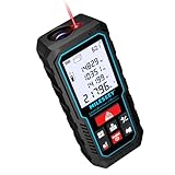
- [Reliable and Efficient] Upgraded electronic level with accuracy up to +/-0.3°and laser tape measure with accuracy up to +/-2mm, MILESEEY D5 delivers more accurate and faster measurements of angle and distance than bubble level meters. And with real-time display of electronic angle, it is much easier for users to find the horizontal direction, which guarantees high-accuracy measure results
- [UNIQUE FUNCTIONS] The high precision laser head component can be measured quickly and accurately in 0.5s, Auto-Level: Only measure the hypotenuse, the horizontal distance and vertical height will be calculated automatically; Auto-height: Only measure 2 hypotenuses, the vertical height will be calculated automatically; Fast measurement: automatic calculation of area and volume with one button operation
- [PRACTICAL MULTIPLE Measurements] 70M laser distance measure accuracy +/-1/16 inch (+/-2mm), and it offers automatic calculation of area, volume and distance, continuous measurement, pythagorean method-3points to meet your different measuring needs.; good laser measuring device for covering large area:home decoration, especially in large areas such as apartments, buildings, real estates, factories, warehouses, construction and industries
- [UNITS SWITCH & 30 DATA RECORDS & Energy-saving Design] freely switch the units in M/ FT/IN/ft+in; 30 data records and recall function which are useful for reviewing and calculating; portable Pocket-sized, non-slip design; 180s of automatic shutdown to save the power, can work up to 5000 times
- [24 MONTHS+ INTERNATIONAL CERTIFICATE] 1 x digital measure laser, 2 x 1.5 V AAA, 1 x user manual, 1 x portable bag, 1 x portable bracelet; CE / FDA / ROHS/ WEEE certification, IP54(splash-proof and dust-proof), We always provide 2-year assurance and technical support for laser measurement tool
Product prices and availability are accurate as of the date/time indicated and are subject to change. Any price and availability information displayed on Amazon at the time of purchase will apply.




