A world bible becomes a playable open-world map through a chain of controlled translations: narrative rules become spatial constraints, constraints become a macro layout, the layout becomes terrain and traversal, and those systems are populated, streamed and tested in the game engine. The most reliable teams validate geography and player movement before polishing assets, use procedural generation for repeatable coverage, hand-author spaces that carry story or gameplay intent, and design runtime streaming at the same time as the map.
What a world bible must provide before map production starts
A world bible is useful to level designers only when its ideas can be turned into decisions about space. “A cold kingdom ruled by rival houses” is atmosphere; it is not yet a production rule. The team has to translate it into regions, elevations, routes, ownership, resources, landmarks, hazards and mission dependencies.

As an Amazon Associate I earn from qualifying purchases.
Create a structured world-bible table before opening the terrain editor. Each row should describe a fact and the map consequence it creates.
Do these 3 things before closing this tab:
1Fix the driver behind crashes, sound loss and screen glitches2Repair Windows errors before they cause bigger problems3Scan for outdated or missing drivers - takes under a minute| World-bible fact | Spatial interpretation | Production check |
|---|---|---|
| Climate | Temperature bands, rainfall, snowline, vegetation and visibility | Do biome boundaries follow believable elevation and drainage? |
| Faction control | Territories, borders, checkpoints, patrol routes and contested corridors | Can a player understand who controls an area from its architecture and activity? |
| History | Ruins, old roads, battlefields, abandoned infrastructure and buried layers | Do historical remnants explain the current routes and settlements? |
| Economy | Farms, mines, ports, markets, warehouses and roads between suppliers and hubs | Can goods plausibly move through the map? |
| Traversal promises | Climbable slopes, swimming areas, vehicle routes, gliding gaps, gates and shortcuts | Does every promised ability have useful terrain to interact with? |
| Mission dependencies | Required sightlines, approach routes, locked regions, staging areas and return paths | Can quests be reached and completed without accidental sequence breaks? |
| Visual references | Landmark silhouettes, material palettes, settlement forms and regional contrast | Can artists identify what must remain unique rather than generic? |
Record hard constraints separately from preferences. “The capital must be visible from the valley” is a testable constraint. “The valley should feel grand” is a design goal that may be achieved in several ways. Also mark forbidden combinations, such as a desert biome next to a permanently flooded wetland without a transition explanation, or a faction’s headquarters placed beyond a route that faction is supposed to control.
#1 Best Overall

- [Ultra-Lightweight Ear Buds Designed for Small Ears] Each earbud weighs only 3.7g and features a compact, ergonomic in-ear design made especially for small ears. Secure, low-profile, and comfortable for workouts, all-day wear or overnight sleeping.The ultra-slim profile sits flush in your ear with no hard edges poking or rubbing, so you can even sleep on your side without discomfort.
- [Immersive Stereo Sound with TOZO OrigX Technology] TOZO OrigX tuning delivers clear vocals, balanced mids, and natural stereo sound for music, podcasts, and videos.
- [Long Battery Life for Daily Use] Get up to 7 hours of playtime on a single charge, with up to 32 hours total using the charging case—ideal for workdays, commuting, and extended listening sessions.
- [Bluetooth 5.3 & Stable Connection] Bluetooth 5.3 provides fast pairing, stable wireless performance, and reduced dropouts as you move around home or office.
- [Deep Bass with Clear Vocals] High-performance drivers produce punchy bass while keeping vocals clean and detailed for everyday listening.
Step 1: Convert constraints into a macro map
The macro map is the first playable model of the world. It contains landmasses, coastlines, mountain barriers, rivers, major roads, settlements, mission arcs and broad biome regions, but not final props or detailed materials.
Place the world’s anchors
Start with the capital, major hubs, faction strongholds, ports, dungeons and signature landmarks. These anchors determine travel demand and establish the map’s visual rhythm. A mountain pass, river crossing or fortified gate should exist because it creates a meaningful decision, not merely because the terrain needs decoration.
Draw primary and alternate routes
Connect anchors with the routes a player is expected to use. Then add alternatives: a dangerous shortcut, a slower safe road, a climbable ridge or a route opened by a later ability. Alternate paths make geography part of decision-making. They also expose contradictions early; if every route bypasses a supposedly strategic fortress, the fortress is not strategically placed.
Quick wins for a faster PC:
Fix the driver behind crashes, sound loss and screen glitchesFind Drivers →Repair Windows errors before they cause bigger problemsFix Now →Test distance and sightlines in blockout
Use crude geometry and placeholder markers to check travel time, landmark visibility and mission order. The player should be able to recognize where to go without seeing every objective directly, while major destinations should provide enough visual evidence to make exploration legible. A valley that must reveal the capital needs an unobstructed or deliberately framed view; a surprise ambush needs concealment that is consistent with the route and the player’s camera.
Step 2: Build terrain before final art
Terrain establishes what the player can reach, see and traverse. Use a landscape or heightfield workflow to create elevation, ridgelines, drainage, passes and playable slopes before committing to final buildings or foliage.
Shape elevation and drainage
Lay out watersheds, river sources, floodplains and coastal shelves first. Rivers should have a reason to flow downhill, and settlements should respond to water, defensible ground and transport. Heightfield tools can accelerate this stage, while erosion simulation can produce more convincing channels and slopes. SideFX documents heightfield, erosion and procedural-terrain workflows that can feed Unreal or Unity, making it practical to iterate on terrain outside the final level scene.
Validate traversal on the real movement model
Import the blockout into the engine and use the actual character controller, vehicle, climbing system or glider. A slope that looks gentle in a top-down sketch may be impassable at player scale. Test:
What’s actually slowing this PC down?
Pick the symptom - the matching free tool is one click away.
Rank #2

- 【IP68 Waterproof Multifunctinal Smart Watch】Torjalph fitness activity tracker smart watch is IP68 waterproof technology ,you can wear it when swimming,handwashing,it's rain-proof which means that you perform multiple exercise modes outside without worrying about sweat or rain corroding your fitness smart watch,and this watch equipped with a 230 mAh large capacity battery magnetic charging ,and this sports activity tracker watch can be used 5-7 days If fully charged.
- 【Larger 1.83'' Full Screen Watch & Multi-dial Selection】1.83 inch full HD color touch screen smart watch for men / women provides excellent 240*284 resolution image quality ,This Bluetooth smart watch offers a better touch experience and remarkable immersion and ,more than 200 watch faces for you to choose from App"Da Fit ", you can change the dial style according to your mood to wear keeping the world on your wrist
- 【Accurate Activity Tracker Smart Watch 】sports watch activity tracker uses sweat and dust resistant breathable silicone strap, our Fitness Tracker Smart Watch for Android iOS Phones supports 12 sports modes,walking,running,bicycle,swimming,badminton,basketball,football,rope skipping. This bluetooth calls smart watch for men women is lightweight and stylish, bringing more convenient and relaxing sports experience while also providing more protection.
- 【Your 24 Hour Personal Daily Health Monitor】Fitness watch for women men full touch screen IP67 waterproof bluetooth smartwatch for Android iOS Phones with heart rate blood pressure monitor multifunction Andriod smart watch with steps counter sleep monitor sports fitness watch, monitoring blood oxygen saturation allows you to understand your physical condition in real time to track fitness progress ,to know your health status in time.
- 【More Functions Bluetooth Call Smart Watch】This fitness activity smart watch full screen for iPhone and Android phones includes a bunch of new features including:The bluetooth smart watch can hang up the phone, receive and display WhatsAPP /Text /Facebook /Twitter /Messenger reminder.Support sedentary reminder, alarm clock, stopwatch, timer,weather information,music control, remote camera control compatible with Android 5.0 and above or iOS 9.0 and above smartphones.
- Maximum walkable and drivable slopes.
- Jump gaps, climb transitions and landing areas.
- Camera clearance in narrow passes and under overhangs.
- Navigation around cliffs, water and collision seams.
- Whether traversal abilities create meaningful shortcuts rather than cosmetic movement.
Do not wait for final animation or art to discover that a mission route cannot be reached. A terrain change made at this stage is cheap; the same change after settlement kits, quests and streaming cells are built can invalidate many systems.
Step 3: Define biome and settlement rules
Biomes are not only texture palettes. They combine climate, elevation, soil, water, species, architecture, hazards and human activity. Write rules that describe where each element may appear and how it transitions into neighboring regions.
Use masks and constraints
A biome rule can combine altitude, slope, moisture, distance from roads, faction territory and exclusion volumes. For example, a high-elevation forest may require steepness below a threshold, exclude settlement footprints and become sparser near a ridgeline. A farm region may require relatively flat ground, proximity to water and a road connection to a market.
Design transitions instead of hard borders
Use ecotones, changing ground materials, mixed vegetation and architectural variation to connect regions. Abrupt borders are sometimes intentional—for example, a magical scar or engineered wall—but they should be explained by the world’s fiction. Transition rules also prevent procedural placement from producing a patchwork that looks like separate editor layers.
Outdated Drivers Are Slowing You Down
One free scan finds every outdated or missing driver and matches the right update for your exact hardware.Free scan · exact hardware matchWindows Errors? Fix Them Before They Spread
Repair common Windows errors and clear accumulated junk for a smoother, more stable PC - no reinstall needed.Free scan · no reinstallMake settlements support the map
Place villages where roads, resources and defensible terrain intersect. A mining settlement needs extraction areas and a route for materials; a port needs navigable water, storage and inland connections. These relationships give the player environmental evidence about how the world works and help missions feel rooted in place.
Step 4: Decide what is hand-authored and what is procedural
The useful boundary is not “artists versus code.” It is whether a location needs unique authored intent or can be generated from stable rules and then curated.
| Hand-author | Generate or rule-place | Why |
|---|---|---|
| Capital cities and faction strongholds | Regional vegetation and terrain breakup | Hubs need bespoke navigation, identity and pacing; background coverage benefits from consistency. |
| Boss arenas and mission interiors | Rocks, debris and roadside dressing | Combat spaces require deliberate sightlines, cover and encounter flow. |
| Tutorial routes and critical vistas | Secondary paths and repeated architectural elements | Teaching and landmark composition cannot be left to chance. |
| Signature landmarks and dungeon entrances | Biome dressing and transitional areas | Unique silhouettes orient players; procedural rules fill large low-attention spaces. |
| Quest staging areas | Foliage clusters, scattering and density variation | Mission dependencies need stable coordinates; decoration can vary within limits. |
Procedural generation increases coverage; it does not replace art direction. Every generator needs seeds, masks, density limits, exclusion volumes and artist overrides. Version those inputs so a build can be reproduced after a terrain or mission change. A designer should be able to answer why a tree, road segment or ruin appeared in a location and alter the rule without manually hunting through thousands of instances.
Rank #3
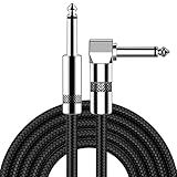
- [Low Noise High Fidelity] New bee guitar cord with 22AWG oxygen-free-copper center conductors provides enhanced signal transfer, the PVC insulation material and the high-density stranded copper double shield provide noise rejection for quiet operation
- [Ideal for Choice] New bee 1/4 straight and right angle metal connectors, ensures a secure connection in any instrument, pedal, or amp jack. L shape great fro on stage guitar stands
- [Wide Compatible] Suitable for mixer, power amplifier, microphone, effector, decoder, equalizer, electoronic organ, electric guitar, electric bass and other electronic equipments. Widely used in the installation of smart home, karaoke speaker, professional stage audio, etc
- [Easy Disassemble] Making incidental repairs quick and easy! Very nice, flexible cable
- [Dont Hesite to Order] 24 hours customer services and professional technology team are standing by
Step 5: Author points of interest and mission spaces
Points of interest (POIs) are the places that make a large map worth crossing. Give each POI a purpose before assigning a visual kit: combat, resource gathering, narrative discovery, traversal challenge, faction interaction or environmental storytelling.
Build a readable approach
Players should receive clues before arrival: a skyline silhouette, smoke, unusual color, road treatment, sound cue or changing enemy presence. The approach should offer at least one decision—whether to take a direct road, scout from high ground or enter through a riskier flank—unless the scene is intentionally linear.
Protect mission dependencies
Reserve space for quest triggers, NPC staging, combat boundaries, objective visibility and return routes. A procedurally placed rock formation that blocks an objective marker is a production bug, not a harmless variation. Maintain exclusion volumes around critical interactions and rebuild generated content whenever mission geometry changes.
Use landmarks as navigation infrastructure
A landmark must be distinctive from the directions in which players approach it. Test its silhouette against the sky, nearby terrain and weather conditions. Several medium landmarks can create a chain of orientation cues when a single distant tower would disappear behind terrain or fog.
Step 6: Integrate the map with engine systems
Map design and technical world organization are one pipeline. Epic’s documented large-world toolset groups Landscape, Open World Tools, Hierarchical Level of Detail (HLOD), Level Streaming and the Procedural Content Generation Framework as related parts of outdoor production. Its PCG documentation describes a system built for extensibility and interactivity that can integrate procedural and traditional workflows, with biome generation as a common use case.
Unreal Engine workflow
In Unreal Engine, a typical process is to establish Landscape terrain, divide content into streamable regions, generate HLOD representations for distant geometry and use PCG graphs for rule-driven placement. Keep mission-critical actors and generated background layers organized separately so a designer can revise one without damaging the other.
Unity workflow
Unity teams can apply the same division of responsibilities with terrain tools, additive scene organization and custom or third-party procedural systems. A GDC Vault session on creating FPS open worlds describes a small team using algorithmic content generation with Unity, illustrating how rule-based production can extend a limited art staff without surrendering review and curation.
Rank #4

- Digital Family Calendar: BSIMB digital calendar wall touch screen puts an end to your chaotic life. Designed for busy families, the digital calendar keeps you organised and in step with your family. Assign different colours and tasks to each family member to make family scheduling easier and more intuitive.
- Easy Setup and Auto-Sync: Plug in, connect to WLAN and auto-syn your electric calendar in minutes. Digital wall calendar compatible with Google calendar, iCloud calendar, Outlook calendar, Cozi calendar and Yahoo calendar. Add events directly on the device or through the ecalendar app. Electronic calendar stays current whether you're at work or traveling—no manual updates needed.
- All-In-One Home Assistant: Smart calendar builds habits and encourage independence with personalised chores. Display daily meal plan to reduce the daily ‘What's for dinner?’ stress. To-do lists keep track of everything you want. Turning chores into valuable achievements with stars and rewards, making life easier and more enjoyable.
- Manage Anytime Anywhere: BSIMB electronic calendar for family stay connected with the powerful ecalendar app. Access and manage your digital wall calendar anytime, anywhere with free features like stars & rewards, photo screensaver, chore charts, meals plans, to-do lists etc. Electronic planner paid features like Magic Import tailor advanced tools for users with special needs.
- Stay in Touch with Loved Ones: Share photos or videos from your phone to electronic wall calendar with app, instantly update your life moment, and keep in touch with your family, especially those who are far away; you can also surprise your smart calendar digital wall by sending him a wish card; it's also great for keeping tech-illiterate elders in touch with the youngsters.
Houdini plus an engine
Houdini is well suited to reusable terrain and content-generation tools. Heightfields, erosion networks and procedural assets can produce data that is exported to Unreal or Unity. This approach is valuable when the team expects repeated regeneration, wants the same rules to serve multiple regions or needs to keep terrain authoring independent from runtime level editing.
| Option | Strength | Trade-off to evaluate |
|---|---|---|
| Integrated Unreal stack | Landscape, PCG, streaming and HLOD are available in one environment | Teams must establish strict organization so generated and authored content remain maintainable. |
| Unity with algorithmic tools | Flexible engine workflow for small teams and custom generation | More pipeline decisions may fall to the team, including scene partitioning and tooling. |
| Houdini feeding an engine | Reusable terrain, erosion and procedural-asset networks | Requires a reliable export, versioning and regeneration process between tools. |
Compare these choices on four practical axes: control over authored spaces, speed and coverage, runtime and memory cost, and how quickly content can be regenerated after a mission or traversal change.
Free tools Windows power users keep installed
One-click scans. No signup required.
Step 7: Stream and optimize a huge world
An open world cannot keep every asset, collision mesh, AI system and effect active at full detail. Split the map into runtime regions and decide what is loaded, simulated and rendered at each distance.
Partition by player experience and technical boundaries
Streaming cells should reflect travel routes, natural occluders and gameplay encounters rather than arbitrary squares alone. Avoid boundaries that cut through a mission arena, settlement center or high-speed vehicle route. Give neighboring cells enough overlap or transition time to prevent visible pop-in and missing collision.
Use hierarchical detail
HLOD replaces groups of distant objects with cheaper representations. Combine it with distance-based foliage density, simplified collision and reduced simulation for far-away AI. A distant mountain may need only a low-cost mesh and material, while a nearby cover object needs exact collision and high visual detail.
Profile the real bottlenecks
Measure memory, draw calls, shader cost, collision, AI, navigation updates and traversal systems on target hardware. A map can be GPU-bound in a dense forest, CPU-bound in a crowded city or memory-bound when many cells overlap during fast travel. Test ordinary travel, rapid vehicles, teleportation, mission transitions and worst-case weather rather than profiling only an empty landscape.
Step 8: Iterate with repeatable reviews
After a macro change, rebuild affected procedural layers, then review the result at three scales.
- World scale: Are regions, routes, factions and landmarks still coherent?
- Player scale: Are objectives readable, traversal routes fair and encounters paced?
- Runtime scale: Do streaming, memory, collision and AI remain stable during the most demanding transitions?
Keep the bible as a living constraint set. When a mission changes a gate, road or faction border, update the spatial table, regenerate dependent layers and rerun traversal and performance checks. Treat generated output as a build artifact that can be replaced, not as untouchable authored truth.
Common failure modes and fixes
The map is attractive but confusing
Strengthen landmark silhouettes, route hierarchy and destination visibility. Remove decorative clutter that hides road entrances or objective spaces, and test navigation with minimal interface assistance.
Procedural terrain looks repetitive
Increase rule variation by slope, moisture, elevation and regional identity, then hand-author transition zones and high-visibility landmarks. Randomness alone does not create variety; contrasting constraints do.
The Tool Desk
Outbyte Driver Updater FREEFix the driver behind crashes, sound loss and screen glitchesFind Drivers →Outbyte PC Repair FREERepair Windows errors before they cause bigger problemsFix Now →Quests break after generation
Protect mission volumes with exclusions, lock seeds for release builds and run automated checks for blocked entrances, unreachable triggers and altered objective visibility after each regeneration.
Streaming causes pop-in or memory spikes
Revisit cell boundaries, prefetch along high-speed routes, generate HLOD earlier and reduce overlap between full-detail regions. Profile the worst transition rather than optimizing an average location.
Every region feels interchangeable
Give each region a different combination of climate, materials, architecture, route logic, faction activity and landmark language. A new color palette is not enough if the player’s decisions and movement pattern remain identical.
Quick Recap
A practical completion checklist
- Every bible rule that affects space has a recorded map constraint or an explicit reason it does not.
- Primary hubs, routes, barriers, alternate paths and mission arcs work in a low-detail blockout.
- Terrain supports the actual movement abilities, camera and collision systems.
- Biome, settlement and dressing rules include masks, exclusions, density limits and overrides.
- Critical landmarks, hubs, arenas, interiors and quest spaces are deliberately authored.
- Procedural layers use reproducible seeds and can be rebuilt after design changes.
- Streaming regions, HLOD and distant simulation behavior are tested on target hardware.
- Art, design and performance reviews happen after regeneration, not only before it.
Product prices and availability are accurate as of the date/time indicated and are subject to change. Any price and availability information displayed on Amazon at the time of purchase will apply.
Recommended Free Tools

