Satellite imagery can help establish what a site looked like before and after a reported strike. It cannot, by itself, show that a drone was used or identify who carried out an attack. A sound assessment combines dated imagery with geolocation, credible independent reporting, and a clear account of what remains uncertain.
The methods described here are transferable open-source techniques used to investigate conflict incidents and alleged airstrikes generally; they are not a drone-specific detection method.
As an Amazon Associate I earn from qualifying purchases.
What satellite imagery can—and cannot—establish
An image records the state of a location at the time it was captured. Comparing images from before and after a reported incident may reveal changes such as a collapsed roof, debris, scorch marks, or a crater. Those changes can support an assessment that damage occurred at that site during a particular interval.
They do not necessarily reveal when or how the damage happened. Imagery alone cannot identify a weapon, establish that a drone was involved, prove an attacker’s identity or responsibility, or confirm casualty numbers. Those conclusions require other evidence and should be stated only to the extent that the evidence supports them.
#1 Best Overall

- [Drone with Camera with Smart Screen Controller] Equipped with an exclusive LCD screen remote controller, this camera drone requires no smartphone connection to check aerial footage in real time. Two flexible control solutions are supported: direct operation via the integrated screen remote or mobile APP control. It brings straightforward, immersive flight experience well-suited for novice pilots and outdoor travel content creators. Perfect as an FPV drone for adults and kids.
- [Drone with EIS Camera for Adults and Beginners] The drone with built-in 1080P high-definition camera captures crisp aerial snapshots and silky-smooth video clips. Adjust the shooting angle vertically by 90° electrically right from the remote without manual disassembly or modification. An SD card slot on the controller supports local offline storage, so you can store large volumes of footage instantly without waiting for wireless transmission sync. Ideal rc drones with camera for adults 4k for landscape shooting, travel vlogs and outdoor aerial content creation.
- [High-Efficiency Brushless Motors Drone & Ultra-Easy for Beginners] Premium brushless motors drone lower operational noise and enhance wind resistance to guarantee steady shooting in breezy outdoor environments. One key take-off/landing function makes the beginner drone easy to operate, easy to get the drone off the ground or land smoothly; headless mode/3 speed modes are freely switchable to meet the control needs of users at different stages of the game. This foldable quadcopter is perfectly engineered for daily outdoor aerial photography and beginner flight practice.
- [Under 249g FAA-Free & Ultra-Light Foldable Portable Structure] Weighing under 249g, this drone adult model requires no FAA registration. You can easily slip this foldable drone into ordinary backpacks for hiking, camping, road trips and daily outdoor outings. Its lightweight body with a nice carrying bag, you can take it anywhere, a ideal drone with camera for adults and beginners.
- 【The Ultimate Gift Choice for Adults & Kids】 Packaged beautifully, this drone 4k compatible flyer makes an amazing gift for any occasion. The package comes fully equipped with necessary practical accessories including spare replacement propellers and a detailed illustrated user manual to help flyer get started quickly.
A useful investigation therefore separates three questions: where the material was made, when the relevant images were captured, and what the combined evidence supports about the reported event.
1. Define the claim and keep a source log
Before interpreting an image, write down the claim you are checking. Record the wording, alleged location and time, who made the claim, when it appeared, and what evidence accompanied it. Preserve the URL and the date you collected each item.
Look for the earliest available post, file, photograph, or video. A repost is not a second independent witness merely because it appears on another account or website. Note whether each item is primary material—such as footage posted by its apparent recorder—or a report repeating someone else’s account.
Windows Errors? Fix Them Before They Spread
Repair common Windows errors and clear accumulated junk for a smoother, more stable PC - no reinstall needed.Free scan · no reinstallOutdated Drivers Are Slowing You Down
One free scan finds every outdated or missing driver and matches the right update for your exact hardware.Free scan · exact hardware matchAssess sources in context: their history, affiliations, proximity to the event, and whether they have supplied verifiable material. Bellingcat and the Global Legal Action Network’s Yemen methodology describes comparing user-generated content with media reports, local and international NGO material, satellite imagery, and other open-source evidence. Keep each channel identifiable rather than blending them into a single unattributed claim.
Rank #2

- 【2K Ultra HD Camera】Loiley drone features a high-quality 2K HD camera with a 90° remote adjustable angle, allowing you to capture breathtaking photos and ultra-clear videos from the sky. Whether it's a scenic landscape or a special family moment, this drone helps you preserve every beautiful memory with precision. Simply connect your smartphone to the drone’s camera to enjoy a real-time panoramic view, and easily share your adventures directly to social media with just a tap
- 【User-friendly & Optical Flow Positioning】 The Loiley drone operation is magically simple—press the one-touch start/land button to begin flying. With headless mode and gravity sensing, you only need to tilt the controller up, down, left, or right to make the drone fly forward, backward, or sideways. The upgraded optical flow positioning ensures more stable and controllable flight, allowing you to focus on photography. Altitude Hold helps you capture high-quality photos and videos effortlessly
- 【Take it with you】 Loiley drone with camera is your ultimate travel partner! It is small and lightweight, and the size is only 5 x 3 x 2 inches when folded, which can be easily put into a pocket or backpack. Weight under 250g to save you from FAA registration. Whether you're going on an outdoor adventure or exploring new places, you can easily take this mini drone with you and capture amazing aerial shots wherever you go
- 【Safe and Long Battery Life】With two rechargeable drone batteries, this drone extends the flight time to approximately 26 minutes, providing a worry-free flying experience. The batteries are easy to charge and replace, with built-in overvoltage protection. The remote controller emits a low battery warning, ensuring beginners never lose their RC drone
- 【Professional After-Sales Support】A mini drone with a camera makes for a cool and creative gift. Along with that, the package includes a portable bag for outdoor travel. The drone comes with propeller guards, spare fan blades, and remote control batteries, ensuring safety and reliability. Additionally, 24-hour technical support, quality warranty, and Accessories Supply services are provided for customer satisfaction
2. Preserve material and document your work
Keep original files where it is lawful and safe to do so, along with their URLs and relevant metadata. Record when you collected them; online content can be edited, removed, or recirculated without context. Do not assume that a screenshot preserves all information contained in an original file.
Maintain research notes that connect each conclusion to the evidence behind it. The Bellingcat workflow separates identification, collection and preservation, verification, analysis, review and confirmation, and presentation. Its Ukraine investigations manual likewise recommends organizing notes and linking evidence items so another reviewer can follow the reasoning.
3. Geolocate the claimed site
Begin with features visible in the original photo or video, not with a location asserted in a caption. Look for distinctive road layouts, building shapes, terrain, water features, or infrastructure. Compare several of these features against mapping and satellite sources, then explain which matches led you to the proposed location.
Recommended Free Tools
Coordinates are a conclusion, not automatic proof of where an image was made. A location is more persuasive when multiple distinctive features line up and the material can be compared with independent local reporting or other evidence. If the match is broad rather than exact, describe it as an approximate area instead of giving false precision.
Rank #3

- No Registration Needed - Under 249 g, this drone with camera for adults 4K does not require FAA registration or Remote ID for recreational use. Visit the FAA's official website for requirements related to drone registration and Remote ID. [1]
- 4K Ultra HD & 3-Axis Gimbal for Cinematic Quality Shooting - Capture stunning moments in any light—sunrises, sunsets, and night scenes with crystal-clear 4K resolution. Thanks to the 3-axis gimbal, you can achieve cinematic-quality footage with this advanced drone with camera.
- 38kph (Level 5) Wind Resistant - This drone for adults has a stable flight even in Level 5 winds. Brushless motors enhance power and allow takeoff at altitudes up to 4,000 meters.
- Due to platform compatibility issue, the DJI Fly app has been removed from Google Play. To ensure a better product usage experience, please log in to the DJI official website to download the latest version of DJI Fly.
- Uninterrupted Creation with Extended Battery Life - There are three sets available for you to choose from: 1-battery set (31-min), 2-battery set (62-min), or 3-battery set (93-min). [3] Say goodbye to battery anxiety and let nothing hold you back.
Record how you reached the location assessment and link each supporting item in your notes or published analysis. Bellingcat/GLAN’s incident methodology treats geolocation and cross-referencing as parts of the analysis, rather than as substitutes for it.
4. Establish when the satellite image was captured
Find the closest usable imagery from before and after the alleged incident. For every image, record the provider and capture date—and the capture time if available. Preserve the source image or a reliable reference to it, and credit the provider when presenting it. The Bellingcat/GLAN Ukraine manual notes that a displayed date in services such as Google Earth Pro can reflect the viewer’s location, so check what the date represents before using it to build a timeline.
Do not confuse the date an image became available with the date it was captured. Before relying on an image, check the factors that determine whether it can answer your particular question:
Do these 3 things before closing this tab:
1Clear out junk files and repair common Windows errors2Fix the driver behind crashes, sound loss and screen glitches3Repair Windows errors before they cause bigger problems| Factor | What to check | Why it matters |
|---|---|---|
| Capture date and time | Confirm the acquisition date shown by the provider and the meaning of any displayed time or date. | A date that is misread or reflects a viewer’s location can distort the event timeline. |
| Resolution and accuracy | Check the provider’s description of image detail and positional accuracy. | An image may show a broad change while being too coarse or imprecise to support a claim about a particular structure. |
| Revisit frequency and latency | Check how often the area may be imaged and how long data can take to become available. | The nearest available image may still be too early, too late, or separated from the incident by a long interval. |
| Cloud conditions | Check whether clouds or other image conditions obscure the site. | Obscured areas can hide changes or make comparisons unreliable. |
| Coverage and access | Check for geographic gaps, restrictions, licensing conditions, or reduced-resolution coverage. | Some sensitive areas may be unavailable or represented at reduced detail; access conditions can also limit reuse. |
Bellingcat’s imagery toolkit warns that satellite data may not be up to date and that currency and latency vary. A missing or unclear image is not evidence that nothing happened.
Rank #4

- 【Easy to Fly: Master the Sky Instantly】 No experience? No problem! Equipped with One-Key Takeoff/Landing and Altitude Hold, this beginner friendly drone stays rock-solid in the air. It’s so easy to fly that even kids 8-12 and adults who have never flown can master the controls in seconds. Perfect for stable indoor outdoor play, ensuring a stress-free start for every new pilot.
- 【1080P HD Camera & Real-Time FPV View】 Capture your world from a brand-new perspective! The integrated 1080P HD camera delivers crystal-clear aerial snapshots and smooth FPV live video directly to your phone. Use Gesture Selfie to snap photos with a simple hand movement—making it the ultimate smart gadget for creative family fun, backyard adventures, or park exploration.
- 【Double the Flight for Non-Stop Entertainment】 Enjoy twice the joy with 2 modular batteries, providing up to 24 minutes of total flight time. This foldable mini drone is compact and comes with a premium carrying case, making it a portable lightweight companion. Whether it's a camping trip, a beach day, or a weekend family garden play, your aerial entertainment never has to stop.
- 【Thrilling Smart Features for Exciting Play】 Take your recreational flight to the next level! Master breathtaking 360° 3D Flips, steer by tilting your phone with Gravity Control, or design custom paths with Trajectory Flight via the Smart App. With 3-speed adjustments, this RC quadcopter offers a versatile and exciting pastime that grows with your skills, from casual drifting to high-speed stunts.
- 【Safe, Durable & Worry-Free House Fun】 Safety is our priority for every hobbyist. Featuring Headless Mode for easy orientation and 4 protective propeller guards to withstand accidental bumps. Built with high-toughness materials, this small drone is safe for indoor play and sturdy enough for outdoor exploration. It’s the go-to flying toy for boys and girls seeking a reliable and fun-filled adventure.
5. Compare changes carefully
Compare the same area in dated images, at a similar scale and orientation where possible. Describe what is visibly different without assigning a cause prematurely: for example, “the roof appears intact in the earlier image and collapsed in the later one.” If you use marked-up images, make clear what is original and what you have added.
Damage, debris, scorch marks, craters, or vehicle changes may corroborate a report, but they do not on their own establish that a strike caused them. The images may not show the moment of an attack, and the change may predate the claim or have another cause. Connect a visible change to the reported incident only when the timing and independent evidence support that interpretation.
Independent reader supportYour contribution helps us test, update, and keep practical guides available for everyone.6. Corroborate the account and test alternatives
Compare the imagery with independently sourced eyewitness material, local and international media, NGO reporting, official statements, and other open-source evidence. Ask whether the accounts refer to the same place and time, what the site was used for, what was nearby, and whether the reported timeline fits the image dates.
Quick wins for a faster PC:
Fix the driver behind crashes, sound loss and screen glitchesFind Drivers →Repair Windows errors before they cause bigger problemsFix Now →Check whether sources are genuinely independent. Several articles or posts may all trace back to one original account. Record contradictions instead of silently selecting the version that best fits the image. Consider whether damage could have occurred earlier, had another cause, or lies near—but not at—the claimed location.
Best Value
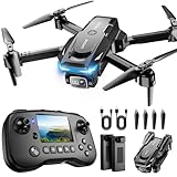
- The PK01 drone's remote comes with a super handy built-in screen—no phone needed—so you can watch live HD footage and check flight stats right in your hands. (An SD card is required to save images and videos; not included) Powered by tough brushless motors, this little flyer is strong, smooth, and built to last. With one-key takeoff/landing, headless mode, and even 360° flips, you’ll look like a pro in no time. Ready for takeoff?🤩
- 📷【Drone with Camera】 Equipped with a 1080P HD 80°adjustable lens, the drone not only assists you in catching every wonderful moment from a bird's-eye perspective but is also perfect for selfies. It can even be used to check the roof of a house or other hard-to-reach areas. You can enjoy the real-time HD pictures and videos via the remote screen & APP. Automatically take photos/videos with gestures. First flight tip: choose a windless indoor space, keep the altitude below 6 meters and the distance below 30 meters to help better practice and control the drone.
- 🕹️【More Fun to Fly】 This foldable drone has 2 control modes: remote control, APP control. You can enjoy exciting features such as one-click 360° flips, 3D flip, waypoint flyflight, gravity control, circle fly, rotation fly, 3 speed gear, gravity sensing and Emergency Stop. (Some functions should be controlled by the app) You can also effortlessly command the remote control drone with simple voice instructions like "Take off"and more.
- 🔋【Long Flying Time and Safer】 The upgraded FPV drone is equipped with two enhanced batteries, extending the flight time to 25 minutes, providing no-worry flying experience. The controller has built-in battery and comes with 2pcs USB charging cable, enables you to charge it effortlessly. Features with emergency stop, 4 propeller guards, child lock feature and low power alarm to ensure a safe and reliable flight. PK01 is lightweight, portable and No FAA Registration needed, makes it a ideal drone for indoor and outdoor activities.
- 📲【How to Connect Your Phone】1.Power off the remote controller. 2. Turn on the drone. Note: Make sure the tail of the drone is facing towards you. 3. Download and log in to the "PK01 DRONE" app. 4. Connect your phone to the Wi-Fi network named "PK01DRONE_XXXXXX" via the app. 5. Move the left and right joysticks of the remote control to the lower left or lower right 45 degrees at the same time. The drone light flashes and then turns on, completing horizontal calibration. 6. Enter the app control interface, tap the "Control Switch" icon, and then select "Take Off" for a successful launch.
The Yemen collection protocol uses at least three cross-referenced sources for its “confirmed” incident grade. That is the standard of that project, not a universal rule for every investigation; what matters in any assessment is explaining the evidence and method behind its confidence level. If the material does not support a conclusion, say that the incident remains unsubstantiated or that the cause is unknown rather than filling the gap with an assumption.
7. State the finding and its limits
Lead with the conclusion and a plainly described confidence level. Separate direct observations from interpretations: what the image shows, what other sources report, and what those combined facts suggest are different kinds of statements. Explain how you established location and chronology, identify the imagery provider and capture date, and link the evidence so readers can inspect the basis for the assessment.
Be especially careful with casualty figures and responsibility. Bellingcat/GLAN’s Yemen methodology notes that casualty reporting can conflict and cautions against counting deaths without direct examinable evidence; the Ukraine manual also warns against unsupported totals. Attribute figures and responsibility claims to their sources unless they have been independently established. Where accounts differ, describe the disagreement or report a supported range rather than presenting a disputed number as settled fact.
Quick Recap
Product prices and availability are accurate as of the date/time indicated and are subject to change. Any price and availability information displayed on Amazon at the time of purchase will apply.




