To read a weather radar map, first identify the product and its timestamp, then use that product’s legend to interpret the colors. A reflectivity map shows radar echoes from precipitation and other targets; an animation shows how those echoes changed between scans. Neither is a perfect picture of rain at the ground or a guarantee of where a storm will go next.
The examples below describe U.S. National Weather Service (NWS) WSR-88D products. Other countries, apps and radar services may use different products, palettes and update schedules, so read the legend and timestamp on the map you are viewing.
As an Amazon Associate I earn from qualifying purchases.
Start with the product name, legend and timestamp
Before interpreting a color, check what the map is measuring. On NWS WSR-88D displays, common choices include reflectivity and velocity; a rainfall-accumulation product answers a different question. The same color can mean different things on different products or platforms, so use the displayed legend rather than assuming a universal color key.
- Base reflectivity: Shows echo intensity from a particular elevation scan. It is a slice of the radar’s observations, not a maximum through the full volume.
- Composite reflectivity: Shows the maximum reflectivity detected through the radar volume. It can reveal a strong echo found above the lowest scan, but does not mean that intensity is occurring at the ground.
- Velocity: Shows motion toward or away from the radar along its line of sight. It is not a map of a storm’s direction of travel.
- Accumulation or precipitation-type products: Estimate accumulated precipitation or classify precipitation rather than showing the same field as reflectivity. Check the product label and its legend for the specific meaning.
Check the timestamp before drawing conclusions. Radar images are observations from particular scan times, and a map or animation may be delayed. The NWS Central Region Event Ready Guide advises: “Be sure the radar data you’re looking at is current! Always check the timestamp.” Confirm your location on the display, too, so you do not confuse a nearby echo with one farther away. NWS Central Region Event Ready Guide
#1 Best Overall

- ⚡️ KNOW YOUR ENVIRONMENT - Real-time measurements of seven weather functions
- ⚡️ KNOW WHEN TO LEAVE - Lightning detection up to 40 miles away ⚡️
- ⚡️ ALL YOU NEED - Temp, Humidity, Pressure, Heat Index, Dew Point, Altitude, Lightning Detector
- ⚡️ INFO AT YOUR FINGERTIPS - Color touchscreen display gives you all the data quickly & easily
- ⚡️ GOES WITH YOU ANYWHERE - Handheld, portable, rugged, water resistant, USB charged Lithium battery
What do the colors on a weather radar map mean?
On a reflectivity map, colors represent the strength of the returned radar signal according to that map’s scale. Reflectivity is commonly expressed in dBZ, a logarithmic measure. Read the actual legend: color steps are not a simple linear scale, and palettes vary among services.
Stronger precipitation echoes often correspond to higher precipitation rates, but the return also depends on what the radar beam encounters. Drop size, precipitation type, beam width and non-weather targets can all affect the signal. A color can suggest a stronger echo; it cannot, by itself, give an exact rainfall amount at your address.
Rank #2

- Multifunction Outdoor Tool: This handheld device combines digital altimeter, barometer, thermometer, electronic compass, weather forecast, time, and backlight in one compact unit, providing comprehensive environmental data for outdoor enthusiasts.
- Wide Measurement Range & High Accuracy: Accurately measures altitude from -700 to 9000m, barometric pressure (300-1100mbar), temperature (-10℃ to +60℃), and provides 16-direction compass heading for reliable navigation in various terrains.
- Portable and Durable Design: Lightweight with protective casing and included lanyard for easy carrying during hiking, climbing, camping, and other outdoor adventures. Powered by 2 AAA batteries (not included) with power-saving feature.
- Crystal Clear LCD with Blue Backlight: Features large LCD screen with ultra-bright blue LED backlight that ensures visibility in all lighting conditions, from bright sunlight to complete darkness, with 5-second backlight activation.
- Weather Forecast Function: Analyzes barometric pressure trends to predict sunny, partly sunny, cloudy, or rainy conditions 12-24 hours in advance, helping you avoid sudden storms and plan outdoor activities safely.
The NWS Storm Prediction Center glossary says values of 50 dBZ or more are normally associated with heavy thunderstorms and may occur with hail. It also cautions that “there are no reliable threshold values to confirm the presence of hail or severe weather in a given situation.” Treat that value as a general association, not a diagnostic cutoff or a warning. NWS Storm Prediction Center glossary
The Tool Desk
Outbyte Driver Updater FREEFix the driver behind crashes, sound loss and screen glitchesFind Drivers →Outbyte PC Repair FREEClear out junk files and repair common Windows errorsFree Scan →How can I tell which way a storm is moving?
Use a loop of recent reflectivity frames and follow the same precipitation area from scan to scan. This shows where the observed echoes have shifted. Storms may change speed, curve or move in different directions, so a short animation is evidence of recent motion, not a forecast or an exact arrival-time estimate.
Rank #3
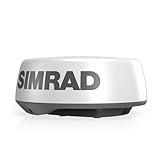
- HALO20 COMPACT 20 INCH DOME RADAR: Provides reliable situational awareness for smaller boats and dayboats, giving you big‑system performance in a space‑saving design.
- 24 NM DETECTION RANGE: Ensures dependable visibility of near‑ and mid‑range targets for confident navigation
- ADVANCED PULSE COMPRESSION: Delivers sharp, accurate target definition both close and far to help identify hazards clearly
- ALL‑CONDITIONS VISIBILITY: Cuts through fog, rain, and darkness to maintain awareness when weather or light changes
- MARPA TARGET TRACKING: Tracks up to 10 targets simultaneously to enhance collision avoidance and safety
Do not confuse that motion with the colors on a velocity product. NWS base velocity describes the radial wind component: on the specified WSR-88D product, negative values indicate motion toward the radar and positive values indicate motion away from it. A red-and-green pattern or a velocity color shows motion relative to the radar, not the storm’s overall path across the map. Check the velocity legend and locate the radar before interpreting it. NWS radar explanation
Why does radar show rain when it is dry where I am?
Radar samples targets in a beam above the surface; it does not directly measure what reaches the ground at each point. As the beam travels farther from the radar, it is generally higher above the ground. The NWS Central Region Event Ready Guide notes that at far distances it may be 10,000 feet or more above ground. That is an illustrative description, not a fixed height for every location. If precipitation is shallow, the beam can pass over it, creating a gap in the map even when rain or snow is occurring below.
Rank #4

- Pro-Level Accuracy, Anywhere - Used by every Major League team, the Pocket Radar Smart Coach delivers ±1 mph accuracy on a baseball thrown from 120 feet away (150 feet for a softball), offering professional-grade reliability for in-game or practice environments without bulky equipment. Its advanced technology ensures reliable data tracking over time compared to the shorter range, less professional products in the market.
- Smart App & Video Integration - Combine radar readings with video analysis using the free companion app. Overlay velocity onto videos in real time to break down mechanics, build confidence, and accelerate skill development.
- Pocket Radar PLUS Subscription Value - Upgrade and unlock powerful features like pitch charting/tagging, slo-motion video playback and the ability to connect with premier player devleopment and streaming partners like Gamechanger, SidelineHD, Athletes Go Live, Mustard App, Onform, Skillshark and many more.
- Remote Coaching & Recruiting Ready - Share video clips and performance data with college recruiters, remote coaches, or team members instantly—making it a powerful tool for player exposure and feedback.
- Instant Performance Feedback - Measure and track velocity in real time during games, practices, or training sessions to monitor progress and make data-driven improvements on the spot.
The NWS guide puts the limitation plainly: “What you see on radar does not always translate to what is actually happening at the surface.” Beam blockage by terrain or structures, ground clutter and unusual atmospheric conditions can also affect returns. NWS Central Region Event Ready Guide
Non-weather echoes can look like precipitation
Radar may detect ground clutter, anomalous propagation, birds, insects, aircraft or wind-farm effects. A single frame can make these echoes difficult to distinguish from precipitation. Check whether the feature moves and changes like surrounding weather across a loop, where it sits relative to your location and the radar, and whether the displayed timestamp is current. When conditions matter for safety, compare radar with official forecasts and warnings rather than relying on an echo alone. Automated hail, rotation and tornado outputs can be error-prone, and radar is not a substitute for conditions at the surface.
Best Value

- High Visibility Floating Core - The perfect compact VHF radio for marine use on any size vessel, designed with a high-visibility orange floating core for buoyancy and easy retrieval if dropped overboard
- 6 Watt VHF Power – Switchable between 1/3/6 Watts of power for range demands and battery optimization, use only the amount of power you need for vessels/stations near and far
- Day/Night Display - Day/Night selectable LCD display for easy viewing and high visibility at any time of day or night, regardless of weather conditions
- Tri-Watch Mode - Instantly access Channels 9, 16, and any user-specified channel with Tri-Watch, allowing you to monitor multiple channels at once in busy waterways for safety
- NOAA Weather Alerts - 12 weather channels and National Oceanic and Atmospheric Administration emergency broadcast channel access to stay informed and safe on the water
Radar does not detect lightning. Lightning information comes from a different data source, so use a service that explicitly includes lightning data if you need to see strikes. NWS Central Region Event Ready Guide
Independent reader supportYour contribution helps us test, update, and keep practical guides available for everyone.Why radar rainfall amounts are estimates
Radar reflectivity can be converted into an estimated rain rate using an empirical relationship, but that conversion is not exact. Different distributions of raindrop sizes can produce the same reflectivity while corresponding to different rain rates. The estimate therefore should not be read as a precise measurement of rainfall at a doorstep.
Some conditions can further distort estimates. An NWS Morristown technical explanation discusses literature findings that melting snow can enhance reflectivity by 5–10 dB, with rain-rate estimates in that situation potentially up to five times too large. Those are reported findings for a particular phenomenon, not an error factor that applies to every radar estimate. NWS Morristown radar rainfall explanation
Quick wins for a faster PC:
Fix the driver behind crashes, sound loss and screen glitchesFind Drivers →Clear out junk files and repair common Windows errorsFree Scan →Scan for outdated or missing drivers - takes under a minuteDriver Scan →Quick Recap
A practical way to check what the map is telling you
- Read the product label and legend. Establish whether you are looking at base reflectivity, composite reflectivity, velocity or an accumulation/type product.
- Check the timestamp and your location. Make sure the data is recent enough for your decision and that you have found the right place on the map.
- Use reflectivity colors as relative echo strength. Do not treat a color as a universal rain category, an exact rain amount or proof of hail or severe weather.
- Loop several frames to assess recent movement. Track the echo’s observed shift, but do not assume it will continue in a straight line or arrive at a precise time.
- Account for radar range and surface conditions. A distant beam may be well above ground, and non-weather echoes or blockage can mislead. Check official forecasts and warnings for safety decisions.
Product prices and availability are accurate as of the date/time indicated and are subject to change. Any price and availability information displayed on Amazon at the time of purchase will apply.




