Quick wins for a faster PC:
Clear out junk files and repair common Windows errorsFree Scan →Scan for outdated or missing drivers - takes under a minuteDriver Scan →Repair Windows errors before they cause bigger problemsFix Now →Use Google Maps and Street View to orient yourself, compare visible layouts, and find details worth checking. Visit a place when current conditions, scale, movement, sound, or lived-in details matter to the scene. Neither method alone gives you a complete picture: online imagery is a dated view, while a visit is a firsthand observation of one place at one time.
What each method can tell you
Google Maps and Street View: remote orientation
Maps and Street View can help you understand how streets, buildings, parks, and routes relate to one another. Use them to shortlist locations, notice visible patterns, and form questions for further research. Treat what you see as reference for original design work, not proof that every detail is current or complete.


As an Amazon Associate I earn from qualifying purchases.
Google cautions that actual conditions can differ from map results: “When you use Google Maps map data, traffic, directions, and other content, you may find that actual conditions differ from the map results, so exercise your independent judgment and use Google Maps at your own risk.” (Google Maps Additional Terms of Service.)
Free tools Windows power users keep installed
One-click scans. No signup required.
A site visit: firsthand observation
A visit can help when a scene depends on how large a space feels, how people move through it, what can be seen from a particular viewpoint, or what it sounds and feels like at ground level. It can reveal materials, activity, weather effects, and social uses that a map image cannot establish. These are reasons to seek firsthand observation, not a guarantee that a visit will capture every relevant condition.
#1 Best Overall
Visit only places you can access safely and lawfully. Make original notes or sketches as you go; a pocket field notebook is one optional way to record observations, not a requirement.
Which approach fits your research question?
| Research need | Start with | Add an on-the-ground check when |
|---|---|---|
| Find a candidate neighborhood, route, or arrangement | Maps or Street View for broad orientation | Access or the present-day layout affects the scene |
| Block out recognizable spatial relationships | Remote map research and original notes | Scale, sightlines, slopes, or pedestrian movement matter to play |
| Capture atmosphere and human detail | Remote imagery to generate questions | Sound, weather, rhythms, materials, or social use are central |
| Depict a current place accurately | Check current sources | A feature is time-sensitive or the Street View capture may be old |
| Reproduce Google content in a shipped game | Check the terms for the specific product and use | Your plan involves screenshots, tracing, extraction, or redistribution; terms alone may not settle every legal question |
This is a practical way to choose research methods, not a guarantee that a particular use of Maps is permitted or that a visit is safe or lawful.
Rank #2
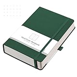
- Dotted Thick Journal: AHGXG dotted journal with medium A5 size 5.75'' × 8.38'', 5 x 5 mm dot grid paper, 160 sheets/320 pages. Provides plenty of writing room to let your creativity flow freely without the fear of running out of room or trying to hurry and end the book
- 100 GSM Acid-free Paper: Dot grid notebook adopts 100 GSM thick paper, designed to avoid ink bleeding through and feathering, suitable for most pens
- Faux Leather Soft Cover: The sturdy soft cover, which can lay flat at 180°, makes the journal more durable and comfortable to touch. It provides a protective layer for the pages and offers a comfortable writing surface
- Humanized Design: Numbered pages, index content pages, and 2 bookmarks help you find important content faster. Journal stencil included, a perfect tool for journaling. Back inner pocket holds notes, business cards, small gadgets, etc. Closes with an elastic band and has a pen holder loop for any pen
- Suitable For: Great for journaling, travel journaling, note-taking, doodling, artist drawing, mood tracking, daily planning, work planning, logbooks, food planning, and more. Makes a great gift for school, children, friends, or business colleagues
How to combine remote research and a visit
- Orient yourself. Use Maps to understand the broad layout and identify a few details that could affect the game world.
- Turn observations into questions. Note what needs checking, such as whether a route is walkable, how a slope feels, or what can be seen from street level. Do not assume that an image answers a current or sensory question.
- Check consequential details. Consult current, independent sources for facts that affect the scene. Visit accessible locations when firsthand observation could materially change your design.
- Record what you observe yourself. Keep original notes and sketches distinct from screenshots or other source content.
- Design an original environment. Use research to inform fictionalized places and design choices. Before embedding or reproducing Google content, check the current rules for the exact content and use.
Why Street View should not be treated as current
Street View shows what cameras captured when they passed, not a live view. Google says processing takes at least a few months and that published imagery may be anywhere from a few months to a few years old. That makes it unsuitable as the sole check for current construction, access, traffic, signage, or other time-sensitive details. Check the image date where available and verify consequential facts using current sources or firsthand observation. (Google’s Street View privacy page.)
What’s actually slowing this PC down?
Pick the symptom - the matching free tool is one click away.
Google says it automatically blurs faces and license plates and allows people to request additional blurring of a person, car, or home. Those privacy measures do not make the imagery real-time or establish that every detail is current.
Rank #3

- Luxurious PU Leather Journal: Premium leatherette hardcover journal offers a blend of sophistication and durability. The stunning texture gives the journal an upscale look and feel and offer exceptional value.
- Generous A4 Journal Notebook: Spacious 8.5 x 11 size of the large journal provides plenty of room to jot down notes, brainstorm ideas, or sketch diagrams, making it a valuable tool for school and work-related tasks.
- Thick Paper Notebook: Thick journal boasts top-tier 192 acid free pages to create a smooth writing experience. This superior quality paper prevents any ink bleed-through, ensuring every note, sketch, or idea remains pristine and undisturbed on the both sides.
- Optimized Wide Ruled Notebook Journal: With the ideal college-ruled line spacing, lined journal accommodates detailed and organized writing to enhance productivity for students, professionals, or anyone in need of a neat writing space.
- Thoughtful Design: Elastic band for closure. Elastic pen loop for different sizes pens. 2 Colored ribbon bookmarks for quick reference. 1 front paper pocket and 1 back expandable pocket for bills, stickers, notes, index tabs. 2 Labels for classification and archive.
Viewing Google content does not automatically grant reuse rights
Researching a place with Maps is different from incorporating Google’s content into a game. Google’s general Maps terms restrict redistribution or sale of Maps content, copying except where permitted, mass downloading, and some uses that create substitute mapping datasets. The Maps Platform terms describe restrictions that include tracing or digitizing roads and building outlines from specified map imagery. Google’s Geo Guidelines say Street View imagery must remain in its embedded context and identify tracing or analyzing imagery to create data as a disallowed use. The developer FAQ says map tiles and satellite imagery cannot be accessed through mechanisms outside Google Maps Platform.
Google’s Geo Guidelines also require attribution for Maps, Earth, and Street View content; attribution can vary by geography and content type. Attribution is not, by itself, permission to extract or reuse imagery. Review the current agreement for the relevant Google product, geography, and implementation, and seek qualified legal advice for consequential commercial use. The published pages do not resolve every possible permission, fair-use, or jurisdiction-specific question.
- Google Maps Additional Terms of Service
- Google Maps Platform Terms of Service
- Google Geo Guidelines
- Google Maps Platform FAQ
Can you build a game world entirely from position-mapped real-world photos?
Photos can inform a world’s appearance, but the available guidance does not establish that a workflow built entirely from position-mapped photos is feasible, accurate, or permitted using Google imagery. In particular, Google’s published guidance places limits on extracting, tracing, analyzing, and redistributing specified content. For a game, distinguish between using maps to research a place and copying map or Street View material into the product; check the applicable terms before planning the latter.
What this comparison can—and cannot—establish
There is no cited controlled comparison showing that Maps research or site visits produce more realistic game worlds. The methods answer different questions: remote maps help with orientation and visible arrangement; a visit can add firsthand observations of a place as experienced at a particular time. For a location-based game example, a 2018 TIME report covered a then-new Google Maps integration and the design value of recognizable real-world features. It is historical context, not evidence of current product availability, terms, or a proven realism advantage.
Quick Recap
Product prices and availability are accurate as of the date/time indicated and are subject to change. Any price and availability information displayed on Amazon at the time of purchase will apply.




