Freedom251 › Point Cloud Software

LidarView
What LidarView is
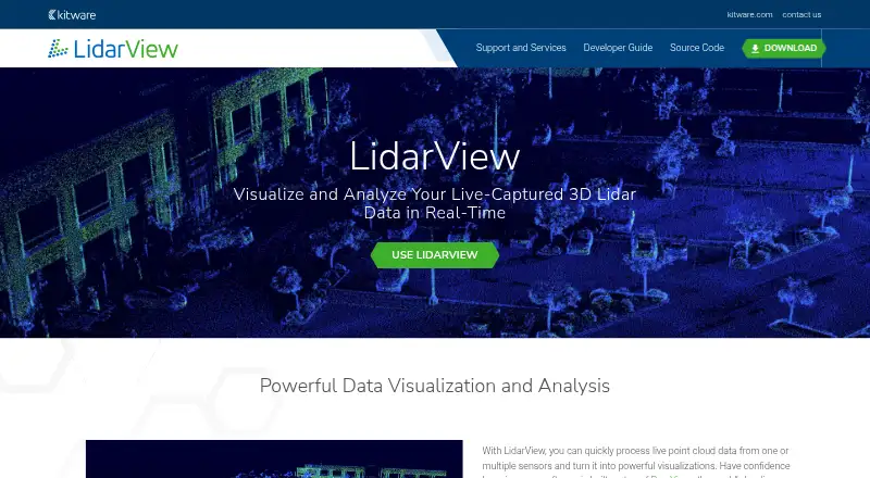
LidarView receives, records, visualizes and processes 3D LiDAR data in real time. It works with live sensor streams and recorded PCAP files, displaying time-stamped returns as point clouds. Users can show or hide laser subsets, display multiple frames and apply 3D transforms. Its SLAM functions reconstruct the surrounding environment and localize the sensor. The product also describes HPC support for AI algorithms used in scene classification, object tracking and 3D reconstruction. Documented interpreters cover Hesai, Leishen, Livox, Ouster, Robosense and Velodyne; additional vendor interpreters can be added through plugins when an open driver or packet specification is available. ROS2IO and PCL plugins are pre-integrated. Built on ParaView, LidarView supports Python scripting and web visualization through trame. The open-source software uses the Apache 2.0 license and has Linux and Windows downloads. Its documentation notes that the supported sensor list does not cover the whole market. Users can seek help through Discourse or file an issue; Kitware offers training and expertise for adaptation and feature development.
Who it suits
LidarView suits users working with LiDAR data who need real-time visualization, processing or SLAM, particularly with a documented sensor or an available open driver or packet specification. It is customizable for sensor workflows and supports Linux and Windows.
What it does well
- Works with live streams and recorded PCAP files.
- Includes SLAM for environment reconstruction and sensor localization.
- ROS2IO and PCL plugins are pre-integrated.
- Open source under Apache 2.0.
- Supports Python scripting and web visualization through trame.
What to know first
- The supported sensor list does not cover the entire market.
- Binary downloads are listed for Linux and Windows.
Plans
| Plan | Billed and limits | Price |
|---|---|---|
| LidarView | No licensing fees · Open source under Apache 2.0 | Free |
As lidarview.kitware.com lists them, read 29 Sept 2026. The maker's own page has the final word.
Getting started
- Visit the LidarView website.
- Choose a Linux or Windows binary download.
- For Linux, review the required system libraries in the documentation.
- Connect a supported live sensor stream or use a recorded PCAP file.
- Use the visualization, processing, and analysis functions for your workflow.
LidarView is a Linux and Windows application for receiving, recording, visualizing and processing 3D LiDAR data. It is best suited to technical users building sensor workflows or analyzing live and recorded captures. Its free, extensible toolkit is substantial, but support for a particular sensor is a prerequisite, not an assumption.
Overview
LidarView brings live sensor streams and recorded PCAP files into the same workflow. Users can inspect data as it arrives and return to saved captures for further work. The Apache 2.0 license allows commercial use without licensing fees, which makes it a practical option for teams that need to adapt their tools rather than buy into a paid platform.
It is built on ParaView, with Python scripting and web-based visualization through trame. That foundation gives technical users ways to extend or present workflows, though the product’s appeal is strongest when those capabilities are useful; a basic viewer may be simpler for straightforward inspection.
Key features
The 3D viewer displays time-stamped LiDAR returns and can isolate laser subsets, show multiple frames and apply 3D transforms. Point-cloud registration and classification, E57 and LAS/LAZ support, and geospatial analysis broaden its role from visual inspection to processing. For teams working with point clouds in several stages, that breadth can reduce the need to switch tools.
SLAM reconstructs the surrounding environment while localizing the sensor. LidarView also describes HPC support for running AI algorithms for scene classification, object tracking and 3D reconstruction. These capabilities suit more involved analysis workflows, but users should weigh them against the work of configuring a customizable technical application.
Documented sensor interpreters cover Hesai, Leishen, Livox, Ouster, Robosense and Velodyne. ROS2IO and PCL plugins are pre-integrated, and additional vendor interpreters can be added when an open driver or packet specification is available. The sensor range is still not comprehensive, so teams with other hardware may face an integration project or need another tool.
Pricing
LidarView is free: its LidarView plan costs nothing, with no licensing fees and an Apache 2.0 open-source license. That makes it suitable for commercial and research users alike without a per-seat charge described in the plan. Kitware also offers training and subject-matter expertise for customers adapting the software or developing features; those services are a route to help when internal development capacity is limited.
Platforms
Binary downloads are documented for Linux and Windows, with required system libraries identified for Linux. Choose it when those desktop platforms fit your deployment; users on other platforms should consider alternatives that support them.
Who it's for
LidarView is a strong fit for sensor and robotics teams, researchers and developers who need to visualize, record or process 3D LiDAR data and value scripting, plugins or SLAM. It is less compelling for someone seeking a finished workflow with guaranteed coverage of any sensor: compatibility depends on the documented interpreters or the ability to add one. Users can seek community help through the ParaView and LidarView Discourse forum or file an issue in the LidarView Git repository.
Pros and cons
- Pros: Free commercial use under Apache 2.0 avoids licensing fees while leaving room to customize.
- Pros: Live and PCAP input, 3D viewing, registration, classification, geospatial analysis and SLAM support several stages of LiDAR work in one application.
- Pros: Python scripting, trame visualization and pre-integrated ROS2IO and PCL plugins offer extension paths for technical workflows.
- Cons: The supported sensor list does not span the whole market, and adding an interpreter depends on an open driver or packet specification.
- Cons: Linux and Windows are the documented binary platforms, limiting its direct fit for users who need another platform.
Alternatives
Point Cloud Software is a broader category to explore when you want to compare point-cloud tools.
- Point Cloud Library is another free option, with a BSD license for commercial and research use and Android, Linux, macOS and Windows platforms. Choose it if that broader platform coverage or its library focus better suits your project.
- WhiteboxTools offers free open tools with 700+ tools through Python, R or QGIS, plus a LiDAR & Forest Analytics — Entry plan at $740 a year. Consider it when that toolset and interface fit better than LidarView’s sensor-centered workflow.
- Open3D is a free option spanning API, Linux, macOS, self-hosted, web and Windows. Pick it if those deployment choices matter more than LidarView’s documented sensor interpreters.
- LP360 is a freemium Windows and web option. Its DJI L1/L2 Cloud batch processing plan costs $620 a year, requires LP360 Drone, includes 20 flights per month and one user; choose it if that defined batch-processing allowance fits your needs.
- Pointly is a freemium API, self-hosted and web alternative with usage-based plans, including Pointly Box usage based at 0.03 € per once. Consider it if a usage-based web or API offering is a better fit.
- Entwine is a free Linux alternative.
- Leica Cyclone 3DR is a paid Windows alternative.
- PDAL is a free option for Linux, macOS and Windows.
Verdict
Choose LidarView if you need a no-license-fee, customizable environment for live or recorded LiDAR data, with visualization, processing and SLAM in one workflow. Its chief advantage is that technical breadth under Apache 2.0; its chief reason to look elsewhere is the chance that your sensor is outside the supported set or cannot be integrated from an open specification.
Verdict
LidarView combines LiDAR visualization, processing and SLAM with support for several named sensors and plugin extensions. Users should check the documented sensor coverage against their equipment before relying on it.
Questions
How much does LidarView cost?
The plan costs nothing, with no licensing fees.
Is LidarView open source?
Yes. Its documentation states that it is open source under Apache 2.0, which it describes as friendly to commercial use.
Which platforms can I download LidarView for?
The documentation identifies binary downloads for Linux and Windows.
Which LiDAR sensors does it support?
Documented interpreters include Hesai, Leishen, Livox, Ouster, Robosense, and Velodyne. Additional interpreters can be added through plugins when an open driver or packet specification is available.
What integrations are included?
ROS2IO and PCL plugins are pre-integrated. LidarView also supports Python scripting and web-based visualization through trame.
Where can users get help?
Users can seek help through the ParaView and LidarView Discourse forum or file an issue in the LidarView Git repository. Kitware offers training and subject-matter expertise.
Facts from LidarView's own pages
- Analysis
- The product page describes HPC support for running AI algorithms for scene classification, object tracking, and 3D reconstruction. · lidarview.kitware.com, 29 Sept 2026
- Commercial support
- Kitware offers training and subject-matter expertise for customers adapting LidarView or developing features for it. · lidarview.kitware.com, 29 Sept 2026
- Data sources
- LidarView accepts live sensor streams and recorded PCAP files. · lidarview.kitware.com, 29 Sept 2026
- Founded
- 1998 · lidarview.kitware.com, 28 Sept 2026
- Framework
- LidarView is built on ParaView and inherits support for Python scripting and web-based visualization through trame. · lidarview.readthedocs.io, 29 Sept 2026
- Headquarters
- Clifton Park, New York, USA · lidarview.kitware.com, 28 Sept 2026
- Intended users
- Kitware describes LidarView as customizable for sensor workflows and says it has worked with LiDAR manufacturers including Velodyne and Ouster. · lidarview.kitware.com, 29 Sept 2026
- License
- The documentation states that LidarView is open source under the Apache 2.0 license, which it describes as friendly to commercial use. · lidarview.readthedocs.io, 29 Sept 2026
- Notable limitation
- The documentation says the current supported sensor list does not cover the entire market, though it is continually growing. · lidarview.readthedocs.io, 29 Sept 2026
- Other integrations
- ROS2IO and PCL plugins are pre-integrated into LidarView. · lidarview.readthedocs.io, 29 Sept 2026
- Platform downloads
- The documentation identifies binary downloads for Linux and Windows and lists required Linux system libraries. · lidarview.readthedocs.io, 29 Sept 2026
- Point cloud visualization
- It visualizes time-stamped LiDAR returns in 3D and can show or hide laser subsets, display multiple frames, and apply 3D transforms. · lidarview.kitware.com, 29 Sept 2026
- Purpose
- LidarView receives, records, visualizes, and processes 3D LiDAR data in real time. · lidarview.readthedocs.io, 29 Sept 2026
- Sensor integrations
- Documented sensor interpreters include Hesai, Leishen, Livox, Ouster, Robosense, and Velodyne; additional vendor interpreters can be added through plugins when an open driver or packet specification is available. · lidarview.readthedocs.io, 29 Sept 2026
- SLAM
- Its SLAM functionality reconstructs the surrounding environment and localizes the sensor. · lidarview.kitware.com, 29 Sept 2026
- Support
- Users can seek help through the ParaView and LidarView Discourse forum or file an issue in the LidarView Git repository. · lidarview.readthedocs.io, 29 Sept 2026
Where LidarView stands on Freedom251
- Point Cloud Software#2 of 24