Freedom251 › Point Cloud Software
WhiteboxTools
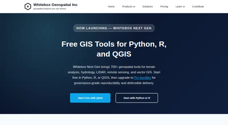
What WhiteboxTools is
WhiteboxTools is a geospatial toolkit for terrain analysis, hydrology, LiDAR, remote sensing and vector GIS. Whitebox Next Gen offers more than 700 tools, including digital elevation model terrain derivatives, watershed delineation, flow routing, point-cloud classification, image analysis, change detection and vector operations. The open tools are available through Python, R and a QGIS plugin, and can be used with notebooks, scripts and local desktop processing. Listed formats include GeoTIFF, Cloud-Optimized GeoTIFF, LAS/LAZ, COPC, GeoPackage, FlatGeobuf, GeoParquet, GeoJSON and Shapefile. It supports Windows, macOS and Linux. The company says processing runs locally, which can suit on-premises or offline workflows. The open core costs nothing. Paid annual Entry subscriptions range from $740 a year to $995 a year; Standard subscriptions range from $1,270 a year to $1,795 a year. Enterprise pricing is custom and not listed.
Who it suits
It suits GIS practitioners who need terrain, hydrology, LiDAR, remote-sensing or vector tools in Python, R, QGIS or local desktop workflows. The local processing option may suit on-premises or offline environments.
What it does well
- More than 700 geospatial tools
- Open tools for Python, R and QGIS
- Supports Windows, macOS and Linux
- Local processing can suit offline workflows
What to know first
- Some Pro use requires a paid subscription
- License-validation reporting cannot be disabled
- Hosted access and SaaS require written authorization
Plans
| Plan | Billed and limits | Price |
|---|---|---|
| Whitebox Open Core (Python, R, QGIS) | Free/open tools; 700+ tools; Python, R, or QGIS | Free |
| LiDAR & Forest Analytics — Standard | per user, per year · Annual subscription; Standard tier; per-user or small team packs | $1,270 a year |
| Environmental Risk & Compliance — Standard | per user, per year · Annual subscription; Standard tier; per-user or small team packs | $1,490 a year |
| Network Planning & Operations — Standard | per user, per year · Annual subscription; Standard tier; per-user or small team packs | $1,795 a year |
| LiDAR & Forest Analytics — Entry | per user, per year · Annual subscription; Entry tier; per-user license | $740 a year |
| Environmental Risk & Compliance — Entry | per user, per year · Annual subscription; Entry tier; per-user license | $890 a year |
| Network Planning & Operations — Entry | per user, per year · Annual subscription; Entry tier; per-user license | $995 a year |
| Environmental Risk & Compliance — Enterprise | custom · Enterprise tier; custom pricing | On request |
The first 8 of 10 plans, as whiteboxgeo.com lists them, read 3 Oct 2026. The maker's own page has the final word. Every plan
Getting started
- Open the WhiteboxTools website.
- Choose the free open tools or a listed paid subscription tier.
- Use the tools through Python, R, or the QGIS plugin.
- Run them on Windows, macOS, or Linux with local desktop processing.
- Use the tools with QGIS, notebooks, R workflows, scripts, or supported geospatial formats.
WhiteboxTools is a local geospatial processing toolkit for terrain, hydrology, LiDAR, remote sensing and vector GIS. It is best suited to analysts who work in Python, R or QGIS and want a broad set of tools for desktop workflows. The free core is a strong starting point, while Pro buyers should weigh annual per-user prices against license limits on hosted and automated use.
Overview
Whitebox Next Gen brings more than 700 geospatial tools to QGIS, Python notebooks, R workflows, scripts and local desktop processing. Its reach—from terrain derivatives and watershed delineation to point-cloud classification, image analysis, change detection and vector operations—makes it a flexible processing companion rather than a point-cloud-only product. That breadth is most useful to GIS practitioners who can put the tools into an existing workflow.
Processing runs locally, which suits on-premises or offline work. The Pro EULA permits collection of non-personally identifiable usage statistics, performance metrics and error logs. Users may opt out of optional telemetry, but not license-validation reporting.
Key features
- Wide geospatial coverage: More than 700 tools span terrain analysis, hydrology, LiDAR, remote sensing and vector GIS. This range can handle varied common analysis tasks within one toolkit; users seeking only point-cloud processing may not need its full breadth.
- Python, R and QGIS access: The open tools are available through these interfaces and can fit notebooks, scripts and established GIS workflows. This is a good match for technically oriented users, rather than a reason to choose it as a standalone point-cloud application.
- Broad format support: Supported formats include GeoTIFF and Cloud-Optimized GeoTIFF, LAS/LAZ and COPC, GeoPackage, FlatGeobuf, GeoParquet, GeoJSON and Shapefile. The mix spans raster, point-cloud and vector data, useful for workflows that move among them.
- Local execution: Desktop processing supports users who need on-premises or offline workflows. Pro use has an important boundary: hosted access, SaaS, embedded systems, cloud deployments and automated batch-processing services are restricted unless Whitebox expressly authorizes them in writing.
Pricing
The Whitebox Open Core plan costs nothing and includes 700+ free/open tools for Python, R or QGIS. It is the natural choice for individuals and teams whose needs fit the open tools and local workflows.
Paid Entry plans are annual per-user subscriptions: LiDAR & Forest Analytics costs $740 a year, Environmental Risk & Compliance costs $890 a year, and Network Planning & Operations costs $995 a year. Each is an Entry-tier per-user license. Entry includes best-effort community support, so buyers prioritizing a support queue should consider Standard instead.
Standard is also billed annually: LiDAR & Forest Analytics costs $1,270 a year, Environmental Risk & Compliance costs $1,490 a year, and Network Planning & Operations costs $1,795 a year. These plans allow per-user licenses or small team packs and include a priority support queue during business hours. Enterprise plans for all three areas have custom pricing and support by agreement. The published plan terms give no trial length or renewal schedule, so those should be confirmed before purchase.
For any Pro tier, the EULA restrictions on hosted, cloud, embedded and automated batch-processing use are consequential: organizations planning to deliver processing as a service need written authorization, not just a suitable workflow.
Platforms
WhiteboxTools supports Windows, macOS and Linux. Its desktop processing and Python, R and QGIS interfaces make it relevant across common desktop GIS environments.
Who it's for
Choose WhiteboxTools if you need a broad toolkit for local geospatial analysis and already use Python, R or QGIS. The free core is especially attractive when its open tools cover your needs. Consider Pro when a paid plan's application area, license structure or support tier fits your work; look elsewhere if hosted access or cloud and automated batch services are central to your deployment.
Pros and cons
- Pro: More than 700 tools cover several geospatial disciplines, reducing the need to assemble a toolkit for each common task.
- Pro: Local processing and Windows, macOS and Linux support fit desktop, on-premises and offline workflows.
- Pro: Python, R and QGIS access helps analysts bring the tools into familiar GIS and scripting environments.
- Con: Paid Entry plans are annual per-user subscriptions, which can raise the cost for multiple users.
- Con: Pro EULA restrictions limit hosted, cloud, embedded and automated batch-service uses without written authorization.
- Con: Entry support is best-effort community support; priority business-hours support starts at Standard.
Alternatives
For a wider point-cloud software comparison, consider what kind of point-cloud workflow you need. Point Cloud Library is a free option for commercial and research use under a BSD license, while LidarView is free and open source under Apache 2.0. Open3D is another free-plan option with API, web and self-hosted platform support. LP360 offers a freemium option; its DJI L1/L2 Cloud batch processing plan costs $620 a year, requires LP360 Drone, includes 20 flights per month and one user, while Cloud Collaborate costs $930 a year. Pointly is freemium and offers usage-based pricing, including Pointly Box usage from 0.03 € per million points, with volume booked in advance and unlimited parallel jobs. Leica Cyclone 3DR is a paid Windows option with a free plan. PDAL is a free option for Linux, macOS and Windows, and Entwine is free for Linux.
Verdict
WhiteboxTools is a strong choice for GIS analysts who want a broad, locally run toolkit integrated with Python, R or QGIS, especially if the free open core is enough. Its range and platform support are compelling; choose another option or secure written authorization if your work depends on hosted, cloud or automated batch-processing services.
Verdict
The free open core offers a broad geospatial toolkit across common GIS workflows. Before choosing a Pro plan, review its pricing and license limits, including the restrictions on hosted and cloud use.
Questions
Is WhiteboxTools free?
The Whitebox Open Core (Python, R, QGIS) plan is free and includes 700+ tools.
What do the paid plans cost?
Annual Entry subscriptions range from $740 a year to $995 a year per user. Standard subscriptions range from $1,270 a year to $1,795 a year, and Enterprise pricing is custom.
Which operating systems are supported?
WhiteboxTools lists support for Windows, macOS, and Linux.
Is it open source?
The listed Open Core plan is described as free/open tools, available through Python, R, or QGIS.
Does it process data locally?
Yes. The company says processing runs locally and that workflows can suit on-premises or offline environments.
What are the usage and telemetry limits?
The Pro EULA restricts hosted access, SaaS, embedded systems, cloud deployments, and automated batch-processing services unless expressly authorized in writing. Optional telemetry can be disabled, but license-validation reporting cannot.
Facts from WhiteboxTools's own pages
- Company
- The maker is Whitebox Geospatial Inc., which lists Guelph, Canada as its location. · whiteboxgeo.com, 3 Oct 2026
- Execution and data control
- The company says processing runs locally and that workflows can suit on-premises or offline environments. · whiteboxgeo.com, 3 Oct 2026
- File formats
- Listed formats include GeoTIFF, Cloud-Optimized GeoTIFF, LAS/LAZ, COPC, GeoPackage, FlatGeobuf, GeoParquet, GeoJSON, and Shapefile. · whiteboxgeo.com, 3 Oct 2026
- Geospatial functions
- Features include DEM terrain derivatives, watershed delineation, flow routing, point-cloud classification, image analysis, change detection, and vector operations. · whiteboxgeo.com, 3 Oct 2026
- Headquarters
- Guelph, Canada · whiteboxgeo.com, 28 Sept 2026
- Integrations
- Whitebox works with QGIS, Python notebooks, R workflows, scripts, and local desktop processing. · whiteboxgeo.com, 3 Oct 2026
- Interfaces
- The open tools are available through Python, R, and a QGIS plugin. · whiteboxgeo.com, 3 Oct 2026
- License limits
- The Pro EULA restricts hosted access, SaaS, embedded systems, cloud deployments, and automated batch-processing services unless the company expressly authorizes them in writing. · whiteboxgeo.com, 3 Oct 2026
- Operating systems
- The site lists Windows, macOS, and Linux support. · whiteboxgeo.com, 3 Oct 2026
- Purpose
- Whitebox provides geospatial tools for terrain analysis, hydrology, LiDAR, remote sensing, and vector GIS. · whiteboxgeo.com, 3 Oct 2026
- Security and privacy
- The Pro EULA says the software may collect non-personally identifiable usage statistics, performance metrics, and error logs; users may opt out of optional telemetry but not license-validation reporting. · whiteboxgeo.com, 3 Oct 2026
- Support
- Entry includes best-effort community support, Standard includes a priority support queue during business hours, and Enterprise support is available by agreement. · whiteboxgeo.com, 3 Oct 2026
- Tool library
- Whitebox Next Gen provides more than 700 geospatial tools. · whiteboxgeo.com, 3 Oct 2026
Where WhiteboxTools stands on Freedom251
- Point Cloud Software#7 of 24