Freedom251 › Point Cloud Software

LP360
What LP360 is
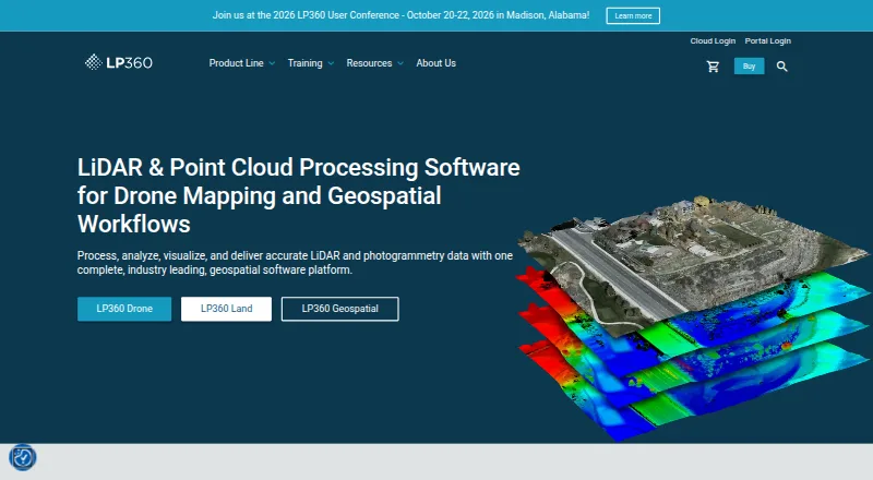
LP360 Drone is desktop software for processing, analyzing, and creating deliverables from drone LiDAR and imagery data. Its synchronized 2D, 3D, and profile views include 3D Gaussian Splat viewing. Processing tools cover LiDAR quality control and repair, filtering, 3D editing, automated ground classification, terrain models, and volume calculations. AI add-ons classify ground and above-ground features, extract forestry outputs, and identify utility corridor features. Supported sensors include DJI, Microdrones, Phoenix LiDAR, Riegl, TrueView, Wingtra, and YellowScan, and the software can combine data with other geospatial sources. Exports include CAD formats and LANDXML; LPLAS files follow the ASPRS LAS specification. Core processing is local, and offline or air-gapped use is supported. Cloud workflows are optional and user-initiated. The Drone license is a floating license for one device and limits projects to 10km². A free plan is listed; LP360 Drone costs $1,675 USD per year.
Who it suits
LP360 Drone suits users processing drone LiDAR or imagery who need classification, terrain, volume, or CAD-related outputs. Its one-device license and 10km² project limit are relevant when assessing fit.
What it does well
- Provides synchronized 2D, 3D, and profile views.
- Includes LiDAR repair, filtering, and ground classification tools.
- Supports offline or air-gapped use.
- LPLAS files follow the ASPRS LAS specification.
What to know first
- The Drone license is for one device.
- Projects are limited to 10km².
- LP360 Drone costs $1,675 USD per year.
- Some cloud workflows may temporarily transfer data to third-party processors.
Limits
The LP360 Drone license is limited to one device and projects up to 10km². Listed add-on limits include 20 flights per month for DJI L1/L2 Cloud batch processing, 200GB storage and 50GB/month streaming for Cloud Collaborate, and five regular monthly jobs for specified AI classification plans, each for 0–10GB projects.
Plans
| Plan | Billed and limits | Price |
|---|---|---|
| 3D Accuracy | usd 1,115 / year · Requires LP360 Drone | $1,115 a year |
| AI Ground Classification | usd 1,360 / year · Requires LP360 Drone · 5 regular jobs per month (0–10GB project) · 1 user included | $1,360 a year |
| Strip Align for Drone | usd 1,675 / year · Requires LP360 Drone | $1,675 a year |
| LP360 Drone | $1,675 usd / year · one-device floating license · project size limited to 10km² | $1,675 a year |
| 3D Photo Engine | usd 2,475 / year · Requires LP360 Drone | $2,475 a year |
| AI Ground+ Classification | usd 2,640 / year · Requires LP360 Drone · 5 regular jobs per month (0–10GB project) · 1 user included · standalone AI Ground Classification not included | $2,640 a year |
| AI Forestry Classification | usd 5,280 / year · Requires LP360 Drone · 5 regular jobs per month (0–10GB project) · 1 user included | $5,280 a year |
| DJI L1/L2 Cloud batch processing | usd 620 / year · Requires LP360 Drone · 20 flights per month · 1 user included | $620 a year |
The first 8 of 9 plans, as lp360.com lists them, read 29 Sept 2026. The maker's own page has the final word. Every plan
Getting started
- Visit the LP360 website.
- Choose the free plan or a paid plan for the tools you need.
- For LP360 Drone, install the Windows desktop application and use its one-device floating license.
- Process data locally, or add cloud workflows when you need online storage, sharing, search, viewing, or streaming.
LP360 Drone is a desktop application for processing drone LiDAR and imagery into analyzed data and deliverables. It is best suited to geospatial teams that need a full local processing workflow, not just a point-cloud viewer. Its strongest case is the breadth of tools; the one-device license and 10km² project limit are meaningful constraints.
Overview
LP360 combines visualization, point-cloud processing, geospatial analysis, and export in one product. The desktop software offers synchronized 2D, 3D, and profile views, along with 3D Gaussian Splat viewing. This makes it a practical choice for teams moving between inspection and analysis, while the project-size ceiling may rule it out for larger jobs.
Key features
Core tools include LiDAR quality control and repair, filtering, 3D editing, automated ground classification, terrain modeling, and volume calculations. LP360 also supports point-cloud registration, E57 and LAS/LAZ, geospatial analysis, and point-cloud-to-mesh workflows. That range suits projects that need measurable outputs as well as cleaned data, rather than simple viewing or conversion.
Optional AI classification add-ons handle ground and above-ground features, forestry outputs, and utility-corridor features. Sensor support includes DJI, Microdrones, Phoenix LiDAR, Riegl, TrueView, Wingtra, and YellowScan; data can also be combined with other geospatial sources. Exports include CAD formats and LANDXML, while LPLAS files follow the ASPRS LAS specification for compatibility with software that reads LAS.
Cloud Collaborate adds online storage, sharing, geographic search, web viewing, and streaming from LP360 Cloud and desktop software. Cloud use is optional: core processing runs locally, transfers are user-initiated, and cloud connections use HTTPS/TLS encryption. LP360 supports offline and air-gapped operation with no external data transmission in that mode. LP360 Online services are hosted on AWS in the United States; some workflows may temporarily transfer data to third-party processors, including servers in France.
Pricing
LP360 uses a freemium model, with a free plan and paid plans from $995/yr. The base LP360 Drone plan costs $1,675 usd / year and includes a one-device floating license, with projects limited to 10km². The license scope and cap make it better suited to bounded individual or team workflows than broad multi-device deployment.
Several add-ons require LP360 Drone, so their prices are incremental rather than stand-alone alternatives. DJI L1/L2 Cloud batch processing is $620 a year and includes 20 flights per month for one user. Cloud Collaborate is $930 a year, with 200GB of storage, one user, and streaming up to 50GB/month. Both are quota-bound cloud options, so readers should match expected flight or streaming volume to those caps.
Other LP360 Drone add-ons include 3D Accuracy at $1,115 a year, Strip Align for Drone at $1,675 a year, and 3D Photo Engine at $2,475 a year. AI Ground Classification costs $1,360 a year and includes five regular jobs per month for 0–10GB projects and one user. AI Ground+ Classification is $2,640 a year with the same job and user limits, but does not include standalone AI Ground Classification. AI Forestry Classification is $5,280 a year, also with five regular jobs per month for 0–10GB projects and one user. Those quotas make the AI plans a more natural fit for recurring, moderate-volume work than high-throughput classification.
Platforms
LP360 is offered for web and Windows. The core product is a desktop application, with web access tied to optional cloud collaboration workflows. Local processing and offline operation are useful for air-gapped environments; readers needing a native desktop workflow on another operating system should look elsewhere.
Who it's for
LP360 fits geospatial professionals and organizations processing drone LiDAR and imagery from supported sensor systems, especially when one workflow must cover repair, classification, terrain or volume analysis, and CAD or LANDXML export. It is less suitable for users with projects exceeding 10km², those needing multiple licensed devices, or anyone seeking only a free viewer or general-purpose point-cloud toolkit.
Pros and cons
- Pros: A broad chain of local processing and analysis tools, from repair and classification to terrain models and volume calculations, can reduce the need to split those stages across separate software.
- Pros: Support for multiple named sensor families and LAS-compatible LPLAS exports helps fit mixed-source and downstream geospatial workflows.
- Pros: Optional cloud features coexist with local and offline operation, giving teams a choice about when to share data remotely.
- Cons: The one-device floating license and 10km² project cap limit fit for larger projects or wider device deployment.
- Cons: Cloud and AI add-ons impose user, storage, streaming, flight, or job limits, and several require the paid LP360 Drone license.
Alternatives
Choose Point Cloud Library if a free, BSD-licensed option for commercial or research use is the priority. WhiteboxTools is a free alternative with more than 700 open tools for Python, R, or QGIS, while its LiDAR and forest analytics entry plan is priced at $740 a year. LidarView is a free, Apache 2.0 open-source option for Linux and Windows. Open3D is another free choice, with API, web, self-hosted, and desktop platform options.
Pointly is a freemium alternative with usage-based plans, including pricing from 0.03 € per million points. Entwine and PDAL are free alternatives; Leica Cyclone 3DR is a paid option.
See the Point Cloud Software directory for more options.
Verdict
LP360 is a strong fit for geospatial teams that need local drone LiDAR and imagery processing, classification, analysis, and export in one Windows-centered workflow. Its breadth and offline capability are the main reasons to choose it; the project cap, one-device license, and add-on quotas are the clearest reasons to look elsewhere.
Verdict
LP360 Drone brings local LiDAR and imagery processing together with classification, analysis, and export tools. Check the project-size limit and license terms, and note that cloud workflows are optional rather than required.
Questions
How much does LP360 cost?
LP360 lists a free plan and paid plans from $995/yr. The LP360 Drone plan is $1,675 USD per year; listed add-ons have separate annual prices.
Is there a free plan?
Yes. LP360 lists a free plan.
Which platforms does LP360 support?
The listed platforms are web and Windows. LP360 Drone is a desktop application.
What does LP360 process?
LP360 Drone processes, analyzes, and creates deliverables from drone LiDAR and imagery data. It supports point-cloud registration, classification, E57, LAS/LAZ, geospatial analysis, and point-cloud-to-mesh.
Can LP360 work offline?
LP360 says it supports offline or air-gapped use, with local processing and no external data transmission in that mode.
Who makes LP360?
GeoCue says LP360 was founded by QCoherent, acquired by GeoCue in 2009, and is now developed in-house at GeoCue.
Facts from LP360's own pages
- AI classification
- Its AI add-ons classify ground and above-ground features, extract forestry outputs, and identify utility corridor features. · lp360.com, 29 Sept 2026
- Cloud collaboration
- The Cloud Collaborate add-on provides online storage, sharing, geographic search, web viewing, and streaming from LP360 Cloud and desktop software. · lp360.com, 29 Sept 2026
- Company
- GeoCue says LP360 was founded by QCoherent, acquired by GeoCue in 2009, and is now developed in-house at GeoCue. · lp360.com, 29 Sept 2026
- Exports
- LP360 supports CAD formats and LANDXML export, and its LPLAS files follow the ASPRS LAS specification and are compatible with software that reads LAS. · lp360.com, 29 Sept 2026
- Founded
- 2003 · lp360.com, 28 Sept 2026
- Headquarters
- Madison, Alabama, United States · lp360.com, 28 Sept 2026
- Hosting and retention
- LP360 Online services are hosted on AWS in the United States; certain workflows may temporarily transfer data to third-party processors, including servers in France. · support.lp360.com, 29 Sept 2026
- Integrations
- The product supports sensors including DJI, Microdrones, Phoenix LiDAR, Riegl, TrueView, Wingtra, and YellowScan, and can combine data with other geospatial sources. · lp360.com, 29 Sept 2026
- Offline operation
- LP360 says it supports offline or air-gapped use, with local processing and no external data transmission in that mode. · support.lp360.com, 29 Sept 2026
- Processing tools
- Features include LiDAR quality control and repair, filtering, 3D editing, automated ground classification, terrain models, and volume calculations. · lp360.com, 29 Sept 2026
- Purpose
- LP360 Drone processes, analyzes, and creates deliverables from drone LiDAR and imagery data. · lp360.com, 29 Sept 2026
- Security
- LP360 describes itself as local-first: core processing is local, cloud workflows are optional and user-initiated, and cloud transfers use HTTPS/TLS encryption. · support.lp360.com, 29 Sept 2026
- Support
- GeoCue lists a technical support phone number of 1-256-715-5091 and provides a help and knowledge base and community forum. · lp360.com, 29 Sept 2026
- Usage limit
- The LP360 Drone license is a desktop application with a floating license for one device and a 10km² project size limit. · lp360.com, 29 Sept 2026
- Visualization
- The desktop product provides synchronized 2D, 3D, and profile views, plus 3D Gaussian Splat viewing. · lp360.com, 29 Sept 2026
Where LP360 stands on Freedom251
- Point Cloud Software#3 of 24