Tangier Explorer is an offline walking-route generator for Tangier that pairs a curated list of local places with a locally run AI model. Its creator, Soufiane Zaari, says travelers choose a theme and trip length, then receive a route with stops, estimated walking times and historical context. The project aims to make the phone a planning tool rather than the focus of the walk.
What Tangier Explorer does
The project article describes six route themes—History, Food, Hidden spots, Sea, Nature and Culture—and three durations: one hour, two hours or a half-day. The app uses those choices to generate a walking itinerary through Tangier, including stops and narrative context. These are the options described by Zaari; the article does not independently verify the interface or route outputs.
As an Amazon Associate I earn from qualifying purchases.
The concept is deliberately local in scope. Rather than asking a general-purpose assistant to invent a city tour from broad knowledge, Tangier Explorer starts with a collection of Tangier places and asks an AI model to shape a route from them.
How the route generator is described to work
Curated places provide the factual base
Zaari says the app uses a local spots.json file containing 148 curated Tangier locations. Each entry is described as having a name, neighborhood, category and description. Areas named in the article include the Kasbah, Marshan, Perdicaris Forest, Cap Spartel and Grand Socco. The count and coverage are the author’s claims, not an independently audited dataset.
#1 Best Overall

- Explore confidently with the reliable handheld GPS
- 2.2” sunlight-readable color display with 240 x 320 display pixels for improved readability
- Preloaded with Topo Active maps with routable roads and trails for cycling and hiking
- Support for GPS and GLONASS satellite systems allows for tracking in more challenging environments than GPS alone
- 8 GB of internal memory for map downloads plus a micro SD card slot
Gemma turns selected places into a narrative
The reported architecture is summarized as “Data is Truth, Gemma is Storyteller.” The app filters the places according to the selected theme, then supplies a subset to Gemma 3 (4B), which Zaari says runs locally through Ollama on a laptop. The model is instructed to use only the supplied locations. In principle, that separates the source of the landmarks from the model’s storytelling: the curated file determines which places are available, while the model creates transitions and context for the itinerary.
That constraint can reduce the opportunity for the model to introduce places outside the selected data, but it is not proof that every description or generated route is accurate. Zaari’s article does not include an independent fact-check or route-by-route accuracy audit.
Rank #2

- Bright, high-resolution 5” glass capacitive touchscreen display lets you easily view your route
- Get more situational awareness with alerts for school zones, speed changes, sharp curves and more
- View food, fuel and rest areas along your active route, and see upcoming cities and milestones
- View Tripadvisor traveler ratings for top-rated restaurants, hotels and attractions to help you make the most of road trips
- Directory of U.S. national parks simplifies navigation to entrances, visitor centers and landmarks within the parks
What the author reports from walking the routes
Zaari says he used the app outdoors in Tangier and followed a generated circuit during a period when mobile-data signal dropped. He reports that local inference meant the route could be generated without depending on 4G coverage at that moment. He also describes the generated transitions as concise and says the narrative captured the rhythm of walking through the Kasbah. These are the author’s field observations, not controlled test results.
Recommended Free Tools
The account also reveals a practical weakness: an early one-hour route included too many steep uphill segments. Zaari says he limited the number of candidate stops to bring the expected pace closer to reality. This matters because choosing a shorter list of places does not by itself make a route terrain-aware. The article does not establish that the generator accounts for elevation, walking speed, closures or accessibility.
Rank #3

- Compact and lightweight GPS handheld navigator boasts an anti-slip design offering a bright 3.2" screen that is sunlight readable, even in bright sunlight, plus, physical buttons provide more versatility in any conditions
- Get multi-GNSS support(GPS+GALILEO+BEIDOU+QZSS) for superior positional accuracy,so you know exactly where you are,location precision within 6 ft
- The handheld GPS navigator uses GPS technology to capture your trip or waypoint so you can guide back to your starting position
- Equip with 3-axis compass and barometric altimeter,follow your bearing on the digital compass, which provides an accurate heading even when stationary
- Hike in any weather with the water-resistant design (rated to IP66) ,Rechargeable battery can provide up to 36 hours of battery life in full charge, recharge easily with a standard USB-C cable
What “offline” does—and does not—establish
Running inference locally is the project’s stated way to avoid sending a generation request to a cloud model. Zaari also says travel interests and schedules stay on the device. The article does not document a privacy audit, all data flows, location permissions or whether every feature works without connectivity.
Offline generation should not be confused with an entirely offline setup. The account does not explain whether downloading Ollama, acquiring the Gemma model or installing the app requires an internet connection. Nor does it specify hardware requirements beyond saying the model runs locally on a laptop. A traveler considering the project should therefore distinguish between generating a route after setup and obtaining or configuring the software in the first place.
Rank #4
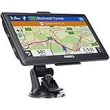
- 【Latest 2026 North America Maps】 OHREX 7" GPS Navigator for Car Truck RV works completely offline without cell service. It comes preloaded with 2026 North America maps (USA, Canada, Mexico) and does not require an internet or cellular connection to navigate.
- 【Free Lifetime Map Updates 】 Get the latest map by connecting OHREX GPS Navigation to the Windows pc. You can also use an exteranl TF Card for map update (with Mac & Windows system). Lifetime Map is free updated without Ads . You can regularly download latest data for maps, speed, and points of interest.
- 【Driver Alerts】 OHREX N700 GPS uses satellite positioning to determine your location and provides turn-by-turn voice guidance, speed camera and real-time alerts even in areas with no cell service — perfect for remote truck and RV routes.
- 【Professional GPS Navigation】 OHREX 7 inch TouchScreen GPS Navigation for Car Truck Motorhome & RV.(1) You can Customize Route According to Your Vehicle’s Weight, Length, Height and Width, Avoid Roads with Width/Height/Weight Restrictions (2) Intelligent Route Planning Fast & Economical. (3) Fast & Accurate GPS Tracking. (4) Displays Current Speed and ETA.
- 【Professional Solution】OHREX GPS navigation supply regular maps upgrades and any question inquiry. USA local brand, established professional technician team in the United States, have been recognized by our customers.
What makes the approach useful—and what remains unproven
- Local grounding: The reported place file gives the model a bounded set of locations to work from, rather than leaving the choice of landmarks entirely to generated text.
- Potentially useful without mobile data: Local inference can avoid reliance on a cloud request during route generation, based on the author’s account. The article does not establish that mapping, navigation or every app function remains available offline.
- Human-scale pacing still needs more than AI: The uphill-heavy one-hour route shows that a plausible itinerary narrative is not the same as a realistic walking plan.
- Local knowledge is only as dependable as its inputs: The author describes the dataset as curated, but the article supplies no independent validation of its entries, completeness or update process.
The project’s stated ambition is captured in Zaari’s line: “Technology should encourage us to experience the world, not trap us behind glass.” Tangier Explorer expresses that idea by using a screen to assemble a walk, then positioning the route itself as the reason to put the phone away. Whether it achieves that consistently depends on the quality of the underlying place data and the accuracy of its pacing and directions—areas the project article does not independently evaluate.
Do these 3 things before closing this tab:
1Fix the driver behind crashes, sound loss and screen glitches2Repair Windows errors before they cause bigger problems3Scan for outdated or missing drivers - takes under a minuteSource and scope
The project details and field-use account here come from Soufiane Zaari’s article, “Tangier Explorer – Bringing Open-Source AI to the Alleyways of Tangier”, published on DEV Community on October 5, 2026. They describe the creator’s implementation and observations; no independent evaluation is established by that account.
Quick Recap
Product prices and availability are accurate as of the date/time indicated and are subject to change. Any price and availability information displayed on Amazon at the time of purchase will apply.




