Freedom251 › Data Storytelling Tools

Mapji
What Mapji is
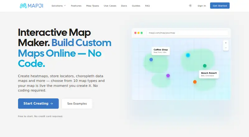
Mapji is a browser-based, no-code tool for creating and publishing interactive maps. It offers 10 map types, including heatmaps, choropleths, store locators, crowdsourced maps and story maps. You can add markers, lines and polygons, build routes, and adjust map themes without coding. Data can come from CSV, Excel, GeoJSON, KML, KMZ or GPX imports, or from a connected Google Sheet. Sheet syncing is read-only and checks for changes roughly every five minutes.
For Draw and Compare maps, Mapji can place external WMS, WMTS, ArcGIS, TileJSON or PMTiles layers beneath your data. Maps are available at a Mapji URL and can also be embedded in an iframe or published on a custom domain. The Free plan costs nothing and includes map building, data imports, Google Sheets connections and publishing to a Mapji subdomain. Imported point data must already include latitude and longitude; Mapji does not geocode addresses. Published maps can be opened by anyone with the URL, and there is no password-protected or private publishing mode.
Who it suits
Mapji suits creators, businesses and researchers who need to build and share interactive maps without code. Its listed use cases include real estate, logistics, healthcare and research.
What it does well
- Build maps from 10 map types.
- Draw markers, lines, polygons and routes without code.
- Import six listed file formats or connect Google Sheets.
- Embed maps or publish them on a custom domain.
- The Free plan includes map building and publishing.
What to know first
- Imported addresses are not geocoded; point data needs coordinates.
- Anyone with a map URL can access it.
- Google Sheets sync is read-only and checks roughly every five minutes.
Limits
The Free plan includes map building, imports, Google Sheets connections and publishing to a Mapji subdomain. Each data source is limited to 10,000 features, imports to 25 MB, and isochrone maps to five origin points.
Plans
| Plan | Billed and limits | Price |
|---|---|---|
| Free | Free to start; build maps, import data, connect a Google Sheet and publish to a Mapji subdomain at no cost | Free |
As mapji.com lists them, read 5 Oct 2026. The maker's own page has the final word.
Getting started
- Open mapji.com in a web browser.
- Start with the Free plan at no cost.
- Build a map and add data with a supported import or a Google Sheets connection.
- Publish to a Mapji subdomain, embed the map with an iframe, or use a custom domain.
Verdict
Choose Mapji if you want to build and publish interactive maps in a browser, with multiple import options and no-code drawing tools. Look elsewhere if your maps need private, password-protected access or automatic geocoding of imported addresses.
Questions
How much does Mapji cost?
The Free plan costs nothing.
Which platforms does Mapji support?
Mapji is available on the web.
What data can I import?
Supported imports include CSV, Excel, GeoJSON, KML, KMZ and GPX. You can also connect Google Sheets as a live source.
Can I keep a published map private?
No. Published maps are reachable by anyone with the URL, and Mapji has no password-protected or private publishing mode.
Does Mapji geocode imported addresses?
No. Imported point data needs latitude and longitude coordinates.
Can I publish a map outside a Mapji URL?
Maps can be embedded with an iframe or published on a custom domain.
Facts from Mapji's own pages
- Background layers
- Draw and Compare maps can use external WMS, WMTS, ArcGIS, TileJSON or PMTiles layers beneath map data. · mapji.com, 5 Oct 2026
- Data imports
- Supported imports include CSV, Excel, GeoJSON, KML, KMZ and GPX, and Google Sheets can be connected as a live data source. · mapji.com, 5 Oct 2026
- Geocoding
- Mapji does not geocode imported addresses; imported point data needs latitude and longitude coordinates. · mapji.com, 5 Oct 2026
- Integrations
- Google Sheets sync is read-only and checks for changes roughly every five minutes. · mapji.com, 5 Oct 2026
- Intended users
- The homepage presents use cases for creators, businesses and researchers, including real estate, logistics, healthcare and research. · mapji.com, 5 Oct 2026
- Limits
- The FAQ lists a limit of 10,000 features per data source and 25 MB per import file, with up to five isochrone origin points. · mapji.com, 5 Oct 2026
- Map building
- Users can draw markers, lines and polygons, create routes, and customize map themes without code. · mapji.com, 5 Oct 2026
- Map types
- It offers 10 map types, including heatmaps, choropleths, store locators, crowdsourced maps and story maps. · mapji.com, 5 Oct 2026
- Privacy
- Published maps are reachable by anyone with the URL, and Mapji has no password protected or private publishing mode. · mapji.com, 5 Oct 2026
- Product
- Mapji is a no-code, browser based tool for building and publishing interactive maps. · mapji.com, 5 Oct 2026
- Publishing
- Maps are live at a Mapji URL when created and can be embedded with an iframe or published on a custom domain. · mapji.com, 5 Oct 2026
- Support
- Mapji provides a contact form and lists [email protected] for questions and feedback. · mapji.com, 5 Oct 2026
Where Mapji stands on Freedom251
- Data Storytelling Tools#14 of 22