The Tool Desk
Outbyte Driver Updater FREEFix the driver behind crashes, sound loss and screen glitchesFind Drivers →Outbyte PC Repair FREERepair Windows errors before they cause bigger problemsFix Now →Ground-penetrating radar (GPR) can reveal buried features when they create a detectable contrast with the surrounding material. That may include some metal and plastic pipes, pavement layers, reinforcement, defects, bedrock, or fracture zones. But a radar image shows signal responses—not labeled objects—and a scan cannot prove that everything underground has been found. Depth, material, moisture, antenna choice, survey coverage, and interpretation all affect what the result means.
What a GPR scan actually shows
GPR sends electromagnetic energy into a surface and records signals reflected back from below it. Reflections occur where electrical properties change, especially dielectric permittivity and electrical conductivity. A boundary between two materials, or an object surrounded by different material, may therefore appear as a response in the data.
As an Amazon Associate I earn from qualifying purchases.
That response is evidence of a contrast or anomaly, not an automatic identification. A scan does not directly label an echo “water pipe,” “void,” or “bedrock.” The operator interprets the pattern in light of the target being sought, the surrounding materials, the survey setup, and other available information. FHWA’s guidance on Underground Utilities – Ground-Penetrating Radar (GPR) describes GPR as a method whose results depend on site conditions and whose collection, processing, and interpretation require advanced expertise and training.
This distinction matters whenever a scan informs excavation, construction, or an assessment of a structure. A visible response may be worth investigating, but the image alone may not establish its identity, dimensions, or significance. Conversely, an area without a clear response is not proof that it contains nothing.
#1 Best Overall

- TECHNOLOGY: The Uig ground scanner works with three professional scanning and imaging technologies with a multi-functional imaging sensor with modern and highly effective technologies supported by a lightweight movable arm to facilitate scanning and imaging of targets, in addition to the option of distinguishing metals and voids with two different sounds.
- SIZE AND WEIGHT: The Uig ground scanner is characterized by its small size, and lightweight, which makes it preferred by prospectors, due to its ease of use in exploration and searches for precious metals, buried treasures, and voids in the ground.
- ACCURACY: High speed and accuracy in detecting targets underground.
- EFFECTIVE: Very effective in scanning targets inside ancient archaeological walls.
- LANGUAGES: A list of several languages supported by the application attached to the device, namely: (English – Arabic – Spanish – French – German – Portuguese).LANGUAGES: A list of several languages supported by the application attached to the device, namely: (English – Arabic – Spanish – French – German – Portuguese).
What GPR can reveal
Some buried utilities
GPR can respond to metallic and nonmetallic utilities when the object creates enough contrast with its surroundings. FHWA’s utility guidance describes a strong response for metal or steel, a medium-to-strong response for PVC and concrete, and weaker responses for some electrical and fiber-optic lines. These are relative examples, not guarantees: the same kind of line may be easier or harder to detect depending on the site.
Plastic water pipes are therefore within GPR’s potential range, but “plastic” alone does not determine whether a pipe will show up. Its size, depth, condition, backfill, nearby features, and the properties of the surrounding ground all affect the response. A scan that finds one nonmetallic line does not establish that it will find every line of that material at another location.
Pavement and concrete features
GPR can be used to investigate pavement layers, dowels, reinforcement, and some defects or voids. FHWA’s Pavements – Ground-Penetrating Radar Base, Subbase, and Subgrade Defect Detection guidance notes an important limitation: a defect may be detectable only when it contains a meaningful air pocket or water. Even when a void is visible, its bottom may not be, which can make its internal thickness difficult to estimate.
GPR can thus help identify a feature that warrants closer evaluation, but its image may not provide a complete measurement of a defect. The response should be interpreted for the material and structure being surveyed rather than treated as a direct picture of every layer or the full extent of damage.
Rank #2

- HIGHLY PRECISE DEVICE: Experience the power of deep seeking and ground penetrating radar technology. This device rapidly detects dozens of meters downward to quickly distinguish between valuable and non-valuable gemstones.
- LONG RANGE DETECTION: This hand held detector features a full digital system locating diamonds and 18 different species of gemstones in the ground with extreme accuracy. Maximum capacity amounts to 3000 meters in distance and 120 meters in depth, with a 10-hour battery life.
- NEWLY DESIGNED SYSTEM: System features include large and small diamond search systems as well as a search system specifically designed for gemstones.
- INDUSTRY LEADERS: Detector Power has over 10 years of experience so it’s no surprise that our products lead the industry in design and functionality. We put the power of detecting into your hands!
- AUTHORIZATION AND GUARANTEE: When purchasing a product from us, prior bank authorization may be necessary to prevent order cancellation. Please confirm this with your bank before your purchase in an effort to avoid order delays. Detector Power lives up to our reputation of excellence through a guaranteed manufacturer's warranty on all products. We are also proud to offer a hassle-free 15-day return policy to our valued customers.
Geologic boundaries and fractures
USGS material describes GPR applications for imaging bedrock depth and fracture zones. These features can be revealed only if the signal reaches them and a useful reflection returns. A geologic interface that lies beyond the effective penetration at a particular site will not become visible simply because the survey is intended to find it.
What GPR cannot reliably establish
That an area is clear of every utility
A survey may fail to detect a utility of interest. FHWA’s IV. Site Characterization and Utility Locating – Avoiding Utility Relocations warns that detection is site-specific and that utility surveys may not find every utility. A line can be missed because its response is too weak, because conditions interfere with the signal, or because another feature complicates interpretation.
For that reason, a GPR result should not be presented as proof that an excavation area is free of utilities. For consequential utility work, FHWA’s guidance calls for calibration with other non-destructive evaluation methods and ground-truth activities. The appropriate corroboration depends on the project and the decisions being made.
What lies beneath a strong reflector
Metal reflects virtually all incident energy, according to FHWA’s utility guidance. A metal object or layer can therefore obscure features below it: the radar may show the reflector without revealing what lies behind or beneath it. The absence of a deeper response in that situation does not establish that no deeper feature exists.
Rank #3
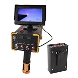
- 15m Deep Detection & 1000m Long-Range Scanning: Professional-grade underground metal detector reaches up to 15 meters (49 feet) in depth and covers a long-range search area of 1000 meters (3280 feet). Ideal for locating gold, silver, copper, and other in vast outdoor areas
- Microcomputer Control with Self-Calibration System: Built-in microcomputer control chip unit enables automatic calibration and self-checking before each use. The intelligent system scans and detects quickly, significantly improving working efficiency for treasure hunters and professional prospectors.
- High-Sensitivity Detection with Fast Response: Features excellent sensitivity and stability with rapid inductive response speed. The advanced detection technology accurately identifies different metal types, reducing false signals and saving you time during searches
- Durable ABS Construction with Portable Design: Crafted from lightweight yet sturdy ABS material for long-lasting durability in the field. Compact and ergonomic design makes it easy to carry during extended treasure expeditions.
- Versatile Use for Treasure, , & Jewelry : Perfect for professional gold prospecting, , collecting, and jewelry recovery. Whether you're exploring historic sites, beaches, or remote wilderness, this metal detector delivers reliable performance
Deep features in every kind of ground
There is no universal depth to quote for GPR. Conductive clay-rich material can limit imaging of deeper interfaces, and substantial moisture can attenuate the signal. USGS identifies conductive clay-rich overburden as a limiting condition for imaging deeper features; its Appendix A—Methods of Characterization also identifies attenuation as the primary constraint on depth for this shallow, high-resolution method.
GPR is not a way to see through every material or to obtain the same penetration at every site. The target must be within the range where enough signal can travel to it and return with usable information.
A definitive object identity from an image alone
Because GPR registers changes in electrical properties, different objects or boundaries can produce responses that require interpretation. The scan may locate an anomaly without establishing exactly what caused it. Context and, where appropriate, other survey methods or ground-truth checks are needed to confirm an interpretation.
What controls the result
Soil, moisture, and surrounding materials
Moisture and clay can weaken signals and reduce useful penetration. Salts in concrete can interfere with a survey, and external electromagnetic radiation can degrade some data. These effects help explain why the same target can produce different results at different sites. The relevant question is not just “Can GPR find this material?” but whether this target, at this depth, has a detectable contrast under the conditions at this location.
Rank #4

- UIG GROUND SCANNER latest scan technique to find treasure & metals | exclusively at Detectors Shop
- We offer you the most advanced and unique technology in the world, which integrates three different imaging systems in a single device specialized in the exploration and search of metals, treasures, archaeological graves, tunnels, caves, and voids in the ground with ease and great precision, in addition to conducting accurate scans of ancient and archaeological walls.
- After great efforts, scientific research and field experiments carried out by GER Detect in cooperation with UIG Detectors.
Antenna frequency: depth versus detail
Antenna frequency involves a tradeoff. Lower-frequency antennas generally penetrate farther but provide less precision; higher-frequency antennas generally provide finer detail at shallower depth. Neither choice delivers maximum depth and maximum detail at once, so antenna selection should reflect the target and the survey’s purpose.
FHWA’s utility guidance gives examples of 100 MHz antennas reaching up to 100 ft and 400 MHz antennas reaching up to 12 ft. These figures are examples in that guidance, not promises for a particular site, target, soil, or survey. They should not be used as a general depth specification without considering the conditions that control attenuation and the feature being sought.
Antenna deployment and survey design
Ground-coupled antennas are pulled over or kept close to the surface to support in-depth data collection. Air-coupled systems can collect data at higher speeds with less effect from surface conditions. These deployment approaches involve different practical tradeoffs; neither removes the need to match the setup to the target and the site.
Free tools Windows power users keep installed
One-click scans. No signup required.
Coverage also matters. When comparing survey proposals or interpreting results, consider the target’s expected depth and size, desired resolution, ground or material conductivity and moisture, antenna frequency and deployment, and scan-line density. A survey design that does not adequately cover the area or resolve the feature of interest cannot support stronger conclusions than its data allow.
Best Value
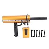
- EXCELLENT SENSITIVITY AND STABILITY: This metal detector delivers exceptional sensitivity and stability, ensuring accurate and reliablity metal detection in various terrain and depth conditions.
- POWERFUL AND INTELLIGENT FEATURES: The advanced modular design and intelligent functionality of this detector provide powerful, convenient, and efficient scanning and detection capabilities for an enhanced metal detecting experience.
- REMOTE SEARCH SYSTEM: Equipped with a remote search system and accurate detection system, this detector breaks through traditional detection methods, providing optimal depth and accuracy for metal detection.
- MICROCOMPUTER CONTROL: The detector features a calibration system with a microcomputer control chip unit, allowing for quick and convenient scanning and detection, greatly enhancing efficiency for metal detecting enthusiasts.
- METAL DETECTION SOLUTION: This device represents the most advanced and practical metal detection method currently available, offering an excellent solution for all your metal detection needs.
How to assess a GPR survey or result
For a useful comparison of setups or survey work, ask how the method fits the feature you need to find and how uncertainty will be handled. The following checks help distinguish a targeted investigation from an unsupported promise of certainty:
- Define the target. Specify the suspected feature, approximate size and depth if known, and the decision the survey must inform.
- Describe the site conditions. Consider whether moisture, clay, salts, conductive materials, nearby objects, or electromagnetic interference may affect the signal.
- Match frequency to the goal. Establish whether the priority is greater penetration or finer detail, recognizing the tradeoff.
- Check the deployment and coverage plan. Ask how the antenna will be used and whether the survey lines and coverage are appropriate for the target and area.
- Evaluate interpretation expertise. Collection, processing, and interpretation are distinct parts of the work. FHWA states that “Advanced expertise and training are required for data collection, processing, and interpretation.”
- Plan corroboration for consequential decisions. For utility work, FHWA calls for calibration with other NDE methods and ground-truth activities. Ask how an interpreted response will be checked before acting on it.
A good interpretation should distinguish observed responses from conclusions about their cause. It should also make clear where the survey could not provide a confident answer—for example, where attenuation, a strong reflector, or limited coverage affects what can be seen.
Practical answers to common questions
Can ground-penetrating radar see through concrete?
GPR can investigate some features in concrete and pavement, including reinforcement, dowels, layers, and certain defects. The result depends on the concrete and the target. Salts can interfere, and a void may be detectable only when it contains a meaningful air pocket or water; its bottom may remain unseen. A scan is not a guarantee that every feature behind or within concrete will be visible.
How deep can ground-penetrating radar detect?
Depth depends on the site, target, and antenna rather than one universal maximum. Lower frequencies generally favor penetration, while higher frequencies favor detail. FHWA’s examples—up to 100 ft for 100 MHz and up to 12 ft for 400 MHz—are not guarantees. Conductive clay-rich ground and significant moisture can reduce useful depth.
Can GPR find plastic water pipes?
It can respond to some nonmetallic pipes, including PVC, when there is enough contrast with the surrounding material. FHWA characterizes PVC response as medium-to-strong in its utility guidance, but actual detectability is site-specific and does not guarantee that any particular plastic pipe will be found.
What can block or weaken a GPR signal?
Conductive clay-rich material, significant moisture, salts in concrete, electromagnetic interference, and a metal object or layer can hinder useful imaging. Metal can obscure what lies below it; attenuation can prevent a deeper feature from producing a usable return.
Quick Recap
Sources
- FHWA InfoTechnology, Underground Utilities – Ground-Penetrating Radar (GPR).
- FHWA, IV. Site Characterization and Utility Locating – Avoiding Utility Relocations.
- FHWA InfoTechnology, Pavements – Ground-Penetrating Radar Base, Subbase, and Subgrade Defect Detection.
- USGS, Ground-Penetrating Radar.
- USGS, Appendix A—Methods of Characterization.
Product prices and availability are accurate as of the date/time indicated and are subject to change. Any price and availability information displayed on Amazon at the time of purchase will apply.

