Lake-effect snow is a localized precipitation mechanism; a nor’easter is a large coastal low-pressure storm. Lake-effect snow forms when cold air crosses relatively warm, open lake water and collects heat and moisture. A nor’easter develops when contrasting cold continental and milder ocean air helps intensify a low-pressure system along the East Coast. A nor’easter can create conditions that enhance lake-effect snow, so the labels can overlap rather than describe mutually exclusive storms.
The essential difference: mechanism versus storm system
These terms operate at different scales. Lake-effect snow describes how snow is produced: cold air travels over a warmer lake, gains water vapor and heat, becomes unstable, rises, and forms snow showers that winds carry onto land. It may affect a narrow strip while nearby communities receive little or no snow.
As an Amazon Associate I earn from qualifying purchases.
A nor’easter describes a regional weather system: a strong low-pressure area that affects the East Coast of North America. Its name comes from the typical northeasterly winds along coastal areas. A nor’easter can bring snow, rain, damaging winds, rough seas, and coastal flooding across a broad area.
Outdated Drivers Are Slowing You Down
One free scan finds every outdated or missing driver and matches the right update for your exact hardware.Free scan · exact hardware matchWindows Errors? Fix Them Before They Spread
Repair common Windows errors and clear accumulated junk for a smoother, more stable PC - no reinstall needed.Free scan · no reinstallThe practical distinction is useful during forecasts. “Lake-effect” tells you to look for sharp differences over short distances and rapidly changing conditions. “Nor’easter” tells you to assess a storm’s track, precipitation type, wind field, coastal surge, and other regional hazards.
#1 Best Overall

- [Color LCD Screen Weather Station] Newentor temperature & humidity monitor with a large color LCD display shows essential home weather information at a glance: indoor/outdoor temperature & humidity, daily high/low records, customizable alerts, time/date, alarm clock & snooze, weather forecast, moon phase, and barometric pressure.
- [Two Power Modes & Adjustable Backlight] To enjoy a 24/7 continuous always-on vibrant display, simply connect this home weather station to a wall outlet using the included DC power adapter. When operating on battery power only (batteries not included), the digital thermometer automatically enters an eco-energy-saving mode, where the screen lights up for a quick 15-second glance before dimming. It is the perfect bedside or living room clock designed to fit your power preference.
- [3-channel Home Weather Stations Wireless Indoor Outdoor] Wireless temperature forecast station supports up to 3 remote sensors to monitor inside outside temperature & humidity of multiple locations. Package contains one remote sensor.
- [Wireless Forecast Station] The weather forecast station calculates the weather forecast for the next 12-24 hours, 7 to 10 days calibration ensures an accurate personal forecast for your location.
- [Wireless Weather Station with Atomic Time&Date] Atomic alarm clock weather station can be used not only as a wireless indoor outdoor thermometer but also as an atomic clock with dual alarms.
How lake-effect snow forms
1. Cold air arrives over open water
Lake-effect snow requires a cold air mass moving across a lake that is comparatively warmer and not fully covered by ice. The larger the open-water area, the longer the air can remain in contact with the surface. That distance is called the fetch.
2. The lake adds heat and moisture
Water evaporates into the lowest part of the air while heat moves upward from the lake. The formerly cold, dry air becomes warmer and more humid near the surface. Because the air above remains colder, the lowest layer becomes buoyant and unstable.
3. Rising air forms clouds and snow
The warmed, moistened air rises into colder air. As it rises, it cools, water vapor condenses into cloud droplets and ice crystals, and snow develops. Stronger instability can produce deeper clouds and heavier snow showers.
4. Wind carries snow inland
Winds steer the resulting clouds toward the downwind shoreline. A steady wind can organize snow into a long, narrow band. Terrain may force air upward and increase snowfall in higher locations, while a small change in wind direction can move the band to a different set of communities.
The National Weather Service (NWS) summarizes the process as snow showers created when cold, dry air passes over a large warmer lake and picks up moisture and heat. The definition applies to the physical process, not to a particular snowfall total or warning threshold.
Why lake-effect snow is so localized
Lake-effect forecasts are difficult because several variables interact over short distances:
- Wind direction: It determines which shoreline and inland corridor are downstream. A shift of only a few degrees can move the heaviest band.
- Wind speed: Faster winds can move snow farther inland, while changes in speed can disrupt or reorganize a band.
- Fetch: A longer path over open water gives the air more opportunity to acquire heat and moisture.
- Lake ice: Ice limits evaporation and heat transfer. As ice coverage increases, lake-effect potential generally decreases, although local openings can still matter.
- Instability and moisture: Greater temperature contrast between the lake and air, plus sufficient moisture, supports deeper and more vigorous clouds.
- Terrain and elevation: Hills and higher ground can enhance lift and increase accumulation in favored locations.
- Shoreline orientation: The shape of the coast and nearby land controls where bands move ashore and how far they persist.
This combination explains why one town can experience heavy snow and near-whiteout visibility while another town a short drive away sees only flurries. The boundary can be abrupt rather than gradual.
What’s actually slowing this PC down?
Pick the symptom - the matching free tool is one click away.
What changes lake-effect intensity during an event?
Lake-effect snow is not a single burst that behaves the same way from start to finish. If the wind remains aligned with a long fetch, a band can stay organized and repeatedly affect the same corridor. If wind direction veers or backs, the band can shift toward a different shoreline or inland route. A change in wind speed can also alter how far the snow travels before weakening.
Open water is a basic requirement. Ice reduces the surface area available for evaporation and the transfer of heat into the air. That does not mean every remaining opening produces heavy snow, because the incoming air must still be cold enough, moist enough, and unstable enough, and the wind must carry the developing clouds toward land. Forecasters therefore examine ice coverage together with wind, moisture, temperature contrast, terrain, and shoreline shape.
Rank #2

- COMPLETE WEATHER STATION: (1) Osprey Sensor Array with Rain Cup, and (1) Brilliant, Easy-to-Read LCD Color Display
- AUTHENTIC HYPER-LOCAL DATA: Monitor your actual home and backyard weather conditions with our wireless and Wi-Fi-enabled sensor array measuring wind speed/direction, temperature, humidity, rainfall, UV intensity, and solar radiation
- SMART HOME READY: Set up alerts, access your data remotely, and program your home based on weather conditions using IFTT, Google Home, Alexa, and more
- ENHANCED WIFI: Enables your station to transmit its data wirelessly to the world's largest personal weather station network (optional setting)
- JOIN THE COMMUNITY: Connect to Ambient Weather Network to customize your dashboard tiles, share hyperlocal weather conditions via social feeds and create your own forecasts (coming soon)
Elevation can make the snowfall difference even sharper. Air forced up hills cools and can deposit more snow at higher locations, while nearby lower ground may remain in a lighter band or outside it altogether. These factors explain why a forecast may identify a snow belt rather than promise one amount for an entire county or region.
How a nor’easter develops
Temperature contrast supplies energy
Nor’easters commonly form near the East Coast between Georgia and New Jersey and then move northeast toward New England and the Canadian Maritimes. A typical winter setup places cold Arctic air moving south and east over land while warmer air advances north from the Gulf of Mexico and the Atlantic. Relatively mild coastal water can warm the air over the ocean.
Do these 3 things before closing this tab:
1Scan for outdated or missing drivers - takes under a minute2Clear out junk files and repair common Windows errors3Fix the driver behind crashes, sound loss and screen glitchesThe sharp contrast between cold continental air and milder, moist ocean air helps a low-pressure circulation intensify. As the low deepens, pressure gradients strengthen and winds increase. The storm’s position and movement determine where precipitation and the strongest winds occur.
One storm, several precipitation types
A nor’easter does not guarantee snow. Cold air may support snow inland, while warmer air near the coast changes precipitation to rain, sleet, or freezing rain. A narrow zone near the storm’s thermal boundary can change from one type to another as the low tracks or the air column warms.
Coastal hazards are part of the storm
Because the system is centered near the ocean, impacts can extend well beyond snowfall. A nor’easter may produce:
- Heavy snow over inland and northern parts of the storm track
- Heavy rain closer to milder coastal air
- Gale-force or stronger winds
- Rough seas and dangerous marine conditions
- Coastal flooding when wind, waves, and elevated water levels coincide
The exact combination depends on the low’s track, strength, timing, temperature profile, and coastal geography. Local NWS forecasts and warnings are the authoritative source for a specific event.
Quick wins for a faster PC:
Clear out junk files and repair common Windows errorsFree Scan →Scan for outdated or missing drivers - takes under a minuteDriver Scan →Regional storm structure versus local snow bands
A nor’easter’s broad circulation can cover coastal and inland areas at the same time, but its effects are not uniform. The storm track and temperature profile determine where snow ends, where rain begins, and where mixed precipitation develops. Wind and water hazards may be greatest near the coast even when the heaviest snow falls farther inland.
Lake-effect snow works on a smaller geographic scale. Its source is the lake surface immediately upwind, and its most important forecast question is often which communities lie beneath the downwind band. A regional storm can change the wind direction or supply a colder air mass, but the lake still has to provide the heat and moisture needed for the local process.
Lake-effect snow and nor’easters compared
| Comparison | Lake-effect snow | Nor’easter |
|---|---|---|
| What the term describes | A snow-producing air–lake interaction | A broad East Coast low-pressure storm |
| Main energy source | Heat and moisture transferred from relatively warm, open lake water to cold air | Temperature contrast between cold continental air and milder, moist ocean air |
| Typical footprint | Narrow, localized bands downwind of a lake | Regional impacts along the coast and offshore, often extending inland |
| Primary forecast sensitivities | Open water, lake ice, wind direction and speed, fetch, instability, moisture, terrain, elevation, and shoreline orientation | Storm track and development, temperature profile, precipitation type, wind field, and coastal conditions |
| Typical hazards | Heavy snow in a narrow corridor, sudden visibility drops, and dangerous travel | Snow or rain, strong winds, rough seas, coastal flooding, and dangerous travel |
| Can it occur inside the other? | Yes. A regional storm can provide winds and cold air that support lake-effect bands. | Yes. A nor’easter can be the broader weather pattern while lake-effect snow occurs downwind of a lake. |
Can a nor’easter cause lake-effect snow?
It can create a favorable environment, but it does not automatically produce lake-effect snow. A nor’easter may pull cold air across a lake, strengthen winds, or change wind direction. If the lake remains sufficiently open and warmer than the incoming air, the air–lake exchange can generate snow bands during or after the coastal storm.
Rank #3
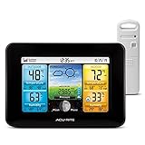
- Simple Setup and Use: Install 2 AA batteries (not included) in the outdoor weather station sensor and easily hang on a post or tree branch using the integrated hanger to begin receiving your weather forecast and hyperlocal conditions
- Real-Time Weather Conditions: This indoor outdoor weather station has an indoor temperature gauge and an outdoor temperature thermometer for indoor and outdoor temperature, humidity, and barometric pressure trends from an outdoor temperature sensor
- Weather Forecast and Forecasting Technology: The outside temperature thermometer wirelessly relays data to provide a hyperlocal, personalized weather forecast 12 hours from your current conditions, so you can plan your la crosse or other sports game!
- Illuminated LCD Color Display: Easy-to-view digital indoor outdoor thermometer display has an adjustable dimmer to make for the perfect addition to your home technology and allows easy placement anywhere in the house, office, or as an RV weather station
- Dynamic Forecast Icons and Moon Phase: With multiple thermometers & weather instruments data, this digital indoor outdoor thermometer display has trend arrows and provides the current moon phase to further impact your weather monitoring capabilities
In that situation, the terms answer different questions. “Nor’easter” identifies the regional low-pressure system. “Lake-effect snow” identifies snow generated locally as air crosses the lake. The overlap is possible, not inevitable: a storm may pass too far away, bring air that is not cold enough, or arrive after ice has reduced the lake’s moisture supply.
Recommended Free Tools
How to tell which process is driving the snow
Look first at the pattern of precipitation. A broad shield spreading across several states is more consistent with the large-scale precipitation area of a nor’easter, although local bands can occur within it. A narrow, persistent stripe aligned with a downwind lake shoreline points toward lake-effect snow. The two patterns can appear in sequence: widespread storm precipitation may be followed by narrower bands as colder air flows over open water.
Also separate the precipitation label from the hazard label. “Lake-effect” describes the source of the snow, while “nor’easter” describes the storm circulation. “Blizzard” describes a combination of wind, visibility, and duration. These labels can all apply to different aspects of one event, but none should be treated as a synonym for another.
How to read a forecast for each type
Signals of lake-effect snow
- Forecast wording names a particular lake, downwind shoreline, or snow belt.
- Snow totals vary sharply between neighboring communities.
- Short-fuse updates emphasize wind direction, band placement, and visibility.
- Radar or satellite imagery shows a narrow, persistent band rather than a broad shield of precipitation.
- Local conditions can change rapidly when the band wobbles or reorganizes.
Signals of a nor’easter
- Forecast maps show a strengthening coastal low and a track toward New England or the Canadian Maritimes.
- Advisories address several hazards at once, such as snow, rain, wind, coastal flooding, and marine conditions.
- Precipitation type changes with distance from the coast or as the storm track shifts.
- Officials discuss shoreline water levels, waves, or storm surge in addition to accumulation.
For either setup, use the NWS forecast office serving your location for current watches, warnings, advisories, expected timing, and local criteria. A national storm description cannot determine the exact conditions on your road or shoreline.
Warnings, blizzards, and why snowfall totals are not enough
Warning criteria for lake-effect snow vary by region; there is no single universal accumulation number that applies everywhere. NWS lake-effect snow warnings address significant lake-induced snow, whether localized or more widespread, and may emphasize the potential for sudden visibility restrictions.
A blizzard is a separate hazard definition, not another name for lake-effect snow or a nor’easter. NWS criteria require all of the following:
- Sustained winds or frequent gusts of at least 35 mph
- Visibility below one-quarter mile because of falling or blowing snow
- Those conditions lasting at least three hours
A lake-effect band can produce blizzard conditions if wind, visibility, and duration meet that definition. A nor’easter can also produce them over part of its circulation. Conversely, heavy snow without the required wind and visibility conditions is not technically a blizzard.
Travel and preparedness decisions
Before the storm
- Check the latest local NWS forecast, watches, warnings, and advisories rather than relying on a single earlier forecast.
- Identify whether your location is in a narrow lake-effect snow belt or within the broader projected nor’easter track.
- Plan around the timing of the worst conditions, not just the storm’s start and end times.
- Keep a winter vehicle kit, including suitable clothing, water, a flashlight, and basic emergency supplies. NWS winter guidance also lists a shovel as a useful supply.
- Charge phones and arrange alternatives if roads, rail lines, or flights may be disrupted.
During intense snow
- Follow local authorities’ advice about staying off roads.
- Expect visibility to fall suddenly inside a lake-effect band, even if conditions were clear minutes earlier.
- Increase following distance and avoid stopping in travel lanes where drifting snow can hide vehicles.
- Near the coast during a nor’easter, avoid flooded roads and exposed shorelines; water can move quickly and conceal washouts.
- Use official updates when precipitation changes from snow to sleet, freezing rain, or rain, because traction and power-outage risks can change.
Common misconceptions
“Lake-effect snow is always lighter than a nor’easter.”
Not necessarily. Lake-effect bands cover less area, but a persistent, intense band can produce very heavy snow in its narrow path and make travel dangerous.
“A nor’easter always means snow.”
No. Its defining feature is the coastal low-pressure system and its characteristic wind pattern. Depending on the temperature profile, a nor’easter may bring rain, sleet, freezing rain, snow, or several types at once.
The Tool Desk
Outbyte Driver Updater FREEFix the driver behind crashes, sound loss and screen glitchesFind Drivers →Outbyte PC Repair FREERepair Windows errors before they cause bigger problemsFix Now →Rank #4

- Comprehensive Weather Information: One of the best weather stations, receive over 55 data points that allow you to monitor historical data, the heat index, dew point, feels like temperature, pressure trends with trend arrow, and more
- Real-Time Weather Conditions: Look no further for the perfect indoor and outdoor weather station! Wirelessly receive readings for indoor/outdoor temperature and humidity, wind speed/direction, barometric pressure, and rainfall directly to your home weather station
- Easiest Setup on the Market: Just install batteries, attach the wireless outdoor sensor to a pole or post using the included mounting bracket, and you’re ready to be the neighborhood weather expert
- Weather Clock: The indoor weather station display is a large, color LCD Display with the current time, date, and an adjustable dimmer, making it convenient to read and easily view indoor and outdoor data, time, and conditions
- Weather Forecast: The outdoor weather station collects elevation data and combines it with barometric pressure data from the indoor weather station to provide a personalized weather forecast 12 hours from your current conditions
“If my neighbor has heavy snow, I should receive the same amount.”
That assumption is especially unreliable with lake-effect snow. Wind direction, terrain, and band movement can create sharp accumulation differences over a short distance.
“A large snowfall total proves blizzard conditions.”
Snow amount alone does not define a blizzard. The NWS definition depends on wind, visibility, and duration.
“The two labels are competing explanations.”
They answer different questions. One identifies the local process that creates snow; the other identifies a regional storm system. Using both labels can be more accurate than choosing only one.
Independent reader supportYour contribution helps us test, update, and keep practical guides available for everyone.Frequently asked questions
Which usually covers a larger area?
A nor’easter generally has the broader footprint because it is a regional low-pressure system affecting the East Coast, nearby waters, and areas inland. Lake-effect snow is usually concentrated in narrow bands downwind of a lake, though several bands can affect a wider region at different times.
Why can lake-effect snow start or stop so suddenly?
The snow band is tied closely to wind direction, wind speed, shoreline orientation, and the location of the open-water fetch. A small wind shift can move the band away from one community and over another, producing a sharp change in visibility and snowfall over a short distance.
Does lake ice stop lake-effect snow completely?
No. More ice generally limits evaporation and heat transfer, reducing lake-effect potential, but remaining open water can still supply moisture. Cold air, instability, wind, and a favorable fetch must also be present.
Can a nor’easter bring rain and snow at the same time?
Yes. A nor’easter can place colder air inland and milder air near the coast, so snow may fall in one part of the storm while rain, sleet, or freezing rain occurs elsewhere. The boundary can move as the storm track and temperature profile change.
What should I watch besides the snow total?
Watch visibility, wind, precipitation type, timing, and—near the coast—water levels, waves, and flooding. A modest accumulation with strong wind or rapidly falling visibility can be dangerous, while a large accumulation without blizzard conditions is still a different hazard.
Free tools Windows power users keep installed
One-click scans. No signup required.
Is there one snowfall amount that triggers a lake-effect warning?
No universal amount applies everywhere. NWS warning criteria vary by region and may focus on significant lake-induced snow and sudden visibility restrictions. Follow the forecast office serving your location rather than applying a single nationwide threshold.
Best Value

- Illuminated Indoor Outdoor Weather Station for Home with Large Colorful Display: The home weather station delivers large big numbers for weather forecast info, indoor outdoor temperature, atomic time, date, year and calendar day, which is super easy to read from afar.
- Indoor outdoor Thermometer Wireless with High/Low Temperature Alert: The digital weather station supports 3 outdoor sensors which helps to monitor temperature and humidity of multiple locations (one sensor included). With the high/low temperature alert function, the weather station clock keeps you informed about the changes of weather thermometer outdoor.
- WWVB Atomic Weather Station with Auto DST: Weather atomic clock with indoor/outdoor temp always keeps precise time and date by receiving the WWVB atomic signal. The self setting digital weather clock will automatically adjust to daylight saving time with auto DST feature, no more resetting twice a year.
- Personal Weather Forecast Station: This weather stations wireless indoor outdoor predicts the next 12-24 hours weather condition with a 7-day calibration through the pressure of your location which provides you a better outing experience.
- 5 Level Adjustable Backlight Brightness: The weather clock indoor outdoor temperature atomic with backlight dimmer function helps you avoid high-intensity light that disturb your sleep and easily check the weather situation during the day.
Where should I get event-specific information?
Use the National Weather Service forecast office for your location and follow local emergency-management instructions. Those sources provide current watches, warnings, advisories, timing, precipitation type, and local criteria that a general description cannot supply.
What to remember
Lake-effect snow is generated locally when cold air crosses warmer open water and is redirected inland by wind. Its hallmark is narrow, shifting bands and highly uneven snowfall. A nor’easter is a regional East Coast low-pressure storm fueled by contrasts between cold land air and milder, moist ocean air. It can produce snow, rain, strong winds, rough seas, and coastal flooding across a much wider area.
Because one term describes a mechanism and the other describes a storm system, they can occur together. Make decisions from the local forecast and warnings, and treat sudden visibility loss, strong winds, and coastal flooding as serious hazards regardless of which label appears in the headline.
Frequently Asked Questions
What is the simplest difference between lake-effect snow and a nor’easter?
Lake-effect snow is a local snow-making process caused by cold air crossing warmer open lake water. A nor’easter is a broad East Coast low-pressure storm that can bring snow, rain, wind, rough seas, and coastal flooding.
Can both happen during the same weather event?
Yes. A nor’easter can supply cold air or winds that support lake-effect bands. The overlap is possible, not guaranteed, because open water, temperature contrast, moisture, and wind alignment are still required.
Why are lake-effect totals so different from one town to the next?
Bands are controlled by wind direction, fetch, lake ice, instability, terrain, elevation, moisture, and shoreline orientation. A small wind shift can move the heaviest snow into a neighboring community.
Does every nor’easter produce a blizzard?
No. Blizzard status depends on sustained winds or frequent gusts of at least 35 mph, visibility below one-quarter mile from falling or blowing snow, and those conditions lasting at least three hours. A nor’easter may produce rain or mixed precipitation instead.
Do these 3 things before closing this tab:
1Scan for outdated or missing drivers - takes under a minute2Clear out junk files and repair common Windows errors3Fix the driver behind crashes, sound loss and screen glitchesWhat is the safest forecast source for a specific storm?
Check the National Weather Service forecast office serving your location, along with local authorities. They provide the current watches, warnings, advisories, timing, precipitation type, and regional warning criteria.
The Bottom Line
Lake-effect snow is a localized air–lake process; a nor’easter is a regional coastal storm. Lake-effect bands depend on open water, cold air, moisture, instability, wind, and terrain. Nor’easters depend on the contrast between cold land air and milder ocean air and can bring snow, rain, wind, rough seas, and coastal flooding. The systems can overlap, so follow local NWS warnings for the hazards affecting your location.
Quick Recap
Product prices and availability are accurate as of the date/time indicated and are subject to change. Any price and availability information displayed on Amazon at the time of purchase will apply.

