Do these 3 things before closing this tab:
1Fix the driver behind crashes, sound loss and screen glitches2Clear out junk files and repair common Windows errors3Scan for outdated or missing drivers - takes under a minuteSet up emergency contacts and health details before your hike, then learn which feature does what: Emergency SOS is for contacting responders; location sharing is for updating a trusted person. Whether either can work without cellular or Wi-Fi depends on your phone model, software, region, and a clear view of the sky. Check eligibility and practise the on-device demo before relying on satellite features.
Before you leave: prepare your phone and your plan
Do this while you still have reliable service. A phone feature is not a substitute for telling someone your route and expected return time, or for planning how you will get help if your phone cannot connect.
As an Amazon Associate I earn from qualifying purchases.
- Set up emergency contacts and health information. On iPhone, complete Medical ID and add emergency contacts. Apple recommends doing this before entering an area without cellular or Wi-Fi. See Apple’s Emergency SOS via satellite guide.
- Check your device and region. Apple’s instructions for satellite Emergency SOS and Find My location sharing specify iPhone 14 or later. Google’s Pixel Satellite SOS is limited to certain Pixel 9 models and regions; check Google’s current Satellite SOS requirements for your model and location. Availability and activation requirements can change.
- Configure Pixel Emergency SOS if you use it. Open Settings > Safety and emergency > Emergency SOS. Verify the local emergency number, emergency contacts, and Personal Safety location permission. Assisted calling depends on location. Google documents options for a power-button trigger, including confirmation by touch-and-hold or automatic action after a five-second countdown. See Google’s Emergency SOS instructions.
- Set up routine sharing in advance. For iPhone satellite sharing, use the iPhone you will carry, turn on Share My Location, and add the intended recipients before coverage ends. The recipient must already be sharing their location with you.
- Try the demos. On iPhone, go to Settings > Emergency SOS > Try Demo; Apple says the demo does not call emergency services. On a supported Pixel, go to Settings > Safety & emergency > Satellite SOS to check status and try the demo. Google says setup can depend on software/API updates and satellite-network registration; during the demo, the mobile network is temporarily disabled and restored when you exit.
- Charge the phone and plan for power. Satellite attempts can take time. Consider battery needs for the whole trip, not just the emergency feature.
Emergency SOS and location sharing are different
Emergency SOS is an emergency workflow intended to reach local responders, with a possible option to notify your emergency contacts. Routine location sharing is a check-in with a person you trust; it does not summon emergency services. Do not treat one as a substitute for the other.
| Workflow | Purpose | What the platform documents | Key conditions |
|---|---|---|---|
| iPhone Emergency SOS via satellite | Contact emergency services when an emergency call cannot connect. | Emergency questionnaire and satellite connection flow; configured contacts may be notified. Apple says the phone can share questionnaire answers, location including elevation, battery level, and configured Medical ID/contact information after connection. | Apple’s guide specifies iPhone 14 or later. Try the local emergency number first; sky visibility, regional availability, and on-screen prompts matter. Apple guide. |
| iPhone Find My via satellite | Send your location to a person for a non-emergency check-in. | Shares your location with someone who is already sharing their location with you; it does not show their location back to you during the send. | Requires setup in advance, iPhone 14 or later, a clear view of sky and horizon, and following the phone’s orientation prompts. Apple says you can send once every 15 minutes. Apple guide. |
| Pixel Satellite SOS | Contact emergency services when no mobile or Wi-Fi network is available. | Emergency questionnaire and satellite messaging flow, with an option to notify emergency contacts. The reviewed Google instructions describe an emergency-services workflow, not a separate routine satellite check-in. | Only certain Pixel 9 models and regions are listed by Google; Google Messages must be the default messaging app. Connection and response times vary with location and site conditions. Google guide. |
| Pixel Emergency SOS | Use the configured phone emergency feature to call for help and, depending on settings, share location or record video. | Power-button-triggered emergency actions, configured in Safety and emergency settings. | Google says this feature does not work in airplane mode or when Battery Saver is on. These are Pixel-specific constraints; do not assume they apply to other phones. Google guide. |
How to use iPhone satellite features on a hike
In an emergency: Emergency SOS via satellite
- Try calling the local emergency number first. Apple notes that an ordinary emergency call may connect even when your usual carrier network is unavailable. If the call does not connect, follow the iPhone’s emergency options and choose Emergency Text via Satellite.
- Answer the on-screen emergency questions and follow the instructions to point or position the phone toward the satellite. Stay where you have the clearest available view of the sky and keep following prompts until the message is sent and a connection is established.
- Choose whether to notify emergency contacts when prompted. After connection, the phone shares the information described in Apple’s guide, including questionnaire answers and location. Depending on site conditions, connecting and exchanging messages can take time.
If you start a satellite emergency session accidentally, Apple’s instruction is: “If an Emergency SOS via satellite session has been made and you don’t need emergency services, don’t end the session. Wait until a responder answers, then explain that you don’t need help.” Follow the full Apple instructions.
#1 Best Overall

- Service plans required - as low as $4.99 per month for SOS satellite assist
- Provides advanced 2-way satellite-enabled messaging. Compatible with iOS 14 and Android 10 and later smartphones
- Stay in contact wherever you go—reliable satellite coverage keeps you firmly on the grid even if you're off the edge of the map, ensuring you're in touch with those who matter
- Simply press the check-in button and send your coordinates or a message to your loved ones, giving them peace of mind whilst you do your thing
- SOS assist allows you to check in and trigger SOS without a connection; unlimited SOS included with every service plan
For a non-emergency check-in: Find My via satellite
- Open Find My > Me.
- Under My Location via Satellite, tap Send My Location and follow the prompts.
- Keep the phone oriented as instructed, with an open view of the sky and horizon, until Find My confirms that the location was sent.
This must be arranged before the hike: Share My Location must be on, and the person receiving your location must already be sharing theirs with you. Apple says this location send can be used once every 15 minutes; it does not display the other person’s location to you as you send yours. Dense foliage and other obstructions can interfere, and a send may take minutes. See Apple’s Find My satellite instructions.
How to use Pixel Satellite SOS on a hike
On an eligible Pixel, dial the local emergency number. If neither mobile nor Wi-Fi service is available, choose Satellite SOS > Use Satellite SOS > Start in the dialer. Complete the emergency questionnaire, choose whether to notify emergency contacts, then position the phone as prompted. Remain outdoors with a clear view of the sky and watch for the service provider’s reply. Google says connection and response times vary by location and site conditions.
Rank #2
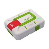
- Always connected: Travel beyond cell coverage with the safety and preparedness platform that delivers peace of mind, everywhere. Pair ZOLEO with your smartphone and stay connected with your Safety Circle, including adventurers, loved ones, and work teams responsible for duty of care. Send text messages and emails over the Iridium satellite network, cellular, or Wi-Fi using the lowest-cost network available (service plan required).
- Refreshed design: Stay connected with the ZOLEO experience you trust, now with a fresh new colour for easy identification, USB-C charging for compatibility with universal cords, and faster, more secure Bluetooth pairing.
- Instant Emergency SOS: SOS activates immediately on button press with no countdown delay. Connects to 24/7 emergency monitoring center. Access Medical Assist for non-emergency help.
- USB-C charging: Charges via universal USB-C, compatible with most cables, power banks, and car chargers.
- Optional Travel Risk Management Coverage: Feel more secure wherever you go with a Field Rescue Membership from Global Rescue. Affordably priced, this travel risk management add-on offers immediate medical coverage for safe extraction and transportation to the nearest capable medical facility.
Google Messages must be the default messaging app for the documented Satellite SOS flow. Confirm that your model, region, software, and satellite-network registration are eligible before the hike; the Satellite SOS settings page and demo are at Settings > Safety & emergency > Satellite SOS. See Google’s Satellite SOS guide.
What’s actually slowing this PC down?
Pick the symptom - the matching free tool is one click away.
What to expect when you have no service
- “No bars” does not automatically mean an emergency call cannot connect. On iPhone, try the local emergency number before moving to satellite text if the call fails. Apple says an emergency call may connect without your usual carrier network.
- Satellite needs an unobstructed path. Trees, terrain, buildings, and other obstructions can make connection harder. Follow the phone’s positioning cues rather than assuming that a satellite feature will work from any spot on the trail.
- Messages are not instantaneous or guaranteed. Apple says a Find My satellite location can take minutes to send; Google says Pixel connection and response times vary. The official instructions do not promise coverage everywhere.
- Availability is specific to device, software, and region. Check the current manufacturer requirements for the exact phone you carry and where you will hike. A feature visible on one model or in one country may not be available on another.
- Keep ordinary safety planning in place. Leave a route and return-time plan with a trusted person, carry enough power, and do not wait for a phone to become your only safety measure.
Frequently asked hiking questions
How do I share my location when I have no service?
On iPhone 14 or later, Find My can send your location via satellite if it was configured in advance, your recipient is already sharing their location with you, and you have a clear view of the sky and horizon. The documented flow is Find My > Me > Send My Location under My Location via Satellite. Google’s Satellite SOS instructions describe emergency contact with responders and optional contact notification, not routine satellite location sharing.
Rank #3

- Global Iridium Satellite Coverage: Stay connected anywhere on Earth with 100% global Iridium satellite coverage for two-way SMS, email, GPS tracking, offline maps, SOS, weather updates, and location sharing—all through the Bivy app, compatible with both iOS and Android. Monthly: (Basic $19.99 | Plus $34.99 | Unlimited $59.99). Annual: (Basic $14.99 | Plus $29.99 | Unlimited $54.99). One time 3-month commitment per device, then month-to-month. Plans available globally.
- 24/7 Emergency SOS Monitoring with Global Rescue: Feel confident wherever you go with Global Rescue’s 24/7 SOS monitoring. Activate an emergency alert instantly via the Bivy app or device button to connect with emergency services and share your real-time location—anywhere in the world.
- Dedicated Phone Number and Email: Each Bivy Stick comes with a dedicated SMS phone number and email address upon activation, so you can stay reachable even when you're off the grid.
- Unlimited GPS Check-Ins and Live Tracking: Send unlimited, customizable check-in messages with your GPS location directly from the device or app. Share a live map with your exact coordinates and breadcrumb trail, so friends and family can follow your journey.
- Group Messaging and Tracking with GroupTrack: Stay connected off-grid with GroupTrack—message and share locations with up to 12 people. Track your group using the Bivy Stick, mobile app, or a web browser—ideal for adventurers, outdoor teams, guides, and families.
Does my phone’s satellite SOS work where I’m hiking?
It depends on your exact model, software, activation status, region, and conditions at your location. Check Apple’s or Google’s current eligibility page before departure and try the built-in demo where available. Even an eligible phone needs suitable conditions to establish a satellite connection, and the manufacturers do not guarantee service at every hiking location.
Does Pixel Emergency SOS work in airplane mode or Battery Saver?
Google says Pixel Emergency SOS does not work in airplane mode or when Battery Saver is on. That limitation applies to the documented Pixel Emergency SOS feature; it should not be generalized to other phone platforms.
Quick Recap
Rank #4

- Global Iridium Satellite Coverage: Stay connected anywhere on Earth with 100% global Iridium satellite coverage for two-way SMS, email, GPS tracking, offline maps, SOS, weather updates, and location sharing—all through the Bivy app, compatible with both iOS and Android. Monthly: (Basic $19.99 | Plus $34.99 | Unlimited $59.99). Annual: (Basic $14.99 | Plus $29.99 | Unlimited $54.99). One time 3-month commitment per device, then month-to-month. Plans available globally.
- 24/7 Emergency SOS Monitoring with Global Rescue: Feel confident wherever you go with Global Rescue’s 24/7 SOS monitoring. Activate an emergency alert instantly via the Bivy app or device button to connect with emergency services and share your real-time location—anywhere in the world.
- Dedicated Phone Number and Email: Each Bivy Stick comes with a dedicated SMS phone number and email address upon activation, so you can stay reachable even when you're off the grid.
- Unlimited GPS Check-Ins and Live Tracking: Send unlimited, customizable check-in messages with your GPS location directly from the device or app. Share a live map with your exact coordinates and breadcrumb trail, so friends and family can follow your journey.
- Group Messaging and Tracking with GroupTrack: Stay connected off-grid with GroupTrack—message and share locations with up to 12 people. Track your group using the Bivy Stick, mobile app, or a web browser—ideal for adventurers, outdoor teams, guides, and families.
Product prices and availability are accurate as of the date/time indicated and are subject to change. Any price and availability information displayed on Amazon at the time of purchase will apply.

