There is no verified public live feed in the available official guidance that confirms whether a particular West Bank road or checkpoint is open right now. Before traveling, check the current travel advisory issued by the government relevant to your citizenship and itinerary, use security alerts only for the threats they cover, and consult recent local and UN movement reporting. Recheck close to departure: the UK Foreign, Commonwealth & Development Office (FCDO) warns that road closures can occur with little notice.
The useful question is not simply whether a source is official, but what it reports, where its information applies, and how recently it was updated. A travel advisory helps you assess the decision to travel; an alert system covers specified threats; movement reports document access restrictions or local conditions. Keeping those roles separate can prevent a dated map or an unrelated alert from being mistaken for confirmation that a route is open.
As an Amazon Associate I earn from qualifying purchases.
Start with the travel advisory for your citizenship and destination
A travel advisory answers whether a government recommends travel and identifies areas or risks of concern. It does not establish whether a specific road is passable at a particular time. Read the current advisory from the government relevant to you, note its publication or update date, and check the geographic scope before making a decision.
As of its August 26, 2026 advisory, the U.S. Department of State says: “Reconsider Travel to West Bank due to terrorism and unrest.” That is the U.S. government’s recommendation and stated rationale on that date. The UK FCDO provides its own location-specific advice for Palestine. Advice can differ between governments and between areas, so do not treat one government’s warning about a particular location as a statement about every destination, or assume another government uses the same recommendation.
#1 Best Overall

- 40% Smaller & Lighter Portable Charger: Powered by the industry’s first TinyCell high-density battery technology, this ultra-compact 10,000mAh portable charger power bank is 40% smaller and 36% lighter than conventional chargers. Whether you are an office user slipping a mini small portable battery into a purse for commuting, or a student looking for lightweight college essentials, you get powerful daily carry convenience without the extra bulk to keep you powered on the go.
- 45W Pro Speed Portable Phone Charger: This 45W fast charger boosts an iPhone 17 Pro Max to 76%, a Galaxy S25 Ultra to 84%, or an iPad Pro to 60% in just 30 minutes (charging from 20%). Whether you are a driver needing a quick portable charger for car, a commuter relying on a desk phone charger, or a gamer wanting a seamless Switch battery pack and Steam deck charger portable, you will spend less time tethered to a wall and more time enjoying your day.
- Detachable Cable for Multiple Devices: Unlike a standard portable charger with built in cable that becomes useless if the cord breaks, INIU's 0.4ft detachable braided USB-C cable can be swapped anytime to save your investment. It effortlessly transforms into a versatile travel charger for multiple devices, ensuring your family or group travelers always have a reliable portable charger for all cell phones to keep everyone connected without carrying messy cords.
- Airline-Safe Travel Essentials: This TSA-compliant, flight safe power bank provides nearly 2 full charges for your smartphone, making it the perfect battery pack flight safe for business trips, cruise vacations, and airplane travel essentials. Beyond flights, it empowers campers, hikers, and outdoor users with ultimate camping essentials and road trip essentials—so you can explore freely without battery anxiety, making it ideal gifts for travelers women and men.
- Trusted Emergency Backup: As the SAFE Fast Charge Pro trusted by over 38 million users, we ensure the safest charging with the highest-grade materials. When unexpected storms or hurricanes strike, it acts as a lifeline—providing a dependable power outage battery backup and emergency phone charger for emergency users.
Use the advisory to assess the broader decision to travel, not as a route-status check. If your itinerary crosses areas treated differently in the advisory, read the location-specific wording against your actual destinations rather than relying only on the headline level.
Check the issuing authority and the date on the page each time you consult it. A recommendation quoted from an advisory dated August 26, 2026, describes that advisory on that date; it should not be presented as the current recommendation if the page has since changed. The same principle applies to any geographic restriction or risk description: match the wording to the location you plan to visit, rather than extending it to places the advisory does not discuss.
For travelers who hold more than one citizenship or whose itinerary involves different jurisdictions, the practical starting point remains the government advice relevant to their own circumstances and planned destinations. The sources here do not establish a single advisory that supersedes all others. Compare the issuing government, date, recommendation, risk rationale, and geographic scope instead of trying to reduce different advisories to one universal rating.
Free tools Windows power users keep installed
One-click scans. No signup required.
Know what each information channel can—and cannot—tell you
These sources serve different purposes. A travel advisory describes risk and a government’s recommendation; a security alert reports specified incidents or threats; movement reporting documents access restrictions or local conditions. None of the surfaced sources provides a route-level guarantee that a road or checkpoint will be open when you arrive.
| Channel | What it reports | How to use it | What it does not establish |
|---|---|---|---|
| Government travel advisory | Travel recommendations, security risks, and location-specific guidance from the issuing government. | Check the advisory relevant to your citizenship and itinerary; record the update date and geographic scope. | Whether a particular road or checkpoint is open now. |
| Government alerts | Alerts or updates within the stated scope of the alert service. | Use the alert channel for the threats and locations it explicitly covers. | General road closures or route passability unless the service expressly says it reports them. |
| UN and local movement reporting | Documented access restrictions and local reporting, with dates that indicate when the information was collected or published. | Use it for movement context, then check for newer locally relevant information before setting out. | A live traffic map, a current open/closed status for every route, or a guarantee about future conditions. |
Think of this as a comparison of purpose, scope, and freshness—not a ranking of which channel is fastest. The cited pages do not provide comparable real-time latency figures or promise route-by-route confirmation. An official source can be authoritative about its own subject and still be the wrong tool for a different question. For example, a government recommendation is relevant to whether to travel, while an obstacle inventory is relevant to understanding documented movement constraints; neither substitutes for a current report explicitly covering a planned route.
When comparing updates, note four details: who issued the information, which places it covers, when it was published, and what it actually reports. Also distinguish a publication date from an observation date. A fact sheet published in April may describe conditions documented months earlier. A recent article may refer to an earlier incident. The label “official” does not remove the need to check these details.
Set up alerts for the purpose they actually serve
The U.S. State Department recommends that U.S. travelers enroll in the Smart Traveler Enrollment Program (STEP) for U.S. government updates and alerts. Treat STEP as a way to receive government information, not as a road-closure service.
Outdated Drivers Are Slowing You Down
One free scan finds every outdated or missing driver and matches the right update for your exact hardware.Free scan · exact hardware matchPC Slower Than It Used to Be?
A free scan shows the junk files, broken settings and background clutter dragging Windows down - then fixes them in one click.Free scan · Windows 10 & 11The State Department also mentions Home Front Command Red Alert for rocket, missile, and armed unmanned aerial vehicle (UAV) intrusions on devices within Israel. Its stated function is a security warning for those threats; it is not presented as a West Bank road-closure feed. Do not use the presence or absence of a Red Alert notification to infer that a road or checkpoint is open, or that other risks are absent.
Rank #2
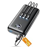
- Huge Capacity 60000mAh Power Bank: ZZI portable charger features a new high-density polymer battery that provides 10 charges for iPhone 15, freeing you from battery anxiety. Compatible with almost all types of smart devices on market including iPhone 17/16/15/14/13/12 Series, iPad, Samsung, Google Pixel series, Switch, and other Android phones and tablets.(IMPORTANT: 60000MAH PORTABLE CHARGER ARE NOT ALLOWED ON AIRPLANE)
- Charge 5 Devices Simultaneously: Portable charger power bank comes with a 3-in-1 high-strength nylon braided cable (Type-C / iOS / Micro USB) that has passed over 10,000 folding and plug-in/unplug tests, ensuring long-term durability and wear resistance. Charge up to five devices at once—suitable for home, travel, camping, hiking, vacation and outdoor trips
- 22.5W Super Fast Charging & Battery Protection: The battery charger can charge your iPhone 15 to 60% in just 30 minutes — 3 times faster than a standard portable phone charger. Built-in smart recognition chip automatically adjusts power output for different devices, delivering efficient and safe charging that protects your battery—so you can enjoy worry-free charging every time
- Ultra Compact & Smart LED Display: With its massive 60,000mAh capacity, ZZI battery bank provides long-lasting power without feeling bulky. Measuring only 5.8×2.9×1.1in, its size is similar to an iPhone 15, about twice the thickness, striking an ideal balance between capacity and portability. The LED digital display of portable battery shows the remaining battery in real time, allowing precise control over every charge
- Reliable 5-Layer Safety Protection: The battery pack portable charger features overcharge, overcurrent, overdischarge, overvoltage, and short-circuit protection, keeping your devices safe at all times, giving you complete confidence with every charge. What You Get: 1* power bank, 1* 3-in-1 USB cable, and 1* user manual
These two channels should not be conflated. STEP is described as a way for U.S. travelers to receive U.S. government updates and alerts. Red Alert is described for a specific set of incoming threats on devices within Israel. Neither description says it confirms the status of a particular West Bank road. If you use one of these channels, interpret its notifications within the scope the issuing authority states; silence from the channel is not a route update.
The guidance does not specify a fee, enrollment deadline, or guaranteed delivery time for these channels. Do not assume a notification service will arrive before a condition affects your plans, and do not make a route decision based only on whether a notification appeared. The role of an alert is to communicate the information it is designed to provide, not to certify that other conditions are safe or unchanged.
Use OCHA data as dated movement context, not live navigation
The United Nations Office for the Coordination of Humanitarian Affairs (OCHA) April 2026 fact sheet documents 925 movement obstacles affecting 3.4 million Palestinians across the West Bank, including East Jerusalem, as of December 2025. OCHA says that total was 43% above the annual average of 647 obstacles over the preceding 20 years. These are dated observations about movement restrictions affecting Palestinians. They are not a count of roads currently closed, a probability of danger to an individual visitor, or confirmation that a particular route is passable today.
The fact sheet breaks the documented obstacles down by type. All figures below describe the situation as documented in December 2025 and were published in OCHA’s April 2026 fact sheet:
| Documented obstacle type | Count |
|---|---|
| Road gates | 232 |
| Partial checkpoints | 218 |
| Checkpoints staffed 24/7 | 89 |
| Linear closures | 114 |
| Earthmounds | 167 |
| Roadblocks | 105 |
OCHA also reports that over 120 new road gates were installed during 2025. That figure describes installations over that year; it does not say how many were closed on the date of your trip. A mapped obstacle is not proof that it remains closed, while the absence of a mapped obstacle is not proof that a road is open. Check the map’s date and the fact sheet’s underlying observation date whenever you use them.
The figures give scale and describe categories of documented obstacles; they should not be converted into a prediction for an individual journey. For instance, the count of 89 checkpoints staffed 24/7 is a category in the December 2025 inventory, not a count of checkpoints that will be staffed in the same way on your travel date. Likewise, the total of 925 is an obstacle count across the West Bank including East Jerusalem, not a tally of 925 roads that are closed at once.
Use the map and fact sheet to understand where movement restrictions have been documented and how the inventory is described. Before relying on any specific map feature, inspect its date and the map’s stated scope. Do not assume that a symbol conveys a live status unless the map explicitly says so. These sources are useful context, but the material cited here does not present them as real-time navigation products or promise that every route’s current passability is represented.
Quick wins for a faster PC:
Repair Windows errors before they cause bigger problemsFix Now →Scan for outdated or missing drivers - takes under a minuteDriver Scan →Clear out junk files and repair common Windows errorsFree Scan →Check local reporting near the time you plan to travel
The FCDO says road closures can occur with little notice and advises travelers to keep up to date through local media and international information outlets such as the UN Access Coordination Unit. These sources can add current context that a dated obstacle inventory cannot provide. Still, the available guidance does not establish a single public service that reliably verifies the live status of every road or checkpoint for visitors.
Rank #3

- Huge Capacity 50000mAh Portable Charger - The 50000mAh power bank ultra-high massive capacity will keep your phone and other device running for many days!Without extra worry about low phone battery. Ideal for traveling, camping and hiking.
- Latest PD 22.5W High-Speed Charging - OHOVIV 50000mAh Portable phone charger adopts the latest Super Charger Protocol and Fast Charger Protocol with 22.5W output USB-C port.Support QC4.0 QC3.0 huge capacity power bank with fast charging, it only takes 30 minutes to charge your iPhone 14 from 0% to 55%.(NOTE: The 50000mAh PORTABLE CHARGER ARE NOT ALLOWED ON AIRPLANE!!)
- Power 3 Devices at Once - Cell phone external battery pack is equipped with 2 USB-A (22.5W output) ports, 1 USB-C (18W input/22W output) port and 1, and it can charge three devices at the same time. The portable power bank is universally compatible with all products via USB charging cable, including all iOS and Android smartphones, watch, bluetooth headsets and so on.
- LED Digital Display & Compact Design - OHOVIV 50000mAh Cell phone portable charger comes with smart LED digital display, accurately keep track of remaining juice, allowing you to easily operate your power.Our battery pack charger portable is 13.4*7*3.4cm(5.27*2.75*1.33in), and weigh 613g (21.6oz), which is easy to carry.
- Safe Powerful Phone Charger - OHOVIV 50000mAh portable charger power bank with premium Li-polymer battery, this portable battery charger can charge your devices multiple times.Battery bank adopt smart chips to prevent overcharge, overvoltage, overcurrent, and short circuit to ensure customer safety.
Look for information that is recent and relevant to the places and route you intend to use. Pay attention to when it was published, the area it covers, and whether it reports an observed closure or merely describes a known obstacle. If reports do not resolve your route’s status, treat that uncertainty as unresolved rather than filling the gap with an assumption based on a map or an alert app.
“Recent” is not enough by itself: a report should also relate to the route and intended time you care about. A closure notice about another area, or an older account of a known obstacle, may help explain context but does not confirm current conditions on your route. When several reports differ, compare their dates, geographic scope, and subject before treating one as applicable. The material available here does not support a universal rule for choosing between conflicting local reports, so keep any unresolved difference explicit.
The FCDO’s warning is especially important when planning around a saved itinerary. A map or status check completed earlier can become stale if a closure occurs with little notice. Recheck near the time of travel, and do not claim that an old status remains true simply because no newer notice has surfaced. If you cannot find a current, locally relevant confirmation, the honest result is uncertainty—not an inferred “open” status.
Do these 3 things before closing this tab:
1Clear out junk files and repair common Windows errors2Fix the driver behind crashes, sound loss and screen glitches3Repair Windows errors before they cause bigger problemsA repeatable checking routine
- Before deciding to travel: Open the current advisory from the government relevant to your citizenship and itinerary. Note the advisory date, recommendation, stated risks, and any location-specific scope that applies to your destinations.
- Set up relevant government notifications: If you are a U.S. traveler, consider STEP for U.S. government updates and alerts. If you use Home Front Command Red Alert, understand that its stated alerts concern rocket, missile, and armed-UAV intrusions on devices within Israel, not road status.
- Build movement context: Consult OCHA’s latest available access map and fact sheet. Record both the publication date and the date to which the reported obstacle data refers. Do not treat the mapped information as live navigation.
- Check recent local and UN reporting: Close to the intended journey, review local media and the UN Access Coordination Unit, as the FCDO advises. Confirm that any report applies to the route and date you care about.
- Recheck before setting out: Review the relevant sources again shortly before departure. A saved map or an earlier check may no longer reflect conditions because closures can occur with little notice.
- Pause if route status remains unclear: Do not describe the route as open based on the absence of a reported closure. Seek current, locally relevant information before traveling; if you cannot establish the status, the available sources do not support a confident passability claim.
Make the routine practical by keeping a short note of what you checked: the advisory’s issuing government and date, the OCHA publication and observation dates, and the dates and locations covered by any local reports. That record helps distinguish a new update from a document you already consulted. It is not a substitute for fresh information; it simply makes it easier to see when your last check occurred and whether a source is relevant to the journey you are considering.
Do not wait until the final moments to learn what each source can tell you. Read the advisory before deciding whether to travel, understand the scope of any alert channel you choose to use, and consult movement context while planning. Then return to recent local and UN reporting close to the intended journey and recheck before setting out. This layered sequence follows the different purposes of the sources without implying that any one of them guarantees access.
How to interpret conflicting or incomplete updates
- Different dates: Prefer the newest relevant report for current context, but retain the date and scope of older official documents when using them to understand persistent movement obstacles.
- Different geographic scopes: Match each statement to its stated area. A warning or incident report about one location does not automatically describe another part of the West Bank.
- Different kinds of information: A broad advisory, a security alert, an obstacle inventory, and a local report are not interchangeable. A report on one subject cannot fill a gap in another.
- No report found: Lack of a recent closure notice is not evidence that a road is open. The available sources do not provide a comprehensive live confirmation service.
- Unclear route status: Keep the uncertainty explicit and seek current local information rather than inferring access from a map symbol, an older observation, or a security alert.
One common mistake is to treat a precise number as a current route instruction. OCHA’s December 2025 figures are specific and useful for describing documented obstacles, but precision does not make them live. Another is to treat a security alert’s silence as reassurance about road access. The alert’s stated subject matters just as much as its issuing authority. A third is to apply a recommendation or report beyond its stated geography; location-specific wording should remain location-specific.
If two updates appear inconsistent, first ask whether they concern the same place and period and whether they describe the same thing. A report that documents an obstacle and a report that describes a current local condition may both be accurate while answering different questions. If they still leave uncertainty about the route, do not resolve it by choosing the more convenient interpretation.
What a careful answer to “Are roads open today?” looks like
Without a verifiable, current, route-specific source, the accurate answer is that the available information does not confirm whether a particular road or checkpoint is open today. An advisory can explain the government’s travel recommendation; a dated OCHA fact sheet can describe documented movement obstacles; and local or UN reporting can provide more recent context. None of those should be presented as a live passability guarantee unless the source actually makes one.
Rank #4

- 40% Smaller & Lighter Portable Charger: Powered by the industry’s first TinyCell high-density battery technology, this ultra-compact 10,000mAh portable charger power bank is 40% smaller and 36% lighter than conventional chargers. Whether you are an office user slipping a mini small portable battery into a purse for commuting, or a student looking for lightweight college essentials, you get powerful daily carry convenience without the extra bulk to keep you powered on the go.
- 45W Pro Speed Portable Phone Charger: This 45W fast charger boosts an iPhone 17 Pro Max to 76%, a Galaxy S25 Ultra to 84%, or an iPad Pro to 60% in just 30 minutes (charging from 20%). Whether you are a driver needing a quick portable charger for car, a commuter relying on a desk phone charger, or a gamer wanting a seamless Switch battery pack and Steam deck charger portable, you will spend less time tethered to a wall and more time enjoying your day.
- Detachable Cable for Multiple Devices: Unlike a standard portable charger with built in cable that becomes useless if the cord breaks, INIU's 0.4ft detachable braided USB-C cable can be swapped anytime to save your investment. It effortlessly transforms into a versatile travel charger for multiple devices, ensuring your family or group travelers always have a reliable portable charger for all cell phones to keep everyone connected without carrying messy cords.
- Airline-Safe Travel Essentials: This TSA-compliant, flight safe power bank provides nearly 2 full charges for your smartphone, making it the perfect battery pack flight safe for business trips, cruise vacations, and airplane travel essentials. Beyond flights, it empowers campers, hikers, and outdoor users with ultimate camping essentials and road trip essentials—so you can explore freely without battery anxiety, making it ideal gifts for travelers women and men.
- Trusted Emergency Backup: As the SAFE Fast Charge Pro trusted by over 38 million users, we ensure the safest charging with the highest-grade materials. When unexpected storms or hurricanes strike, it acts as a lifeline—providing a dependable power outage battery backup and emergency phone charger for emergency users.
Keep the question narrow: identify the route and intended travel time, then check the most recent information that explicitly covers them. If the latest available reporting still does not answer whether that route is passable, say so and do not proceed on the assumption that it is.
This distinction also improves how you describe what you have learned to anyone traveling with you. You can say that an advisory recommends reconsidering travel, that a dated inventory records obstacles as of a stated date, or that a recent local report describes a closure in a specified area. Those are bounded statements. Calling a route “open” requires a current, route-specific basis that the sources described here do not provide.
Independent reader supportYour contribution helps us test, update, and keep practical guides available for everyone.Frequently asked questions
Is there a public live map that confirms a West Bank road or checkpoint is open right now?
The sources described here do not establish a single public live service that confirms a particular road or checkpoint is open at the moment of travel. OCHA maps and fact sheets provide dated movement context, while local media and the UN Access Coordination Unit may provide more recent information. Check their dates and scope, and do not treat a lack of a closure notice as proof of access.
The Tool Desk
Outbyte PC Repair FREERepair Windows errors before they cause bigger problemsFix Now →Outbyte Driver Updater FREEScan for outdated or missing drivers - takes under a minuteDriver Scan →Does OCHA’s map show which roads are open today?
No live status guarantee is established by the cited OCHA material. OCHA’s April 2026 fact sheet documents 925 obstacles as of December 2025, including road gates, partial checkpoints, and other categories. Use the map and fact sheet as dated documentation, not live navigation. A mapped obstacle does not prove a road is currently closed, and an unmapped road is not thereby confirmed open.
Does Home Front Command Red Alert provide road-closure notifications?
The State Department describes Red Alert as warning of rocket, missile, and armed UAV intrusions on devices within Israel. It does not present Red Alert as a road-closure feed. Its presence or absence cannot confirm whether a West Bank road or checkpoint is passable.
Which travel advisory should I check?
Start with the current advisory issued by the government relevant to your citizenship and itinerary, and read its geographic detail as well as its headline recommendation. The U.S. State Department’s August 26, 2026 advisory says, “Reconsider Travel to West Bank due to terrorism and unrest.” The UK FCDO provides its own location-specific advice for Palestine, and recommendations can differ by government and area. Recheck the issuing page for its current date and wording.
How close to departure should I check again?
The FCDO warns that road closures can occur with little notice, so recheck local and UN reporting close to the intended journey and again before setting out. The sources here do not prescribe a particular number of hours in advance or guarantee that any interval is sufficient. If the latest relevant information still does not establish route status, keep that uncertainty explicit.
What’s actually slowing this PC down?
Pick the symptom - the matching free tool is one click away.
Do OCHA’s obstacle counts indicate how dangerous a route is for an individual traveler?
No. The 925 obstacles and the breakdown by type document movement restrictions affecting Palestinians across the West Bank including East Jerusalem as of December 2025. They are not a probability of danger to an individual visitor, a current road-closure count, or a route-specific passability assessment.
Best Value

- 87W Power to Share: Distribute 87W across three devices, with a single device receiving up to 65W, to rapidly charge iPhones, Samsung phones. Quickly charge a 14" MacBook Pro to 50% in under 40 minutes.
- Speedy Cable Charging: Utilize the built-in cable to elevate your iPhone 15 Pro to 58% or a MacBook Air to 52% in 30 minutes. You can also fully recharge this power bank in 1.5 hours with a 65W charger.
- 20,000mAh for Extended Use: Eliminate concerns about battery depletion with a 20,000mAh power bank that ensures consistent, reliable charging for all your devices, also approved for airline travel.
- Lasts Longer, Charges Faster: The integrated USB-C cable is designed to endure, withstanding over 10,000 bends for dependable charging and convenient storage.
- What You Get: Anker Power Bank (20K, 87W, Built-In USB-C Cable), 6.2 × 2.9 × 1.0 in (15.5 oz), welcome guide, 18-month warranty, and friendly customer service.
Frequently Asked Questions
Is there a public live map that confirms a West Bank road or checkpoint is open right now?
The sources described here do not establish a single public live service that confirms a particular road or checkpoint is open at the moment of travel. OCHA maps and fact sheets provide dated movement context, while local media and the UN Access Coordination Unit may provide more recent information. Check their dates and scope, and do not treat a lack of a closure notice as proof of access.
Does OCHA’s map show which roads are open today?
No live status guarantee is established by the cited OCHA material. OCHA’s April 2026 fact sheet documents 925 obstacles as of December 2025, including road gates, partial checkpoints, and other categories. Use the map and fact sheet as dated documentation, not live navigation. A mapped obstacle does not prove a road is currently closed, and an unmapped road is not thereby confirmed open.
Does Home Front Command Red Alert provide road-closure notifications?
The State Department describes Red Alert as warning of rocket, missile, and armed UAV intrusions on devices within Israel. It does not present Red Alert as a road-closure feed. Its presence or absence cannot confirm whether a West Bank road or checkpoint is passable.
Recommended Free Tools
Which travel advisory should I check?
Start with the current advisory issued by the government relevant to your citizenship and itinerary, and read its geographic detail as well as its headline recommendation. The U.S. State Department’s August 26, 2026 advisory says, “Reconsider Travel to West Bank due to terrorism and unrest.” The UK FCDO provides its own location-specific advice for Palestine, and recommendations can differ by government and area. Recheck the issuing page for its current date and wording.
How close to departure should I check again?
The FCDO warns that road closures can occur with little notice, so recheck local and UN reporting close to the intended journey and again before setting out. The sources here do not prescribe a particular number of hours in advance or guarantee that any interval is sufficient. If the latest relevant information still does not establish route status, keep that uncertainty explicit.
Do OCHA’s obstacle counts indicate how dangerous a route is for an individual traveler?
No. The 925 obstacles and the breakdown by type document movement restrictions affecting Palestinians across the West Bank including East Jerusalem as of December 2025. They are not a probability of danger to an individual visitor, a current road-closure count, or a route-specific passability assessment.
The Bottom Line
Use government travel advice to assess whether to travel, alerts only for the threats they expressly cover, and OCHA plus recent local and UN reporting for dated movement context. The U.S. advisory dated August 26, 2026 says “Reconsider Travel to West Bank due to terrorism and unrest”; OCHA’s April 2026 fact sheet records 925 movement obstacles as of December 2025. Neither a dated obstacle map nor the absence of an alert confirms that a road is open. Because the FCDO warns closures can occur with little notice, recheck close to departure—and if current route status remains uncertain, do not present it as confirmed.
Quick Recap
Product prices and availability are accurate as of the date/time indicated and are subject to change. Any price and availability information displayed on Amazon at the time of purchase will apply.

