Recommended Free Tools
The dependable way to detect drones near a power station, refinery, airport, data center, port or other critical site is a layered system: use radar and radio-frequency (RF) sensors for primary detection, add electro-optical/infrared (EO/IR) cameras and acoustic sensors for confirmation, and fuse the observations into one track. Check Remote ID and airspace-authorization information when you are authorized to do so, then have trained personnel verify, document and escalate the event.
An alert is not proof that a drone is hostile, illegal or even correctly classified. The Federal Aviation Administration (FAA) states that “Detection systems do not have the ability to determine intent or the level of threat posed by UAS.” Your design therefore needs both technical coverage and a disciplined investigation and response process.
As an Amazon Associate I earn from qualifying purchases.
What a critical-infrastructure drone detection system must do
A useful system answers four separate questions without confusing them:
What’s actually slowing this PC down?
Pick the symptom - the matching free tool is one click away.
- Is there an airborne object? Radar can detect reflected energy and movement, including aircraft that are not transmitting.
- Is it likely to be a drone? RF, radar, EO/IR and acoustic signatures can be correlated to classify a track, but each sensor has blind spots and false alarms.
- Which compliant operation or aircraft is it? Remote ID and authorized airspace data may associate a broadcast with an aircraft or operator-related identifier.
- What should the facility do? Personnel must compare the track with normal activity, assess proximity to protected assets, preserve evidence and notify the appropriate security and public-safety contacts.
Detection, identification and mitigation are distinct functions. Purchasing a platform that has optional counter-UAS features does not give a private facility permission to intercept communications, jam navigation or control a drone.
#1 Best Overall

- REAL-TIME PRESENCE AWARENESS Track drones as soon as they enter your airspace with instant detection alerts. Know when and where an unmanned aircraft shows up — not hours later.
- DIARY LOG & HISTORICAL RECORDS The Bridge Kit logs every detection. Keep a searchable timeline of drone activity — perfect for reporting incidents to law enforcement, HOA boards, security teams, or legal documentation.
- PRECISE REMOTE ID STREAMING Supports Remote ID reception to capture both drone location and operator coordinates (when available). Connects directly to mobile apps for easy situational context.
- EASY SETUP + DAILY USE Portable and simple to deploy — just power and place. Ideal for both fixed site monitoring or traveling missions. Works with recommended companion apps for visual tracking.
- Backed by a Veteran-Owned U.S. Company: Trusted by teams across the country looking for affordable, effective counter-drone solutions without the complexity.
Why one sensor is never enough
The FAA identifies radar, RF, electro-optical, infrared and acoustic technologies as stand-alone or combined detection methods. A layered design uses the strengths of one modality to compensate for another.
Radar: physical presence and movement
Radar illuminates an area with radio energy and measures reflections. It can find a non-emitting aircraft and provide range, bearing, altitude and velocity data suitable for a continuous track. Performance changes with terrain, buildings, vegetation, ground clutter, target size, flight profile and radar configuration. Low-altitude drones can be masked by structures or other returns, so a radar alarm is strongest when another sensor confirms it.
RF sensing: control and telemetry emissions
An RF detector listens for emissions associated with a drone, controller or telemetry link. It can provide an early warning and may help distinguish a drone from a bird or conventional aircraft when a recognizable signal is present. A completely autonomous or radio-silent aircraft may produce no useful RF cue. RF monitoring can also capture communications-related information, creating surveillance, privacy and evidence-handling obligations; involve counsel before collecting or retaining it.
EO and IR cameras: visual and thermal confirmation
Electro-optical cameras can show the aircraft, payload, lights and flight behavior in daylight. Infrared cameras can add thermal contrast at night or in poor visible light. Both require a usable line of sight. Rain, fog, smoke, glare, darkness, obstructions and camera vibration reduce classification quality. A pan-tilt-zoom (PTZ) camera is most valuable when a cue from radar or RF can steer it to the right azimuth and elevation rather than forcing operators to scan continuously.
Acoustic sensing: an additional close-range cue
Microphone arrays can recognize rotor and motor sounds, including when visual coverage is blocked. They are useful for low and nearby flights but are vulnerable to industrial machinery, vehicles, wind, construction and other loud sources. Acoustic alarms should be correlated with a second modality before escalation.
Sensor fusion: one operational track
Fusion software or an operator combines time-synchronized observations into a track with a confidence level. Radar supplies kinematics, RF supplies an emission cue, EO/IR supplies imagery and acoustic sensing supplies another independent signature. Agreement among independent sensors reduces single-sensor blind spots; disagreement should trigger verification, not an automatic threat label.
Rank #2

- REAL-TIME PRESENCE AWARENESS Track drones as soon as they enter your airspace with instant detection alerts. Know when and where an unmanned aircraft shows up — not hours later.
- DIARY LOG & HISTORICAL RECORDS The Bridge Kit logs every detection. Keep a searchable timeline of drone activity — perfect for reporting incidents to law enforcement, HOA boards, security teams, or legal documentation.
- PRECISE REMOTE ID STREAMING Supports Remote ID reception to capture both drone location and operator coordinates (when available). Connects directly to mobile apps for easy situational context.
- EASY SETUP + DAILY USE Portable and simple to deploy — just power and place. Ideal for both fixed site monitoring or traveling missions. Works with recommended companion apps for visual tracking.
- Backed by a Veteran-Owned U.S. Company: Trusted by teams across the country looking for affordable, effective counter-drone solutions without the complexity.
Remote ID: useful identification, not universal detection
FAA industry guidance defines Remote ID as “the ability of a drone in flight to provide identification and location information that can be received by other people through a broadcast signal.” As of March 16, 2024, drones over 249 grams, Part 107 operations and Part 91 waiver operations generally must broadcast Remote ID unless an exception applies. The rule does not make every aircraft visible to every facility: exceptions, noncompliance, signal loss, receiver coverage and aircraft outside the applicable categories all matter.
The Tool Desk
Outbyte PC Repair FREEClear out junk files and repair common Windows errorsFree Scan →Outbyte Driver Updater FREEScan for outdated or missing drivers - takes under a minuteDriver Scan →Remote ID should be treated as an input to an already detected track. Match the broadcast location and time to the radar or camera track, and record the confidence of the match. Do not label an unidentified track unlawful merely because no broadcast was received.
What FAA DiSCVR can and cannot do
FAA’s DiSCVR service queries identifiers supplied by an authorized user. It does not detect or monitor drones itself. A search that returns no result therefore does not prove that an operation is unlawful, that the aircraft lacks Remote ID, or that no drone is present. Follow the service’s authorization and access requirements, and treat returned identifiers as sensitive operational data.
Design the system around the site, not a advertised range
No authoritative source establishes a universal detection range, probability of detection or false-alarm rate for all critical-infrastructure sites. Terrain, building geometry, electromagnetic noise, weather, target size and the selected configuration dominate results. Require a documented, site-specific survey and acceptance test rather than relying on a single headline range.
Define the protected airspace
Map the facility boundary, nearby public roads, waterways, rooftops, approach paths, launch-and-recovery areas and assets that require the shortest warning time. Set zones such as an outer awareness area, an investigation area and an inner protected area. The zones should be expressed in three dimensions where altitude matters, not only as a circle on a map.
Do these 3 things before closing this tab:
1Clear out junk files and repair common Windows errors2Fix the driver behind crashes, sound loss and screen glitches3Repair Windows errors before they cause bigger problemsBaseline normal activity
Record authorized flights, recurring helicopters and aircraft, birds, cranes, maintenance equipment and normal RF emitters. A baseline lets the system alert on anomalous tracks instead of treating every object as new. Revisit the baseline after construction, seasonal changes or a change in flight operations.
Rank #3
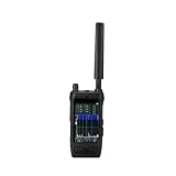
- Handheld drone detector covers 30-6000MHz full-band spectrum, helping you identify drone signals in your operating area
- Compact portable design allows easy carrying, making it convenient for field use and security applications
- Simple interface provides clear signal detection feedback, keeping you informed of nearby drone activity
- Ideal for security personnel and drone operators who need situational awareness, this detector helps monitor the airspace
- Durable construction and reliable performance make it a practical tool for signal detection in various environments
Plan sensor geometry and resilience
Use overlapping fields of view where practical. Place radar and RF equipment to reduce building shadowing and multipath, and place cameras where lighting and weather will not routinely defeat confirmation. Provide protected power, network paths and time synchronization. A design that loses all sensors when one cabinet or network segment fails is not layered in practice.
Implementation: an eight-step workflow
- Obtain legal and regulatory review. Ask counsel to assess RF monitoring, privacy, communications interception, spectrum use, data retention and any proposed mitigation. Coordinate with the FAA and relevant public-safety authorities before procurement.
- Survey the location. Document terrain, structures, clutter, lighting, weather, industrial noise, existing cameras, network routes and likely launch points. Identify where low-altitude line of sight is blocked.
- Write detection and response requirements. Specify the areas to cover, required alert lead time, track continuity, operator workload, evidence quality, retention period, cybersecurity controls and the public-safety notification path.
- Select complementary sensors. Use radar and RF for primary cues, then add EO/IR and acoustic coverage where they solve known blind spots. Keep mitigation components separable or disabled unless a legally authorized authority will operate them.
- Synchronize and calibrate. Synchronize sensor clocks to a common trusted time source. Record installation orientation, firmware versions, calibration results and the conditions of each test.
- Integrate track data. Configure the command interface to show one track with source sensors, confidence, last update, altitude, speed, heading and imagery. Prevent duplicate alarms from becoming multiple incidents.
- Test with controlled flights and nuisance sources. Test representative drone sizes and flight paths where authorized, along with birds, vehicles, cranes, helicopters, rain, fog and industrial noise. Document misses, false alarms, latency and recovery after a network or sensor outage.
- Train, operate and review. Train operators to verify rather than assume intent. Run exercises with security, emergency management and public safety, then revise thresholds, zones and contact procedures from the results.
How to compare detection systems
Use a weighted scorecard tied to the site’s risks. The following criteria expose differences that a product feature list often hides.
| Criterion | Questions to ask | Why it matters |
|---|---|---|
| Coverage and low-altitude performance | What area and altitude were demonstrated at this site? Where are terrain and buildings blocking line of sight? | A nominal range does not describe low-level coverage or shadowed sectors. |
| Detection in clutter | How does the system handle towers, cranes, birds, vehicles, vegetation and multipath? | Critical sites generate many non-drone returns and signals. |
| False alarms and track continuity | What nuisance sources were included in acceptance testing? How long does a track persist through a sensor handoff or brief signal loss? | Operators stop trusting systems that alarm constantly or lose tracks. |
| Remote ID and airspace integration | Can authorized Remote ID and airspace data be correlated with sensor tracks? Are unmatched broadcasts clearly marked? | Identification data should support, not replace, physical detection. |
| Weather and terrain resilience | What performance is documented in rain, fog, heat, wind, darkness and electromagnetic interference? | Environmental conditions can remove an entire modality. |
| Privacy and legal posture | What RF data is collected, where is it stored, who can access it and how is it deleted? | Monitoring communications may trigger federal and state legal duties. |
| Cybersecurity | Are devices hardened, patched, authenticated and segmented? Are logs exportable for evidence? | A connected sensor is part of the facility’s attack surface. |
| Staffing and maintenance | How many trained operators are needed? What calibration, subscription, replacement and support work is required? | Coverage that cannot be staffed or maintained is nominal only. |
| Mitigation separation | Can optional countermeasures be disabled and access-controlled independently? | Detection capability does not confer authority to mitigate. |
| Total cost and acceptance evidence | What are installation, networking, training, maintenance and test costs? What site-specific results are included? | There is no universal official price or accuracy benchmark; demand evidence for this location. |
Legal, privacy and governance boundaries
The interagency legal advisory notes that systems “often rely on radio-frequency (RF), radar, electro-optical (EO), infrared (IR), or acoustic capabilities, or a combination thereof.” The technology choice does not eliminate the legal analysis.
Free tools Windows power users keep installed
One-click scans. No signup required.
RF monitoring and communications law
RF systems that monitor communications can implicate the Pen/Trap Statute and the Wiretap Act, depending on what is collected, how it is processed and the jurisdiction. Obtain a written legal opinion before deployment. Limit collection to what the approved mission requires, encrypt stored data, restrict access, set a documented retention schedule and log every export.
Counter-UAS authority
Federal law grants specified counter-UAS powers to designated federal departments and, under conditions, trained state, local, territorial and tribal law-enforcement agencies. Private operators should not assume they may intercept, jam, disable or take control of an aircraft. FAA airport guidance does not support use of C-UAS mitigation systems by entities other than federal departments with explicit statutory authority. A private facility should use detection and reporting unless an authorized public agency directs otherwise.
Evidence and privacy controls
- Define who may view live tracks and who may export video, RF records or Remote ID data.
- Use synchronized timestamps and preserve the original files before analysis or conversion.
- Record sensor health, configuration and operator actions so an incident can be reconstructed.
- Document retention and deletion rules for imagery that includes people, homes or neighboring properties.
- Segment sensors from business networks, require strong authentication and patch them under a change-controlled process.
Incident handling from first alert to handoff
- Acknowledge the alert. Record the exact time, sensor source, zone, confidence and current track status.
- Check for expected activity. Compare the track with the authorized-flight schedule, known aircraft and the site baseline.
- Corroborate. Cue EO/IR, inspect radar kinematics, review RF and acoustic cues, and note which modalities agree or disagree.
- Query authorized data. If available and permitted, compare Remote ID and airspace-authorization information. Record a positive, unmatched or unavailable result without treating an unmatched result as proof of wrongdoing.
- Assess proximity and behavior. Note altitude, heading, speed, dwell time, approach to protected assets, launch or recovery behavior and any payload visible in imagery. Describe observable facts rather than assigning intent.
- Notify the right people. Follow the facility escalation matrix for security leadership, operations, emergency management and the appropriate public-safety authority. Use established contacts instead of improvising.
- Preserve evidence. Save original video, radar and RF records, screenshots, logs, radio traffic and the event timeline. Record the system configuration and weather.
- Close and learn. Document the disposition, update the baseline and correct sensor placement, thresholds or training if the event exposed a gap.
Common failure modes and practical fixes
“The system sees every bird as a drone.”
Review radar classification settings, camera confirmation rules and the nuisance baseline. Add independent cues before alerting an operator, and retest during the site’s busiest periods.
Rank #4
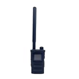
- Wide Frequency Detection: Covers 0-6GHz frequency range, enabling detection of various UAV signals for comprehensive monitoring.
- Dual-Language Support: Compatible with Russian and English, facilitating operation for users of different language backgrounds.
- Handheld Portable Design: Compact and lightweight, easy to carry for on-site UAV detection tasks and mobile monitoring.
- Drone Alarm Function: Triggers timely alarms upon detecting UAV signals, providing quick alerts for potential drone presence.
- UAV Detection Tool: Specialized for identifying drone signals, suitable for scenarios requiring UAV activity monitoring.
“There is no RF signal, so there is no drone.”
RF silence can result from autonomous flight, a different protocol, weak signal, obstruction or a sensor outage. Keep radar and optical coverage active and investigate sensor health before drawing a conclusion.
“The camera never confirms the radar track.”
Check line of sight, PTZ slew limits, focus, lighting, fog, rain and the time synchronization between systems. A camera may be aimed at the predicted position after the aircraft has already moved; use track history and a second viewpoint.
“Remote ID returned nothing.”
Verify receiver coverage, aircraft category, exceptions, signal timing and authorization to query the service. Treat the result as unavailable or unmatched, not as a legal finding.
“Operators ignore alerts.”
Measure nuisance alarms by zone and time of day, then adjust thresholds using controlled tests. Give operators a short verification checklist and require the system to show why an alert was generated.
“A vendor proposes jamming as the solution.”
Stop the purchase decision and obtain legal review. Detection, identification and mitigation are separate functions, and private ownership of equipment does not create authority to use a jammer or takeover capability.
PC Slower Than It Used to Be?
A free scan shows the junk files, broken settings and background clutter dragging Windows down - then fixes them in one click.Free scan · Windows 10 & 11Outdated Drivers Are Slowing You Down
One free scan finds every outdated or missing driver and matches the right update for your exact hardware.Free scan · exact hardware matchWhat to put in a procurement and operating specification
- A three-dimensional coverage map with documented blind spots and the site conditions used for testing.
- Sensor modalities, minimum track-update behavior, clock synchronization method and health monitoring.
- Fusion behavior, confidence scoring, alarm suppression and operator acknowledgment requirements.
- Remote ID and authorization-data interfaces that respect access controls and legal limits.
- Evidence export in native format, immutable timestamps, audit logs and retention controls.
- Cybersecurity requirements for authentication, encryption, segmentation, patching and incident response.
- Weather, electromagnetic-interference, acoustic-noise and power/network resilience requirements.
- Training, maintenance, calibration, spare parts, software support and acceptance-test responsibilities.
- A clear statement that any mitigation function is disabled or controlled by an authorized public agency.
- Named contacts and procedures for facility security, the FAA and local public safety.
Bottom line for facility owners
Start with a site survey, legal review and a written incident workflow. Deploy radar and RF as complementary primary cues, use EO/IR and acoustic sensing to verify and classify, and fuse the data into a time-synchronized track. Use Remote ID only as identification information for compliant broadcasts, never as a guarantee that every aircraft will be found. Preserve evidence, train people to describe observed behavior, and escalate through public-safety channels. Do not intercept, jam, disable or take control of a drone unless a specifically authorized authority is directing and legally empowered to do so.
Quick Recap
Product prices and availability are accurate as of the date/time indicated and are subject to change. Any price and availability information displayed on Amazon at the time of purchase will apply.

