EcoPath AI is described as an open-weight assistant for hikers that can identify plants, help plan routes and deliver voice-guided trail information. But “offline-first” is not enough to establish that those features work without a signal: the project’s described stack includes local models as well as services for voice synthesis, retrieval and cloud sync, and the available information does not specify which functions require internet access.
What EcoPath AI is described as doing
A DEV Community result dated October 6, 2026, presents EcoPath AI as an outdoor assistant for hikers and nature-trail users. It names three intended uses:
As an Amazon Associate I earn from qualifying purchases.
- Plant identification: helping users identify plant species.
- Route planning: assisting with hiking route plans.
- Voice-guided trail alerts: providing hands-free audio information on a trail.
These are author-reported descriptions, not independently verified capabilities. The project is presented as software for a phone or other device, not as a dedicated navigation unit. The available information does not establish its supported platforms, the accuracy of its plant identifications, or whether its route suggestions account for current hazards and trail conditions.
Quick wins for a faster PC:
Scan for outdated or missing drivers - takes under a minuteDriver Scan →Clear out junk files and repair common Windows errorsFree Scan →Does EcoPath AI work offline?
The description calls EcoPath offline-first and says it uses local open-weight models through Ollama. That supports a claim about local model inference, but does not prove that the entire assistant works without connectivity. The same description names ElevenLabs for voice synthesis, Backboard for retrieval-augmented memory, and Render for cloud sync. It does not document whether those services are optional, what features call them, or what data is sent.
#1 Best Overall
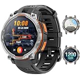
- 💎 OFFLINE MAPS FOR HIKING, RUNNING & CYCLING:Download and use offline maps directly on your smartwatch for hiking, running, cycling and outdoor fitness. Easily check routes without relying on a constant phone connection, making this smart watch for men a practical choice for outdoor training and adventure.
- 💎 GPS & COMPASS FOR MOUNTAIN ADVENTURES: Mens smart watch designed for hiking, climbing and mountain exploration, combining GPS positioning with an altimeter, barometer and digital compass. Track direction, altitude and outdoor conditions to stay better informed on the trail with reliable outdoor navigation.
- 💎 BUILT-IN FLASHLIGHT: The integrated flashlight adds extra convenience during camping, night walks, outdoor work or unexpected power outages at home. Designed as a rugged outdoor military smart watch, it helps you handle low-light situations, check gear and manage emergency repairs with confidence.
- 💎 CHATGPT & AI FEATURES FOR TECH LOVERS:Enjoy smarter everyday interaction with built-in ChatGPT and AI-powered features. Ask questions, get quick information and explore intelligent functions directly from your wrist, making this smartwatch ideal for tech enthusiasts who want more than basic fitness tracking.
- 💎 1.46" DISPLAY & AI WATCH FACES: Smart watches for men featuring a clear 1.46" vivid display make messages, fitness data and daily functions easy to read. This smart watch offers multiple AI watch faces and customizable dial styles to match work, sports, travel or casual outfits, creating a personalized everyday look.
Offline support is a feature-by-feature question, not a single yes-or-no label. Before relying on EcoPath beyond coverage, verify each of these directly with the project:
- Whether the model can be downloaded and run locally after setup, with no network connection.
- Whether voice input and spoken responses work offline, including any speech recognition or synthesis.
- Whether trail information or retrieval data is stored locally and available offline.
- Whether maps can be downloaded and used persistently without signal, and which areas they cover.
- Whether route planning works offline or needs live map, weather, trail or other data.
- Whether cloud sync can be disabled, and how precise location, photos, prompts and trail logs are handled.
Until those details are established, do not assume that “offline-first” means no internet ever, that every feature runs locally, or that all information stays on the device.
Rank #2
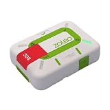
- Always connected: Travel beyond cell coverage with the safety and preparedness platform that delivers peace of mind, everywhere. Pair ZOLEO with your smartphone and stay connected with your Safety Circle, including adventurers, loved ones, and work teams responsible for duty of care. Send text messages and emails over the Iridium satellite network, cellular, or Wi-Fi using the lowest-cost network available (service plan required).
- Refreshed design: Stay connected with the ZOLEO experience you trust, now with a fresh new colour for easy identification, USB-C charging for compatibility with universal cords, and faster, more secure Bluetooth pairing.
- Instant Emergency SOS: SOS activates immediately on button press with no countdown delay. Connects to 24/7 emergency monitoring center. Access Medical Assist for non-emergency help.
- USB-C charging: Charges via universal USB-C, compatible with most cables, power banks, and car chargers.
- Optional Travel Risk Management Coverage: Feel more secure wherever you go with a Field Rescue Membership from Global Rescue. Affordably priced, this travel risk management add-on offers immediate medical coverage for safe extraction and transportation to the nearest capable medical facility.
Is it a navigation or safety tool?
The available EcoPath description does not establish safety validation or emergency-navigation capabilities. Treat any AI-generated identification, trail alert or route suggestion as informational—not as a substitute for reliable maps, current trail-condition information, sound judgment or emergency services. Carry navigation resources and make a route plan that remains usable if your phone loses signal or power.
How to compare EcoPath with other hiking apps
Two other projects illustrate why offline claims need to be checked at the feature level; their specifications should not be attributed to EcoPath.
Rank #3

- Compact and lightweight GPS handheld navigator boasts an anti-slip design offering a bright 3.2" screen that is sunlight readable, even in bright sunlight, plus, physical buttons provide more versatility in any conditions
- Get multi-GNSS support(GPS+GALILEO+BEIDOU+QZSS) for superior positional accuracy,so you know exactly where you are,location precision within 6 ft
- The handheld GPS navigator uses GPS technology to capture your trip or waypoint so you can guide back to your starting position
- Equip with 3-axis compass and barometric altimeter,follow your bearing on the digital compass, which provides an accurate heading even when stationary
- Hike in any weather with the water-resistant design (rated to IP66) ,Rechargeable battery can provide up to 36 hours of battery life in full charge, recharge easily with a standard USB-C cable
| Project | What its documentation says about offline use | Important distinction |
|---|---|---|
| EcoPath AI | Described as offline-first with local models through Ollama; offline requirements for voice synthesis, retrieval, maps and cloud sync are not stated in the available account. | Its platform support, device requirements, data handling and safety status are not established. |
| TrailGuard AI | Its GitHub documentation describes on-device model downloads, GPS tracking and saved offline map tiles. It gives approximate model storage of 2.4–3.4 GB and says map saving is Android-only. | Those storage figures and Android limitation apply to TrailGuard, not EcoPath. TrailGuard describes direct-line return guidance, not obstacle-aware trail routing. |
| EchoTrail | Its site says new AI stories need internet; GPS tracking and stories already generated or preloaded may work without coverage depending on cached content. | EchoTrail describes an audio-story experience, not a route-planning equivalent. It explicitly says it is not a safety, navigation or emergency tool. |
For any hiking assistant, ask whether it provides route guidance, informational storytelling or validated emergency support. Those are different functions, and a feature in one category does not establish capability in another.
Quick Recap
Best Value

- ULTRA-BRIGHT AMOLED DISPLAY: With peak brightness of 2,000 nits, the Amazfit smart watch delivers easy reading of maps and workout data in any light. Night mode and Glove Mode enhance visibility for clear viewing
- DURABILITY FOR EXTREME CONDITIONS: This rugged smart watch, engineered with a 316L stainless steel bezel, withstands temperatures from -22F to 158F, and is water-resistant to 328 feet and can be used for freediving to a depth of 147 Feet
- EXTENDED BATTERY LIFE: The Amazfit T Rex 3 offers over 3 weeks of power with typical use or up to 180 hours in GPS mode, providing long-lasting performance for hiking trips or outdoor activities
- PRECISION NAVIGATION TOOLS: The smart watch for men and women provides free global maps with dual-band positioning. Six satellite systems offer fast, accurate GPS connections and precise turn-by-turn navigation
- EXPANSIVE FITNESS TRACKING: This fitness watch offers 170plus workout modes and AI-generated training plans, providing real-time updates to guide your fitness journey from hiking to surfing
Rank #4

- Compact and lightweight GPS handheld navigator with bright 2.4" high-resolution color screen so you can easily follow your track
- 4 satellites (GPS, Galileo, BeiDou and QZSS) allow you to get optimal accuracy in challenging locations, including steep country, urban canyons and forests with dense trees
- Rechargeable battery can provide up to 20 hours of battery life in continuous use; recharge easily with a standard USB-C cable
- Equip with essential tools like GPS compass which provides an accurate heading, barometric altimeter, sunrise and sunset (No maps)
- Track navigation, Record your tracks before hiking,it can guide back to your starting position when you lost your direction,and store waypoints along a track
What to check before taking EcoPath on a hike
- Device fit: Confirm supported operating systems, model download size, memory and storage needs, and whether setup itself requires connectivity. No EcoPath requirements are established in the available account.
- Offline maps: Find out whether maps can be saved in advance, remain available in airplane mode and cover your intended area.
- Privacy: Determine whether precise location, images, voice recordings or trail logs are transmitted or synchronized, and whether those features can be switched off.
- Reliability: Do not treat plant labels or AI-generated route suggestions as verified. Check important decisions against dependable references and local information.
- Power and backup: Phone-based GPS and voice use can draw on battery. A power bank is ordinary hiking-kit advice, but no EcoPath-specific battery profile or required capacity is established.
Product prices and availability are accurate as of the date/time indicated and are subject to change. Any price and availability information displayed on Amazon at the time of purchase will apply.

