Drones are already part of organized wildfire response, helping incident teams observe fires, map perimeters, use infrared sensors, assess damage and support aerial ignition. AI is also being used in some wildfire-detection camera systems, while other AI applications and broader uncrewed-aircraft roles remain in research or testing. The available evidence does not establish routine front-line ground-robot deployments at active wildfires.
What drones do at wildfires today
Officially operated uncrewed aircraft systems (UAS) give fire managers another way to see conditions and gather information, not a replacement for crewed firefighting aircraft. The Federal Aviation Administration says UAS have provided persistent monitoring, fire-perimeter mapping and infrastructure-damage assessment in recent fire seasons, as well as situational awareness, hotspot detection and support for safer operations in high-risk environments.


As an Amazon Associate I earn from qualifying purchases.
The National Interagency UAS Program’s ordering guide, last updated August 25, 2026, describes three federal incident scenarios:
- Situational awareness, infrared observation and small-area mapping: Agency UAS may be ordered for these tasks; an order can specify electro-optical (EO) and infrared (IR) capabilities.
- Aerial ignition: Agency UAS can support planned ignition work, a specialized fire-management operation rather than general-purpose suppression.
- Large-fire support: Contracted Type 1 UAS can be ordered to support large fires.
The specific aircraft and payload depend on the mission. A visible-light camera can help crews observe conditions or map an area; an infrared sensor can help identify heat signatures. These capabilities support decision-making, but the sources do not establish that every fire team has every capability or that a drone can independently determine how crews should respond.
How drone operations fit into the airspace
Wildfire response aircraft share low-altitude airspace. Drones therefore have to be coordinated with crewed aircraft, incident procedures and any applicable airspace restrictions. A UAS may be useful only if it can fly safely and its information can reach the people managing the incident.
The FAA says Section 910 of the FAA Reauthorization Act of 2024 directs continued coordination with the National Interagency Fire Center (NIFC) and associated agencies, improved response times for emergency airspace access, and standardized coordination and safety procedures. The National Interagency UAS Program’s guide says cooperator pilots on federally managed incidents need a Department of the Interior (DOI) or U.S. Forest Service (USFS) cooperator letter; orders are coordinated through dispatch and regional UAS specialists. The program’s operational updates include an interagency airspace-conflict bulletin dated September 9, 2026, illustrating that procedures are active and can change.
Rank #2
- Good texture and have long service life.
- To ensure the practicality and durability.
- Small and exquisite appearance, with beautiful design.
- Convenient to use and with good performance.
- Great workmanship, perfect replacement for the old or damaged.
Can you fly your own drone near a wildfire?
No: do not fly a recreational drone over or near a wildfire. Follow FAA restrictions and local rules. A personal drone can conflict with firefighting aircraft, even if the pilot intends only to watch or record the fire.
Recommended Free Tools
DOI reported 53 unauthorized drone incursions during wildfires in 2025; 44 directly interfered with or threatened aerial firefighting operations. DOI also recorded four incursions through May 2026. U.S. Wildland Fire Service Director Brian Fennessy warned that managers may have to suspend aerial firefighting whenever a drone is spotted until it is confirmed clear. An unauthorized flight can thus interrupt aircraft operations precisely when crews need them.
Where AI is being used—and what remains research
AI has two distinct roles in the wildfire picture: camera networks that look for possible new fires, and research into tools that could support prediction and response. Evidence of one should not be treated as proof that all the others are operational.
AI-assisted early detection cameras
An Associated Press report describes camera systems that monitor remote and high-risk areas. It reports that Pano AI combines high-definition camera feeds with satellite data and AI monitoring, and that the cameras had been deployed in Australia, Canada and 17 U.S. states. The company said its technology detected 725 U.S. wildfires in the prior year. Those deployment and detection figures are company-reported, not an independent controlled evaluation of accuracy or effectiveness.
Rank #4

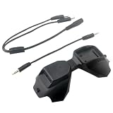
- D2A FPV Analog Adapter Module for FPV Goggles V1/V2 Used Compatible 5.8G TBS Fusion Wildfire Fire True D-X Each Accs
AP also reported Arizona Public Service meteorologist Cindy Kobold’s account that alerts arrived about 45 minutes faster on average than the first 911 call. That is a customer representative’s description of notification timing, not a general guarantee of how much earlier any camera system will detect a fire. CAL FIRE battalion chief Brent Pascua told AP that, in some cases, crews began a response before 911 was called and extinguished fires without receiving a 911 call. These examples help explain why earlier alerts matter, but they do not establish a manufacturer-independent performance rate.
The Tool Desk
Outbyte Driver Updater FREEFix the driver behind crashes, sound loss and screen glitchesFind Drivers →Outbyte PC Repair FREERepair Windows errors before they cause bigger problemsFix Now →Forest Service AI research
A U.S. Forest Service Research and Development fact sheet published May 27, 2026, describes partnerships with Microsoft, Google, the Department of Defense and other technology providers. The work is aimed at improving operations before, during and after wildfires, with innovations intended to be made freely available for firefighting response. The fact sheet describes research and development, not routine deployment of each capability.
Best Value
- Good texture and have long service life.
- To ensure the practicality and durability.
- Small and exquisite appearance, with beautiful design.
- Convenient to use and with good performance.
- Great workmanship, perfect replacement for the old or damaged.
The research directions include:
- Estimating fire growth using soil-moisture-informed machine-learning models, and studying how temperature change and wind turbulence relate to fuel-driven fire spread.
- Using deep learning to improve targeting of aircraft water and retardant drops.
- Developing AI-enabled UAS to detect new starts and assist firefighters.
- Supporting fuel-break planning and earlier wildfire warnings.
The sources do not provide a controlled trial, a peer-reviewed effectiveness estimate or a manufacturer-independent accuracy statistic for these AI applications. Treat them as active research unless an operational deployment is specifically documented.
Independent reader supportYour contribution helps us test, update, and keep practical guides available for everyone.What “robots could be next” means
In current wildfire coverage, “robots” can refer loosely to several different things: uncrewed aircraft, AI software, or ground machines. Those are not interchangeable. Drones already have documented operational support roles; some camera systems use AI; broader autonomous capabilities and ground robots are a separate question.
NASA’s Advanced Capabilities for Emergency Response Operations (ACERO) is working to enable UAS for communications, monitoring, logistics and suppression. CAL FIRE’s 2025 Office of Wildfire Technology Research and Development report says the effort includes safer airspace integration and information sharing among crewed aircraft, uncrewed aircraft and ground crews. It records a test of a portable airspace-management system on March 27–28, 2025, which added a three-dimensional view of airspace, and anticipated further testing through 2025 into 2026.
That work points toward more capable uncrewed aircraft and better coordination, but it is not evidence that autonomous aircraft or ground robots routinely suppress fires during active incidents. The available official evidence does not establish routine front-line ground-robot deployments with field results; that limitation does not rule out prototypes or local trials.
How to judge a wildfire-technology claim
A product label such as “AI,” “autonomous” or “robotic” does not tell you whether a capability is ready for an incident. To understand what a system can do, ask:
Quick Recap
- What mission is documented? Detection, mapping, infrared observation, ignition, logistics, communications and suppression are different tasks.
- What payload and operating conditions are involved? Sensors, endurance, connectivity and the environment affect what information a system can collect and deliver.
- How much autonomy is used? Find out what the system does itself, what a human must approve and who is responsible for acting on an alert or recommendation.
- How does it integrate with incident command and crewed aircraft? Airspace coordination and usable information are part of operational readiness, not optional extras.
- What is its maturity? Distinguish research, a field test, a documented operational use and routine deployment. A company-reported detection total or an individual customer’s account is not the same as a controlled, independent effectiveness study.
Product prices and availability are accurate as of the date/time indicated and are subject to change. Any price and availability information displayed on Amazon at the time of purchase will apply.

