Yes—but only on the map. In a 2020 Berlin artwork, Simon Weckert pulled a handcart containing 99 second-hand smartphones. Google Maps displayed a red congestion zone around the slowly moving group, even though there was no matching traffic jam on the road.
What Simon Weckert’s 99-phone artwork did
Weckert’s project, Google Maps Hacks, involved walking through Berlin with 99 second-hand phones in a handcart. Contemporary reports from The Guardian and Germany’s tagesschau.de said the cluster appeared in Google Maps as a slow-moving traffic obstruction. The artist’s project description presented the idea as turning a normally green street red and noted that map signals can influence people’s physical route choices.
As an Amazon Associate I earn from qualifying purchases.
| Element | What happened |
|---|---|
| Physical setup | One person moved a handcart containing 99 second-hand smartphones through Berlin. |
| Digital display | Google Maps showed a red congestion area around the slowly moving cluster. |
| Actual road conditions | The reported traffic jam was virtual; the stunt did not create a corresponding real-world road queue. |
Was the traffic jam real?
No. The people and phones were physically moving together in a cart, but the congestion shown on the map was a digital interpretation of location signals. There was no evidence that 99 vehicles were stuck or that the road itself became congested.
Crashes, No Sound, or Screen Glitches?
Random freezes, missing sound and display glitches usually trace back to one bad driver. Find and replace yours safely.Free scan · under a minutePC Slower Than It Used to Be?
A free scan shows the junk files, broken settings and background clutter dragging Windows down - then fixes them in one click.Free scan · Windows 10 & 11The demonstration also should not be read as proof that 99 devices is a permanent threshold. The reports describe what happened in that 2020 setup, not a guaranteed device count that will trigger traffic coloring today.
#1 Best Overall

- Universal unlocked. Compatible with all major U.S. carriers, including Verizon, AT&T, T-Mobile and other prepaid carriers.
- Super-bright, super-smooth 6.7" display. See your screen clearly even outdoors in sunlight, and enjoy seamless views with a fast-refreshing 120Hz display.*
- AI-powered camera system. Take stunning photos in any light with the 50MP camera**, look your best with a 32MP selfie cam*****, and capture extreme close-ups.
- Superfast 5G performance. Unleash your entertainment at 5G speed*** with the MediaTek Dimensity 6300 chipset and up to 12GB of RAM with RAM Boost****.
- Long-lasting battery + TurboPower charging. Power through day after day with a 5200mAh battery, then get hours of power in just minutes.****
How Google said Maps estimates traffic
In a September 3, 2020 explanation, Google Maps Product Manager Johann Lau wrote: “When people navigate with Google Maps, aggregate location data can be used to understand traffic conditions on roads all over the world.”
That explanation described traffic estimation as a combination of inputs rather than a single phone-counting rule:
Rank #2

- YOUR CONTENT, SUPER SMOOTH: The ultra-clear 6.7" FHD+ Super AMOLED display of Galaxy A17 5G helps bring your content to life, whether you're scrolling through recipes or video chatting with loved ones.¹
- LIVE FAST. CHARGE FASTER: Focus more on the moment and less on your battery percentage with Galaxy A17 5G. Super Fast Charging powers up your battery so you can get back to life sooner.²
- MEMORIES MADE PICTURE PERFECT: Capture every angle in stunning clarity, from wide family photos to close-ups of friends, with the triple-lens camera on Galaxy A17 5G.
- NEED MORE STORAGE? WE HAVE YOU COVERED: With an improved 2TB of expandable storage, Galaxy A17 5G makes it easy to keep cherished photos, videos and important files readily accessible whenever you need them.³
- BUILT TO LAST: With an improved IP54 rating, Galaxy A17 5G is even more durable than before.⁴ It’s built to resist splashes and dust and comes with a stronger yet slimmer Gorilla Glass Victus front and Glass Fiber Reinforced Polymer back.
- Aggregated location data: Location signals from people navigating with Google Maps can help indicate movement and speed on roads.
- Historical traffic patterns: Past conditions help establish what travel times are normally like at particular times and places.
- Machine-learning predictions: Google said it worked with DeepMind on models that predict travel times and likely traffic conditions.
- Additional sources and community contributions: Contemporaneous reporting quoted Google as saying traffic information is refreshed continuously using several sources, including aggregated, anonymized location data and information contributed by the Maps community.
These statements describe Google’s account in 2020. They do not establish every detail of the current Google Maps system, and they do not show that phone location is its only input.
Do these 3 things before closing this tab:
1Clear out junk files and repair common Windows errors2Scan for outdated or missing drivers - takes under a minute3Repair Windows errors before they cause bigger problemsWhy a cart of phones could affect the display
A map service must infer road conditions from patterns in location and movement data. A tightly grouped set of devices moving slowly along a road can resemble a group of vehicles traveling slowly, especially if the system is designed to identify unusual reductions in speed. In Weckert’s artwork, that interpretation produced the red traffic overlay.
Rank #3

- Charger NOT Included, 6.7" Super AMOLED FHD+, 90Hz Refresh Rate, 385 ppi, 800 nits (HBM), 1080x2340px, 5000mAh Battery
- 128GB, 4GB RAM, microSDXC, Exynos 1330 (5nm), Octa-Core, Mali-G68 MP2 or Mali-G57 MC2 GPU
- Rear Camera: 50MP, f/1.8 (wide) + 5MP, f/2.2 (ultrawide) + 2MP, f/2.4 (macro), LED flash, panorama, HDR; Front Camera: 13MP, f/2.0, Android 14, up to 6 major Android upgrades, One UI 6.1
- 3G: HSDPA 850/900/1700(AWS)/1900/2100; 4G LTE: 1/2/3/4/5/7/12/13/14/20/25/26/28/29/30/38/39/40/41/48/66/71, 5G: 2/5/25/41/66/71/77/78 SA/NSA/Sub6/mmWave - Nano-SIM + eSIM
- US Model – Global Connectivity – Compatible with Most GSM Carriers like T-Mobile, AT&T, MetroPCS, etc. Will Also work with CDMA Carriers Such as Verizon, Straight Talk.
The important distinction is between signal and reality: the phones supplied a cluster of location signals, while the road had no equivalent number of cars. The artwork exposed how an automated map can visualize an inferred condition without independently seeing every vehicle or confirming a physical queue.
What the stunt proves—and what it does not
It demonstrates a possible weakness in signal interpretation
The performance showed that a concentrated group of slow-moving devices could, under the reported conditions, affect the way congestion appeared in Maps. It made an abstract data process visible to anyone watching the map.
Rank #4

- YOUR CONTENT, SUPER SMOOTH: The ultra-clear 6.7" FHD+ Super AMOLED display of Galaxy A17 5G helps bring your content to life, whether you're scrolling through recipes or video chatting with loved ones.¹
- LIVE FAST. CHARGE FASTER: Focus more on the moment and less on your battery percentage with Galaxy A17 5G. Super Fast Charging powers up your battery so you can get back to life sooner.²
- MEMORIES MADE PICTURE PERFECT: Capture every angle in stunning clarity, from wide family photos to close-ups of friends, with the triple-lens camera on Galaxy A17 5G.
- NEED MORE STORAGE? WE HAVE YOU COVERED: With an improved 2TB of expandable storage, Galaxy A17 5G makes it easy to keep cherished photos, videos and important files readily accessible whenever you need them.³
- BUILT TO LAST: With an improved IP54 rating, Galaxy A17 5G is even more durable than before.⁴ It’s built to resist splashes and dust and comes with a stronger yet slimmer Gorilla Glass Victus front and Glass Fiber Reinforced Polymer back.
It does not reveal a universal exploit
The event does not establish that the same procedure works now, that any person can reproduce it reliably, or that a particular number of phones is sufficient everywhere. Google’s systems can change, and traffic estimates can combine multiple inputs and prediction methods.
Recommended Free Tools
It does not explain the entire traffic system
The artwork is a demonstration involving one location and one moment. It is not a complete reverse-engineering of Google’s traffic algorithms. It cannot show how Maps weighs different sources, detects anomalous clusters, filters errors, or communicates uncertainty in every case.
Best Value
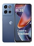
- Carrier: This phone is locked to Tracfone, which means this device can only be used on the Tracfone wireless network. Tracfone plan required, activating is easy, just 3 steps.
- DISPLAY: Immersive viewing on a 6.7-inch super-bright 120Hz display with powerful stereo speakers and Bass Boost for cinematic entertainment.
- CAMERA SYSTEM: Advanced 50MP Quad Pixel camera captures sharp, detailed photos and videos in any lighting condition
- PERFORMANCE: Lightning-fast 5G connectivity paired with a powerful processor and RAM Boost for smooth multitasking.
- BATTERY LIFE: Long-lasting 5000mAh battery with TurboPower charging technology delivers hours of power in minutes.
Google’s 2020 traffic figures in context
Google said in 2020 that people drove more than 1 billion kilometers with Google Maps each day across more than 220 countries and territories. The company also reported that its estimated arrival times were consistently accurate for more than 97% of trips. That percentage is a Google-reported figure, not an independently verified measurement in this account.
Google additionally said worldwide traffic fell by up to 50% when lockdowns began in early 2020. That figure illustrates how quickly real travel patterns can change; it is not a measurement of Weckert’s artwork or its effect on Berlin traffic.
Could this happen in Google Maps today?
The available accounts cannot answer that with certainty. They document a 2020 artwork and Google’s explanation from the same period, while current implementation details were not independently verified. Treat the incident as a historical demonstration of how location data can be interpreted—not as a current, guaranteed recipe for creating a map jam.
Quick Recap
The practical lesson for Maps users
- A red traffic line is an estimate, not a direct photograph of vehicles on the road.
- Map traffic can reflect aggregated and anonymized signals, historical patterns, predictive models and other information.
- Unusual or misleading signals can matter because automated systems infer conditions from data rather than confirming every physical event manually.
- When a route recommendation looks surprising, compare it with what you can observe locally and allow for uncertainty in the estimate.
Product prices and availability are accurate as of the date/time indicated and are subject to change. Any price and availability information displayed on Amazon at the time of purchase will apply.

