uDig
What uDig is
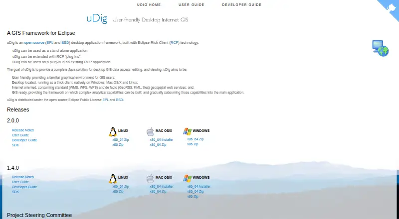
uDig is free, open-source desktop GIS software for accessing, viewing, editing, and analyzing geospatial data. Its Map Editor displays spatial information in layers that users can visualize and modify. The application runs natively on Windows, macOS, and Linux, either standalone or through Eclipse Rich Client Platform plug-ins. It supports WMS, WFS, WPS, GeoRSS, KML, and map tiles, with documented sources including shapefiles, PostGIS, WMS, and WFS. The guide also names Oracle and DB2 databases. Supported formats include GeoTIFF, GML, Shapefile, and World Plus Image; CSV and KML can be imported, while feature layers can be exported to KML and raster coverage to TIFF or ESRI ASCII. Style editing includes SLD import and export. Spatial Operations provide buffer, clip, dissolve, intersect, spatial join, split, and other tools. uDig is licensed under EPL and BSD terms, allowing organizational use without per-seat license costs. GML requires a schema and is limited to GML2 simple-content schemas.
Who it suits
uDig suits GIS users who need a free desktop application for layered map editing, multiple geospatial data sources, and spatial operations. Its plug-in architecture also fits organizations using Eclipse RCP applications.
What it does well
- Free and open source under EPL and BSD licenses
- Runs on Windows, macOS, and Linux
- Supports major web mapping services
- Provides layered map editing
- Includes spatial analysis operations
What to know first
- GML needs a schema for support
- GML is limited to GML2 simple content
- Files are read from disk rather than imported
Verdict
uDig provides broad desktop GIS access, editing, styling, and spatial-processing capabilities without per-seat license costs. Its plug-in architecture and format support are useful, though GML handling has specific limits.
Facts from uDig's own pages
- Architecture
- uDig is built with Eclipse Rich Client technology and can run standalone, as an RCP plug-in, or be extended with RCP plug-ins. · udig.github.io, 9 Oct 2026
- Databases
- The user guide says uDig handles databases such as PostGIS, Oracle, and DB2. · udig.github.io, 8 Oct 2026
- Data sources
- The user guide documents adding layers from shapefiles, PostGIS, WMS, and WFS. · udig.github.io, 8 Oct 2026
- Deployment
- uDig can run as a standalone application, be extended with Eclipse RCP plug-ins, or be used as a plug-in in an existing RCP application. · udig.github.io, 8 Oct 2026
- Desktop platforms
- The project describes uDig as a thick client running natively on Windows, Mac OS/X, and Linux. · udig.github.io, 9 Oct 2026
- File formats
- The user guide lists GeoTIFF, GML, Shapefile, and World Plus Image among supported spatial file formats. · udig.github.io, 9 Oct 2026
- Import and export
- The guide documents importing CSV and KML and exporting feature layers to KML and raster coverage to TIFF or ESRI ASCII. · udig.github.io, 8 Oct 2026
- License
- The project describes uDig as open source under the EPL and BSD licenses. · udig.github.io, 9 Oct 2026
- License cost
- The user guide says the EPL and BSD licenses allow organizations to use the project with no per-seat license. · udig.github.io, 8 Oct 2026
- Licensing
- uDig is open source and distributed under the EPL and BSD licenses. · udig.github.io, 8 Oct 2026
- Local data handling
- Files are read from disk rather than imported into uDig, and the guide says moving data off network drives may improve performance. · udig.github.io, 9 Oct 2026
- Map editing
- The Map Editor lets users visualize and edit spatial information organized as layers. · udig.github.io, 9 Oct 2026
- Maps and editing
- The map editor lets users visualize and edit spatial information organized into layers. · udig.github.io, 8 Oct 2026
- Notable limit
- The file-format guide cautions that many GIS formats consist of multiple same-name files with different extensions, and says all files in a set should be copied together. · udig.github.io, 9 Oct 2026
- Project origin
- The user guide says uDig originated at Refractions Research in Canada with funding from GeoConnections Canada. · udig.github.io, 8 Oct 2026
- Purpose
- uDig is an open-source desktop GIS framework for accessing, editing, and viewing GIS data. · udig.github.io, 9 Oct 2026
- Release notes
- The uDig 2.0 page describes that release as a bug-fix release and says it upgraded GeoTools to the 14.1.x series. · udig.github.io, 9 Oct 2026
- Spatial operations
- The Spatial Operations extensions include buffer, clip, dissolve, fill, hole cut, intersect, polygon-to-line, spatial join, and split operations. · udig.github.io, 9 Oct 2026
- Spatial toolbox
- The Spatial Toolbox can execute tools from loaded libraries on resources displayed in uDig; the guide describes loading OMS3-based JGrasstools modules. · udig.github.io, 9 Oct 2026
- Styling
- The Style Editor supports editing layer appearance and importing or exporting SLD style settings. · udig.github.io, 9 Oct 2026
- Support
- The project lists a user mailing list, developer mailing list, issue tracker, and IRC channel #udig as community resources. · udig.github.io, 9 Oct 2026
- Web services
- The project says uDig consumes geospatial services including WMS, WFS, WPS, GeoRSS, KML, and tiles. · udig.github.io, 9 Oct 2026
Where uDig stands on Freedom251
- GIS Software#27 of 64
- Geographic Information Systems#11 of 19