OpenLayers
What OpenLayers is
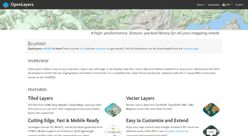
OpenLayers is a JavaScript library for putting dynamic maps into web pages. It can display tiles from OSM, Bing, MapBox, Stadia Maps, and other XYZ sources, as well as OGC mapping services and untiled layers. For vector data, it supports GeoJSON, TopoJSON, KML, GML, Mapbox vector tiles, and other formats. Rendering uses Canvas 2D and WebGL, and mobile support is included. Developers can style maps with CSS, extend them through the API or third-party libraries, and create custom profiles from selected components. Listed integrations and extensions include Cesium, Mapbox styles, Google Maps, ArcGIS REST services, React, Vue, and STAC. OpenLayers is free under the 2-clause BSD License, also known as the FreeBSD license. The recommended installation method is the `ol` package through npm. The hosted build is intended for development, not production; the full library build omits the `geotiff` and `ol-mapbox-style` packages. The API stays unchanged within a major release series, with changes accompanying a new major release. The site links to documentation, tutorials, a workshop, API references, GitHub tickets, and Stack Overflow questions.
Who it suits
It suits developers building web maps who need support for varied map sources and vector formats. Mobile support and custom styling are also available.
What it does well
- Supports tiles, OGC services, and untiled layers
- Renders numerous vector data formats
- Uses Canvas 2D and WebGL
- Mobile support is included
- Free under the 2-clause BSD License
What to know first
- Hosted build is not recommended for production
- Full library build omits geotiff and ol-mapbox-style
Limits
The hosted build is for development and is not recommended for production. The full library build leaves out the `geotiff` and `ol-mapbox-style` packages.
Plans
| Plan | Billed and limits | Price |
|---|---|---|
| OpenLayers | Completely free, open source JavaScript · No paid tiers stated | Free |
As openlayers.org lists them, read 8 Oct 2026. The maker's own page has the final word.
Getting started
- Open the OpenLayers website
- Install the `ol` package with npm
- Add OpenLayers to your web project
- Choose tile, mapping-service, or untiled-layer sources
- Load vector data in a supported format
- Style the map with CSS or extend it through the API
Verdict
OpenLayers provides broad mapping and rendering options for web development, with a stable API within each major release series. Use the npm package for production work rather than the hosted development build.
Questions
How much does OpenLayers cost?
It is listed as completely free, open-source JavaScript software at no cost, with no paid tiers stated.
Where does OpenLayers run?
OpenLayers is a web library installed through npm and used in web pages.
Which map sources can it use?
It supports OSM, Bing, MapBox, Stadia Maps, other XYZ sources, OGC mapping services, and untiled layers.
Which vector formats are supported?
Supported formats include GeoJSON, TopoJSON, KML, GML, Mapbox vector tiles, and other formats.
How is OpenLayers licensed?
The library uses the 2-clause BSD License, also called the FreeBSD license.
Does it provide API access and integrations?
Yes. Developers can extend it through its API, and listed integrations include Cesium, Mapbox styles, Google Maps, ArcGIS REST services, React, Vue, and STAC.
Facts from OpenLayers's own pages
- API stability
- Within a major release series, the API will not be changed, and API changes are accompanied by a new major release. · openlayers.org, 8 Oct 2026
- Audience
- The project describes OpenLayers as a full-featured mapping library emphasizing performance and interoperability. · opencollective.com, 8 Oct 2026
- Customization
- Maps can be styled with CSS and extended through the API or third-party libraries. · openlayers.org, 8 Oct 2026
- Development build limit
- The hosted build is for development and is not recommended for production; the full library build omits the `geotiff` and `ol-mapbox-style` packages. · openlayers.org, 8 Oct 2026
- Installation
- The recommended way to use OpenLayers is to install the `ol` package with npm. · openlayers.org, 8 Oct 2026
- Integrations
- The project lists third-party extensions and integrations including Cesium, Mapbox styles, Google Maps, ArcGIS REST services, React, Vue, and STAC. · openlayers.org, 8 Oct 2026
- Learning and support
- The site links to quick-start documentation, tutorials, a hands-on workshop, API documentation, GitHub tickets, and Stack Overflow questions. · openlayers.org, 8 Oct 2026
- License
- The library is released under the 2-clause BSD License, also called the FreeBSD license. · openlayers.org, 8 Oct 2026
- Map sources
- It supports tiles from OSM, Bing, MapBox, Stadia Maps, and other XYZ sources, as well as OGC mapping services and untiled layers. · openlayers.org, 8 Oct 2026
- Purpose
- OpenLayers is a JavaScript library for putting dynamic maps in web pages. · openlayers.org, 8 Oct 2026
- Rendering and mobile
- It uses Canvas 2D and WebGL, supports mobile out of the box, and lets developers build custom profiles from selected components. · openlayers.org, 8 Oct 2026
- Vector formats
- It can render vector data from GeoJSON, TopoJSON, KML, GML, Mapbox vector tiles, and other formats. · openlayers.org, 8 Oct 2026
Where OpenLayers stands on Freedom251
- Geo Tools#16 of 26
- Interactive Map Software#28 of 40