Freedom251 › GIS and Mapping Software
SAGA GIS
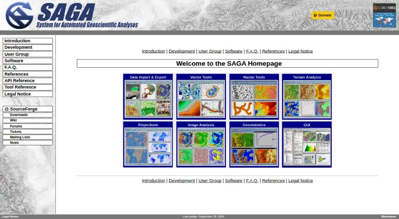
What SAGA GIS is
SAGA GIS is a desktop geographic information system for processing and analyzing geodata. You can access its modules through a graphical interface or scripting environments, including command-line tools and scripts in Python, Java, and R. Its tool library covers climate and weather processing, terrain analysis, hydrology, geostatistics, and geomorphology. For imagery, it includes image processing, classification, segmentation, photogrammetry, and OpenCV tools. Documented data interfaces include GDAL/OGR, PostgreSQL, ODBC, and PDAL, and its coordinate projection routines use PROJ. SAGA GIS is free and open source. The FAQ says most of its source code is GPL-licensed, while the API is LGPL-licensed and can be used in proprietary programs. It supports Windows and Linux; the FAQ says macOS should be possible, though the project page reports no experience with it. Windows users can run the portable version by unzipping the binaries and launching saga_gui.exe. Linux binaries may need system dependencies resolved before they run. The project directs users to its wiki, forums, trackers, and developers for help, and says it does not provide a hotline or guaranteed support. SAGA GIS is available for Windows, Linux, and macOS, and has no free trial.
Who it suits
SAGA GIS suits users working with geodata processing, including geoscience and imagery tasks. It also fits users who want GUI access alongside command-line or Python, Java, and R scripting, and can use the wiki, forums, trackers, or developers for help.
What it does well
- Free and open source, with most source code GPL-licensed.
- Modules are accessible through a GUI and scripting environments.
- Includes terrain, hydrology, climate, and geostatistics tools.
- Imagery library includes classification, photogrammetry, and OpenCV tools.
- Documents interfaces for GDAL/OGR, PostgreSQL, ODBC, and PDAL.
- Windows version can run portably from unzipped binaries.
What to know first
- Linux binaries may need dependency fixes before running.
- The project provides no hotline or guaranteed support.
- The FAQ reports no experience with macOS.
Plans
| Plan | Billed and limits | Price |
|---|---|---|
| SAGA GIS | Free and open source software; most source code is GPL, while the API is LGPL | Free |
As saga-gis.sourceforge.io lists them, read 7 Oct 2026. The maker's own page has the final word.
Getting started
- Visit the SAGA GIS website.
- Check the project website for information about your operating system.
- On Windows, unzip the portable binaries and launch saga_gui.exe if using the portable version.
- Use the graphical interface or a listed scripting environment to access modules.
- Consult the wiki, forums, trackers, or developers for help.
Verdict
Pick SAGA GIS if you want a free desktop GIS with geoscience and imagery tools, scripting options, and documented data interfaces. It may be a weaker fit if you need guaranteed support or depend on a macOS setup confirmed by the project.
Questions
Is SAGA GIS free?
Yes. SAGA GIS is free and open source, and its listed plan costs nothing.
Which operating systems does it support?
The FAQ lists Windows and Linux as supported. It says macOS should be possible, though the page reports no experience with it.
Can I use SAGA GIS from scripts?
Yes. The project lists command-line, Python, Java, and R scripting, alongside access through a graphical interface.
What are its licensing terms?
Most SAGA source code is GPL-licensed. The API is LGPL-licensed, which permits its use in proprietary programs.
Does it offer a free trial?
No. The software is free, and no free trial is offered.
What support is available?
The FAQ points users to the wiki, forums, trackers, and developers. It says there is no hotline or guaranteed support.
Facts from SAGA GIS's own pages
- Coordinate projections
- The tool library says its projection routines use PROJ. · saga-gis.sourceforge.io, 7 Oct 2026
- Data integrations
- The tool library documents interfaces for GDAL/OGR, PostgreSQL, ODBC, and PDAL. · saga-gis.sourceforge.io, 7 Oct 2026
- Geoscience tools
- The tool library includes climate and weather processing, terrain analysis, hydrology, geostatistics, and geomorphology tools. · saga-gis.sourceforge.io, 7 Oct 2026
- Imagery
- The tool library includes image processing, classification, segmentation, photogrammetry, and OpenCV tools. · saga-gis.sourceforge.io, 7 Oct 2026
- Interface
- Its modules can be accessed through a graphical user interface or scripting environments. · saga-gis.sourceforge.io, 7 Oct 2026
- Licensing
- The FAQ says most SAGA source code is GPL-licensed and the API is LGPL-licensed, permitting use of the API in proprietary programs. · saga-gis.sourceforge.io, 7 Oct 2026
- Linux dependency note
- The FAQ says Linux binaries may not run immediately if the system has unresolved dependencies. · saga-gis.sourceforge.io, 7 Oct 2026
- Portable Windows version
- The FAQ says the Windows version can be run portably by unzipping the binaries and launching saga_gui.exe. · saga-gis.sourceforge.io, 7 Oct 2026
- Purpose
- SAGA is a geographic information system for geodata processing and analysis. · saga-gis.sourceforge.io, 7 Oct 2026
- Scripting
- The project page lists command-line, Python, Java, and R scripting. · saga-gis.sourceforge.io, 7 Oct 2026
- Security and compliance
- The official pages opened describe licensing and software capabilities but do not state security certifications or compliance standards. · saga-gis.sourceforge.io, 7 Oct 2026
- Support
- The FAQ says SAGA has no hotline or guaranteed support; it points users to the wiki, forums, trackers, and developers. · saga-gis.sourceforge.io, 7 Oct 2026
- Supported operating systems
- The FAQ lists Windows and Linux as supported and says macOS should be possible, though the page reported no experience with it. · saga-gis.sourceforge.io, 7 Oct 2026
Where SAGA GIS stands on Freedom251
- GIS and Mapping Software#4 of 14
- GIS Software#20 of 64
- Geographic Information Systems#9 of 19
- Geo Tools#15 of 26