Freedom251 › Point Cloud Software

Global Mapper
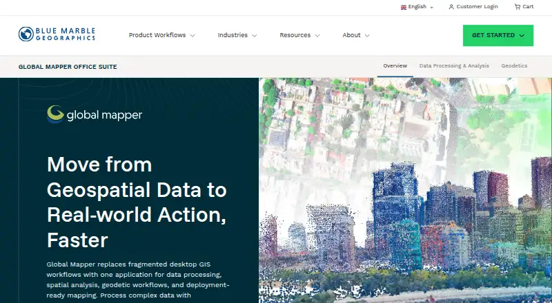
What Global Mapper is
Global Mapper is a desktop GIS application for processing geospatial data, spatial analysis, geodetic work, and preparing maps for deployment. It reads more than 300 vector, raster, elevation, and point cloud formats without add-ons or extra format licenses. Its capabilities depend on the plan: Essentials covers data viewing, conversion, coordinate transformation, reprojection, and streamed online data. Advanced adds terrain and vector analysis, scripting, workflow automation, advanced geodetic analysis, and professional map production. Professional adds lidar and point cloud processing, drone photogrammetry, complex imagery and raster analysis, automated breakline extraction, and AI/ML image classification.
Lidar tools include feature classification, noise removal, point cloud thinning, vector feature extraction, and photogrammetric outputs. The GeoCalc engine includes more than 12,000 geodetic definitions and supports modernized NSRS and CSRS. AI-assisted extraction can identify roads, buildings, vegetation, power lines, and other features. Global Mapper exchanges data with ArcGIS formats, exports to Avenza Maps for offline field use, and supports a workflow involving MAPublisher and Adobe Illustrator. Offline and air-gapped subscription access tokens are available through Blue Marble Hub. Plans start at $599 per user per year, and a trial is available.
Who it suits
Global Mapper suits GIS professionals, surveyors, engineers, government agencies, utilities, environmental consultants, and public safety organizations working with geospatial data. Teams that need lidar processing, advanced geodetics, or AI-assisted feature extraction should consider the Professional plan, which includes those capabilities.
What it does well
- Reads more than 300 formats without add-ons or extra licenses.
- Professional includes lidar, point cloud, and drone photogrammetry tools.
- GeoCalc provides more than 12,000 geodetic definitions.
- AI-assisted extraction identifies roads, buildings, vegetation, and power lines.
- Supports offline workflows and air-gapped subscription access tokens.
- Technical support is included with purchase for the current version.
What to know first
- No free plan is available.
- Professional starts at $2,199 per year.
- Current download compatibility is stated for 64-bit Windows systems.
Limits
The free trial lasts 14 days according to the pricing note. Essentials is limited to data viewing and conversion, coordinate transformation and reprojection, and streamed online data sources; terrain and vector analysis are in Advanced, while lidar and point cloud processing are in Professional.
Plans
| Plan | Billed and limits | Price |
|---|---|---|
| Advanced | Starting at $1,199 /yr · Everything in Essentials · Terrain and vector analysis · Scripting and workflow automation · Advanced geodetic analysis · Professional cartographic map production | $1,199 a year |
| Professional | Starting at $2,199 /yr · Everything in Advanced · Lidar and point cloud processing · Drone photogrammetry · Complex imagery and raster analysis · Automated breakline extraction · AI/ML image classification | $2,199 a year |
| Essentials | Starting at $599 /yr · Data viewing and format conversion · Coordinate transformation and reprojection · Streamed online data sources | $599 a year |
As bluemarblegeo.com lists them, read 7 Oct 2026. The maker's own page has the final word.
Getting started
- Visit the Global Mapper website.
- Request the free trial with an email address; a credit card is not required.
- Choose Essentials, Advanced, or Professional based on the required capabilities.
- Download the desktop software for a compatible 64-bit Windows system.
- Use Blue Marble Hub to obtain offline or air-gapped subscription access tokens if needed.
Verdict
Choose Global Mapper if your work needs broad geospatial format support, spatial analysis, or specialized geodetic and lidar tools. Essentials starts at $599 per year, while advanced production and point cloud capabilities require higher plans. Look elsewhere if you need a free plan or web mapping, which Global Mapper does not provide.
Questions
How much does Global Mapper cost?
Essentials is $599 a year, Advanced is $1,199 a year, and Professional is $2,199 a year.
Is there a free plan or trial?
There is no free plan. A 14-day trial is listed, and requesting it requires an email but no credit card.
Which platforms does it support?
The listed platforms are Android, iOS, and Windows. The current download page states compatibility with 64-bit Windows 11 and Windows Server 2019, 2022, and 2025.
Does Global Mapper support offline use?
Yes. It supports offline workflows, with self-service offline and air-gapped access tokens for subscriptions available through Blue Marble Hub.
What integrations does it offer?
It exchanges data with ArcGIS formats, exports to Avenza Maps for offline field use, and supports a MAPublisher workflow with Adobe Illustrator.
Who makes Global Mapper, and what support is included?
Global Mapper is from Blue Marble Geographics, headquartered in Hallowell, Maine. Technical support is included with purchase for the current software version.
Facts from Global Mapper's own pages
- AI tools
- AI-assisted feature extraction can identify roads, buildings, vegetation, power lines, and other features. · bluemarblegeo.com, 7 Oct 2026
- Data formats
- It supports over 300 file formats, including vector, raster, elevation, and point cloud data, without add-ons or additional licenses. · bluemarblegeo.com, 7 Oct 2026
- Founded
- 1993 · bluemarblegeo.com, 28 Sept 2026
- Geodetics
- The GeoCalc engine provides more than 12,000 geodetic definitions and supports modernized NSRS and CSRS. · bluemarblegeo.com, 7 Oct 2026
- Headquarters
- Hallowell, Maine, United States · bluemarblegeo.com, 28 Sept 2026
- Integrations
- The product supports data exchange with ArcGIS formats and can export to Avenza Maps for offline field use; MAPublisher provides a workflow with Adobe Illustrator. · bluemarblegeo.com, 7 Oct 2026
- Intended users
- The maker identifies GIS professionals, surveyors, engineers, government agencies, utilities, environmental consultants, and public safety organizations as users. · bluemarblegeo.com, 7 Oct 2026
- License options
- The license policy lists node-locked, floating, USB dongle, network, and enterprise license agreement options; Global Mapper perpetual licenses are available. · bluemarblegeo.com, 7 Oct 2026
- Lidar
- Its lidar and point cloud tools include feature classification, noise removal, point cloud thinning, vector feature extraction, and photogrammetric outputs. · bluemarblegeo.com, 7 Oct 2026
- Offline use
- Global Mapper supports offline workflows, with self-service offline and air-gapped access tokens available through Blue Marble Hub for subscriptions. · bluemarblegeo.com, 7 Oct 2026
- Platform
- The current download page states compatibility with 64-bit Windows 11 and Windows Server 2019, 2022, and 2025. · bluemarblegeo.com, 7 Oct 2026
- Purpose
- Global Mapper is a desktop GIS application for geospatial data processing, spatial analysis, geodetic workflows, and deployment-ready mapping. · bluemarblegeo.com, 7 Oct 2026
- Security
- The installation help page states that there are no known security vulnerabilities in the current version of Global Mapper. · bluemarblegeo.com, 7 Oct 2026
- Support
- Technical support is included with Global Mapper purchase and covers the current software version; the policy lists security patches, bug fixes, feature enhancements, and standard support. · bluemarblegeo.com, 7 Oct 2026
- Trial
- The free trial request requires an email and does not require a credit card; the page does not state a trial duration. · bluemarblegeo.com, 7 Oct 2026
Where Global Mapper stands on Freedom251
- Point Cloud Software#10 of 24
- GIS Software#31 of 64
- Geo Tools#20 of 26