Freedom251 › Tree Service Software
MyArborPro Survey App
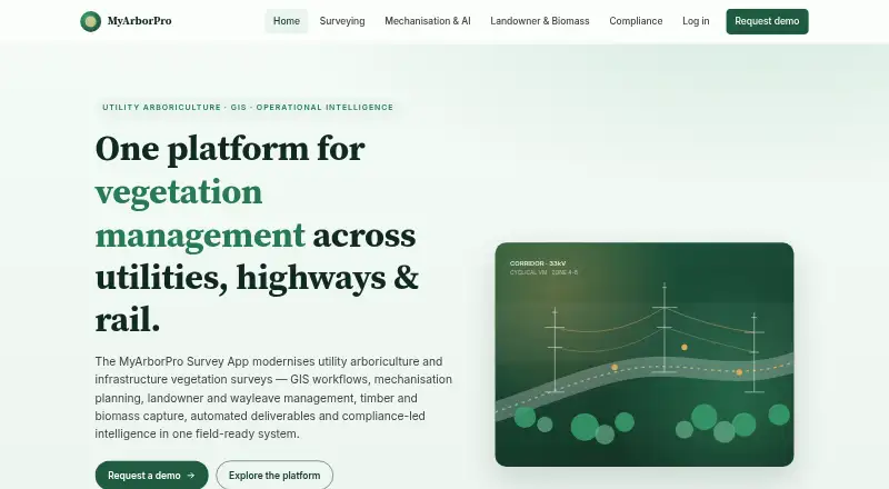
What MyArborPro Survey App is
MyArborPro Survey App is a web GIS platform for utility arboriculture, vegetation management and infrastructure surveying. Its field survey module supports inspections aligned with ENA G55/2, BS5837 and National Highways DMRB LA 104 / LA 119. Utility workflows record tree categories, risks and defects, conductor proximity, clearances and storm damage. Mapping and remote sensing options include GIS corridor maps, drone surveys, LiDAR and orthomosaic compatibility, plus satellite and aerial change detection. Field staff can use a what3words locator and export pins in job packs.
Planning tools estimate clearance time and forecast productivity from survey inputs such as DBH, vegetation density, terrain and access constraints. Compliance features include seasonal constraints, GIS exclusion zones, licence expiry alerts and ecological stop-work triggers. The platform can produce work packs, RAMS, constraint maps, quotes, dashboards and field-generated PDF and Word documents. Other listed capabilities include NRSWA Street Manager syncing, a Chapter 8 traffic management plan generator, consent and wayleave information tracking, and timber and chip valuation with BSL chain-of-custody records. Risk and work-priority scoring includes an audit trail for client handover. The product is presented for DNOs, contractors, asset owners and environmental teams.
Who it suits
MyArborPro suits DNOs, framework contractors, asset owners, National Highways and Network Rail contractors, and environmental teams coordinating vegetation or infrastructure surveys. It is especially relevant where field inspections, mapping, clearance planning and compliance workflows need to feed into work packs and client handover records.
What it does well
- Supports inspections aligned with named industry standards.
- Records utility tree, conductor clearance and storm damage details.
- Combines corridor mapping with drone, LiDAR and imagery compatibility.
- Estimates clearance time and productivity from survey conditions.
- Generates work packs, RAMS, maps, quotes and field documents.
- Includes consent, wayleave and biomass record tools.
What to know first
- Runs on web; no other platform is listed.
- Pricing is available on request.
- A tailored demo requires contacting the team.
Getting started
- Visit the MyArborPro website.
- Request a tailored demo through the contact page.
- Wait for a team member to respond within one working day.
- Use the web platform for surveying and related workflows.
Verdict
Choose MyArborPro if your work involves utility vegetation surveys and you need survey, planning, compliance and handover outputs in one GIS platform. It may be less suitable if you need a published price or a platform beyond web.
Questions
What does MyArborPro Survey App do?
It supports GIS-enabled utility arboriculture, vegetation management and infrastructure surveying, including field inspections, planning, compliance and deliverable generation.
What platforms does it support?
The listed platform is web.
How much does it cost?
Pricing is available on request.
Who is it intended for?
The product is presented for DNOs, framework contractors, asset owners, National Highways and Network Rail contractors, and environmental teams.
Can I request a demo?
Yes. The contact page invites tailored demo requests and says a team member will respond within one working day.
Facts from MyArborPro Survey App's own pages
- Audience
- The demo page names DNOs, National Highways supply-chain and framework contractors, Network Rail contractors, local authorities, infrastructure projects, arboricultural consultants and ecology consultancies as customer groups. · myarborpro.com, 11 Oct 2026
- Automated outputs
- The home page lists work packs, RAMS, GIS constraint maps, quotes and dashboards, with PDF and Word deliverables generated from field data. · myarborpro.com, 11 Oct 2026
- Compliance workflows
- The compliance page lists Network Rail workflows including work-in-proximity-to-track recording, OLE clearance checks, possession-planning inputs and audit-ready records. · myarborpro.com, 11 Oct 2026
- Deliverables
- Listed outputs include work packs, RAMS, GIS constraint maps, quotes, dashboards, and PDF and Word documents generated from field data. · myarborpro.com, 4 Oct 2026
- Ecology
- The home page describes automatic seasonal constraints, GIS exclusion zones, licence-expiry alerts and ecological stop-work triggers. · myarborpro.com, 11 Oct 2026
- Ecology and compliance
- The site describes automatic seasonal constraints, GIS exclusion zones, licence expiry alerts and ecological stop-work triggers. · myarborpro.com, 4 Oct 2026
- GIS and remote sensing
- The site lists corridor mapping, drone-assisted surveys, LiDAR and orthomosaic compatibility, and satellite and aerial change detection. · myarborpro.com, 11 Oct 2026
- Integrations
- The site lists direct API integration with what3words and optional QTRA integration. · myarborpro.com, 11 Oct 2026
- Intended users
- The product is presented for DNOs, framework contractors, asset owners, National Highways and Network Rail contractors, and environmental teams. · myarborpro.com, 4 Oct 2026
- Landowner and biomass tools
- The Landowner Hub tracks consent and wayleave information, while the biomass module covers timber and chip valuation and BSL chain-of-custody records. · myarborpro.com, 4 Oct 2026
- Landowner tools
- The Landowner Hub tracks landowner and per-circuit consent information and can generate consolidated wayleave letters. · myarborpro.com, 11 Oct 2026
- Mechanisation planning
- The planner estimates clearance time and forecasts productivity using survey data such as DBH, vegetation density, terrain and access constraints. · myarborpro.com, 4 Oct 2026
- Purpose
- MyArborPro describes itself as a GIS-enabled platform for utility arboriculture, vegetation management and infrastructure surveys. · myarborpro.com, 11 Oct 2026
- Sales and support
- The contact page invites users to request a tailored demo and says a team member will respond within one working day. · myarborpro.com, 4 Oct 2026
- Security
- The surveying page says risk and work-priority scoring includes a full audit trail for client handover. · myarborpro.com, 4 Oct 2026
- Streetworks
- The compliance page describes NRSWA Street Manager syncing and a Chapter 8 traffic management plan generator. · myarborpro.com, 4 Oct 2026
- Support and sales
- The demo page says a team member will respond within one working day and offers a tailored walkthrough for the customer's framework or site. · myarborpro.com, 11 Oct 2026
- Survey calculations
- The surveying page says Root Protection Areas are calculated automatically and risk and work-priority scoring includes an audit trail. · myarborpro.com, 11 Oct 2026
- Surveying
- The surveying module supports field inspections aligned with ENA G55/2, BS5837 and National Highways DMRB LA 104 / LA 119. · myarborpro.com, 4 Oct 2026
- Survey standards
- Its surveying module supports workflows aligned with ENA G55/2, BS5837:2012 and National Highways DMRB LA 104 and LA 119. · myarborpro.com, 11 Oct 2026
- Timber and biomass
- The biomass module tracks chip and log volumes, matches them with regional buyers and generates Biomass Suppliers List chain-of-custody records and delivery notes. · myarborpro.com, 11 Oct 2026
- Utility surveys
- Survey fields include tree risk and defects, conductor proximity, vegetation-to-line clearance, hazard prioritisation and cyclical management planning. · myarborpro.com, 11 Oct 2026
- Utility workflows
- Utility features include tree categorisation, risk and defect recording, conductor proximity measurements, clearance recording and storm damage workflows. · myarborpro.com, 4 Oct 2026
- what3words integration
- The field locator integrates with the what3words service and can export field pins in job packs. · myarborpro.com, 4 Oct 2026
Where MyArborPro Survey App stands on Freedom251
- Tree Service Software#27 of 27