Freedom251 › Location Intelligence Software
LocationAPI
What LocationAPI is
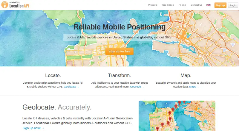
LocationAPI is a geolocation API that estimates where connected devices are from visible cellular towers and WiFi networks, without requiring GPS. Its Geolocation API uses cellular and WiFi data, datasets, and algorithms to calculate locations, and describes worldwide reach for IoT, M2M, and other connected devices. Requests are sent as JSON POST requests to a regional endpoint. The documentation includes examples for cURL, PHP, Python, and JavaScript, as well as an interactive sandbox. A request can contain up to 7 cells and 15 WiFi objects. WiFi positioning is enabled for eligible deployments according to region and intended use.
Location estimates depend on the source and location. The FAQ gives approximate cell-based accuracy of 450 metres in urban areas and 1500 metres in rural areas; for WiFi, it gives around 25–50 metres in urban areas and 50–150 metres in rural areas. The free Developer plan has daily and monthly request limits and is labeled “no commerical use.” Business offers flexible usage options, custom SLAs, and contracts; its price is priced on request, described as low as $0.10 per device. The documentation recommends scoped access tokens, stored server-side and rotated regularly. The company is based in Jubilee Hills, Hyderabad, Telangana, India.
Who it suits
LocationAPI suits developers building location features for IoT, M2M, or other connected devices where cellular and WiFi positioning can be used without GPS. The free Developer plan is limited to non-commercial use, while the Business plan is aimed at projects needing flexible usage, custom SLAs, or contracts.
What it does well
- Calculates locations from cellular and WiFi data without GPS.
- Describes worldwide reach for IoT, M2M, and connected devices.
- Provides cURL, PHP, Python, and JavaScript examples.
- Includes an interactive API sandbox.
- Business offers custom SLAs and contracts.
What to know first
- Developer plan has daily and monthly request limits.
- Developer plan is labeled “no commerical use.”
- WiFi positioning depends on deployment region and intended use.
Limits
The free Developer plan has daily and monthly request limits and is marked for no commercial use. Each request can include at most 7 cells and 15 WiFi objects.
Plans
| Plan | Billed and limits | Price |
|---|---|---|
| Developer | limited requests · no commercial use · email support | Free |
| Business | as low as $0.10 /device · scale to millions of requests · custom SLA & Contracts | $0.10 |
As locationapi.org lists them, read 8 Oct 2026. The maker's own page has the final word.
Getting started
- Open the LocationAPI website and review the Geolocation API documentation.
- Try the interactive sandbox or use a documented cURL, PHP, Python, or JavaScript example.
- Choose the Developer or Business plan for the project.
- Send JSON POST requests to a regional endpoint, including up to 7 cells and 15 WiFi objects.
- Use scoped access tokens, keep them server-side, and rotate them regularly.
Overview
LocationAPI is a geolocation API that estimates connected-device positions from cellular and WiFi signals rather than GPS. It is best suited to developers building location lookup into IoT or M2M services; its focused JSON interface and code examples are useful, but commercial use requires a paid plan and WiFi positioning is conditional.
Requests go to a regional endpoint as JSON POSTs and may include up to seven cells and 15 WiFi objects. The service combines cellular and WiFi data with datasets and algorithms, and is described as covering connected devices anywhere in the world. That reach does not mean uniform precision: typical cell-based estimates are around 450 metres in urban areas and 1,500 metres in rural areas, while WiFi-based estimates are around 25–50 metres in urban areas and 50–150 metres in rural areas. Those ranges make it important to match the expected location quality to the application, especially where WiFi positioning is not eligible.
Key features
The documentation provides ready-made cURL, PHP, Python, and JavaScript examples, along with an interactive sandbox. These are practical aids for teams using those languages, but the core offering remains an API rather than a complete mapping or location-planning environment.
WiFi positioning is enabled only for eligible deployments, depending on region and intended use. Teams relying on its tighter typical accuracy should confirm eligibility before building around it; otherwise, cell-based results can be much less precise. Each request can carry a useful batch of cell and WiFi inputs, though the caps of seven cells and 15 WiFi objects may constrain larger submissions.
For security, the documentation recommends scoped access tokens, keeping tokens on the server, and rotating them regularly. That is sound guidance for an API handling location requests, but it places token management squarely on the integrating team.
Geocoding, Timezone, Maps, and Static Maps are being phased out on this platform, with new integrations for those products directed to LocationIQ. LocationAPI is therefore a narrower choice for device geolocation, not a reason to start a new integration with those sunset services.
Pricing
The Developer plan costs nothing and includes limited requests and email support, but it is labeled “no commerical use.” It is a sensible way to evaluate the API or build a noncommercial project within its daily and monthly limits, not a free tier for a production business service. A free trial is also offered.
The Business plan is priced on request, billed as low as $0.10 /device. It scales to millions of requests and includes custom SLAs and contracts, with flexible usage options based on project needs. This is the relevant tier for commercial deployments, though the per-contact framing means teams should assess expected usage before committing. The company aims to answer queries within one business day and offers dedicated support plans for enterprise customers.
Platforms
LocationAPI supports Android, API, and web. Its integration model is centered on JSON requests, so the platform list is most useful to teams seeking to connect an application or service to the API rather than buyers looking for a standalone desktop mapping tool.
Who it's for
LocationAPI fits developers and product teams that need to estimate the position of connected devices using cellular or WiFi signals, particularly in IoT and M2M services where GPS is unavailable or unsuitable. The Developer plan can support limited noncommercial use; businesses should consider Business and verify WiFi eligibility and expected accuracy for their deployment.
It is a poor fit for teams seeking drive-time analysis, territory planning, or demographic data: those capabilities are not offered. It is also not the right place to begin a new geocoding, timezone, or mapping integration, since those products are being phased out.
Pros and cons
- Pros: JSON POST integration, working examples in four languages, and a sandbox give developers concrete ways to get started.
- Pros: Cellular and WiFi positioning can estimate device locations without GPS, with materially tighter typical WiFi accuracy where an eligible deployment can use it.
- Pros: Business usage can scale to millions of requests and includes custom SLAs and contracts.
- Cons: The free Developer plan prohibits commercial use and has daily and monthly request limits, so it cannot serve as a cost-free business tier.
- Cons: WiFi positioning depends on region and intended use, and cell-based accuracy can be coarse, particularly in rural areas.
- Cons: Request payloads are capped at seven cells and 15 WiFi objects, and broader mapping-related products are being phased out.
Alternatives
Location Intelligence Software is a useful starting point for comparing products across the category.
- Crowd Connected is worth considering when indoor positioning is the priority: its free plan includes one floorplan, unlimited area and MAUs, with limited email support.
- Mapbox Studio suits buyers seeking a mapping studio; the product is free to Mapbox users, though related API and custom tileset usage may be billed separately.
- Sitewise Analytics is a better fit for market analysis, with 70 curated geospatial data variables and eight preset trade area options in its Market Grid plan, which requires a Sitewise account.
- Azure Maps may suit teams wanting a broader mapping service with a free transaction tier spanning Data, Geolocation, Search, Spatial Calculations, and imagery-related services.
- Foursquare is another option for teams evaluating spatial tools, with free community plans for its Spatial Desktop and Spatial Studio products.
- Locus is relevant for readers who want map browsing and measuring tools, with a free account adding population, density, and gender snapshots.
- Mapline is an alternative mapping platform with a free Mapping Starter plan.
- Placer.ai offers a free, limited display of its platform for readers considering a broader location intelligence product.
Verdict
Choose LocationAPI for a focused way to estimate connected-device locations from cellular or WiFi inputs when GPS is not an option and your team can work with a JSON API. Its examples, sandbox, and stated global reach make it a practical developer-oriented choice, but the free plan is noncommercial, cell accuracy can be coarse, and WiFi use is conditional. Commercial projects should weigh the Business plan against their expected contact volume; teams needing mapping suites, planning tools, or demographic analysis should look elsewhere.
Verdict
Choose LocationAPI if your application needs to estimate connected-device locations from cellular or WiFi signals and can work with its JSON API. The free Developer plan has request limits and no commercial use; projects needing commercial usage can consider Business, whose price is listed as price on request.
Questions
Does LocationAPI have a free plan?
Yes. The Developer plan is listed as free, with limited requests and no commercial use.
What does the Business plan cost?
It is priced on request, with a rate described as low as $0.10 per device.
How does the Geolocation API receive requests?
Requests are JSON POST requests sent to a regional endpoint.
What platforms are listed for LocationAPI?
The listed platforms are Android, API, and web.
What accuracy does the FAQ give?
It gives approximate cell-based accuracy of 450 metres in urban areas and 1500 metres in rural areas. WiFi estimates are around 25–50 metres in urban areas and 50–150 metres in rural areas.
Is WiFi positioning available for every deployment?
It is enabled for eligible deployments based on region and intended use.
Facts from LocationAPI's own pages
- Accuracy guidance
- The FAQ says typical accuracy varies by data source and location, with cell-based results around 450 metres in urban areas and 1500 metres in rural areas, and WiFi-based results around 25–50 metres in urban areas and 50–150 metres in rural areas. · unwiredlabs.com, 8 Oct 2026
- API integration
- Requests to the Geolocation API are sent as JSON POST requests to a regional endpoint. · docs.unwiredlabs.com, 8 Oct 2026
- Code examples
- The documentation provides ready-made cURL, PHP, Python, and JavaScript examples and an interactive sandbox. · docs.unwiredlabs.com, 8 Oct 2026
- Commercial use
- The Developer plan is labeled “no commerical use.” · unwiredlabs.com, 8 Oct 2026
- Global reach
- The Geolocation API is described as locating IoT, M2M, and other connected devices anywhere in the world. · docs.unwiredlabs.com, 8 Oct 2026
- Headquarters
- The contact page lists an address in Jubilee Hills, Hyderabad, Telangana, India. · locationapi.org, 8 Oct 2026
- Location sources
- The Geolocation API uses cellular and WiFi data, datasets, and algorithms to calculate device locations. · docs.unwiredlabs.com, 8 Oct 2026
- Pricing limits
- Free Developer Plans have daily and monthly request limits; Business Plans offer flexible usage options based on project needs. · unwiredlabs.com, 8 Oct 2026
- Purpose
- LocationAPI locates connected devices from visible cell towers and WiFi networks without needing GPS. · docs.unwiredlabs.com, 8 Oct 2026
- Request limits
- A request can include up to 7 cells and 15 WiFi objects. · docs.unwiredlabs.com, 8 Oct 2026
- Security
- The documentation recommends scoped access tokens, keeping tokens server-side, and rotating them regularly. · docs.unwiredlabs.com, 8 Oct 2026
- Sunsetting products
- Geocoding, Timezone, Maps, and Static Maps are being phased out on this platform, and new integrations are directed to LocationIQ. · docs.unwiredlabs.com, 8 Oct 2026
- Support
- The FAQ says the company aims to reply to every query within one business day and offers dedicated support plans for enterprise customers. · unwiredlabs.com, 8 Oct 2026
- WiFi eligibility
- WiFi positioning is enabled for eligible deployments based on region and intended use. · docs.unwiredlabs.com, 8 Oct 2026
Where LocationAPI stands on Freedom251
- Location Intelligence Software#4 of 36