GeoNode
What GeoNode is
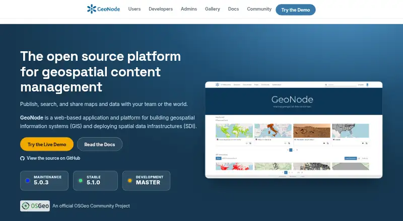
GeoNode is an open-source geospatial content management system for building GIS applications and deploying spatial data infrastructures. Its tools cover creating and managing data and metadata, styling layers, and making map visualizations. Users can upload vector and raster data and build interactive maps, while a dashboard builder and web mapping support ways to present spatial information. Teams can share resources through groups and social features, with fine-grained permissions controlling access; datasets can be public or restricted to selected users. GeoNode lists support for OGC WMS, WFS, WCS, WMTS, and CSW standards. Built on Django, it provides REST APIs for customization and integration with other systems. The project describes Docker-based and bare installations on a host, and its documentation covers Django authentication and OAuth2 interactions with GeoServer. GeoNode is free software under GNU GPL v3 or later, with web, Linux, API, and self-hosted platforms. The official demo is described as having low security and not being suitable for production; its datasets are removed every Sunday. Production deployments should be secured, including replacing default administrator passwords and OAuth2 keys.
Who it suits
GeoNode suits users, developers, and administrators who need to create GIS applications or deploy spatial data infrastructure. It also supports non-specialized users who want to share data and create maps, with permissions for controlling access across teams.
What it does well
- Free and open-source under GNU GPL v3 or later.
- Handles vector and raster data with layer styling and interactive maps.
- Supports sharing through groups and fine-grained permissions.
- Lists five OGC standards for geospatial services and catalogs.
- REST APIs support customization and integration with other systems.
What to know first
- Production deployments require security configuration.
- The official demo is not production-ready and removes datasets every Sunday.
- No hosted plan or paid tier is listed.
Plans
| Plan | Billed and limits | Price |
|---|---|---|
| GeoNode | Free software under GNU GPL v3 or later · No hosted plan or paid tier listed on the pages reviewed | Free |
As geonode.org lists them, read 9 Oct 2026. The maker's own page has the final word.
Getting started
- Open the GeoNode website.
- Choose a Docker-based or bare installation on a host.
- Configure production security, including administrator passwords and OAuth2 keys.
- Use the web platform, API, Linux, or self-hosted deployment.
Verdict
Choose GeoNode if you need an open-source platform for managing spatial data, publishing maps, and controlling shared access. Its APIs, standards support, and deployment options suit developers and administrators as well as map-making teams. Treat the official demo as a temporary, low-security environment rather than a production deployment.
Questions
Is GeoNode free?
Yes. The GeoNode plan is free, and the software is open source under GNU GPL v3 or later.
Can I use GeoNode as a hosted service?
No hosted plan or paid tier is listed. The documentation describes Docker-based and bare installations on a host.
What platforms does GeoNode support?
The listed platforms are API, Linux, self-hosted, and web.
Which geospatial standards does GeoNode support?
The project lists OGC WMS, WFS, WCS, WMTS, and CSW support.
Is the official demo suitable for production?
No. The demo warns that it has low security and is not production-ready, and that datasets are removed every Sunday.
Facts from GeoNode's own pages
- Access control
- Datasets can be public or restricted to specific users. · docs.geonode.org, 9 Oct 2026
- Audience
- GeoNode is presented as a platform for users, developers, and administrators, including non-specialized users sharing data and creating maps. · geonode.org, 9 Oct 2026
- Collaboration
- Resources can be shared across teams using groups, social features, and fine-grained permissions. · geonode.org, 9 Oct 2026
- Data tools
- It includes tools to create and manage data, metadata, and map visualizations. · docs.geonode.org, 9 Oct 2026
- Deployment
- The documentation describes Docker-based and bare installations for deploying GeoNode on a host. · docs.geonode.org, 9 Oct 2026
- Integrations
- GeoNode is built on Django and provides REST APIs for customization and integration with other systems. · geonode.org, 9 Oct 2026
- Notable limit
- The official demo warns that it has low security and is not production-ready, and that datasets are removed every Sunday. · docs.geonode.org, 9 Oct 2026
- Publishing
- Users can upload vector and raster data, style layers, and build interactive maps. · geonode.org, 9 Oct 2026
- Purpose
- GeoNode is an open-source geospatial content management system for developing GIS applications and deploying spatial data infrastructures. · docs.geonode.org, 9 Oct 2026
- Security
- The documentation describes Django authentication and OAuth2-based interactions between GeoNode and GeoServer. · docs.geonode.org, 9 Oct 2026
- Security configuration
- The documentation recommends securing production deployments, including changing default administrator passwords and OAuth2 keys. · docs.geonode.org, 9 Oct 2026
- Standards
- The project lists support for OGC WMS, WFS, WCS, WMTS, and CSW standards. · geonode.org, 9 Oct 2026
- Support
- The project directs users and developers to community mailing lists for questions and discussion. · geonode.org, 9 Oct 2026
Where GeoNode stands on Freedom251
- GIS Software#3 of 64
- Geographic Information Systems#1 of 19
- Interactive Map Software#7 of 40