Freedom251 › Drone Analytics Software

DJI Terra
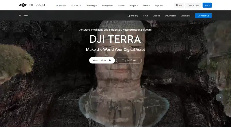
What DJI Terra is
DJI Terra is paid Windows desktop software for creating 2D and 3D reconstructions from visible-light images and processing DJI LiDAR data. It produces 3D models, point clouds, true digital orthophoto maps, and digital surface models, with export to industry-standard formats. Reconstruction includes 3D Gaussian Splatting. DJI says RTK-integrated mapping can reach centimeter-level accuracy without ground control points and meet 1:500 mapping standards. Listed compatible equipment includes Matrice 4E, Matrice 400, Zenmuse P1, Zenmuse L3, and D-RTK 3. Terra can import third-party LAS files and hand models to DJI Modify for editing or DJI Reality for visualization. Plans include Standard, Education, Agriculture, and Flagship, with no prices listed. A 30-day trial has usage limits.
Who it suits
DJI Terra suits mapping and surveying users working with DJI drones, visible-light imagery, or LiDAR on Windows computers. It is also relevant to teams needing orthophoto, point-cloud, GIS, or model exports.
What it does well
- Creates 2D and 3D reconstructions
- Processes DJI LiDAR data
- Exports point clouds and orthophotos
- Supports Gaussian Splatting
- 30-day trial available
What to know first
- Windows only
- Requires NVIDIA graphics
- Trial limited to one computer
Plans
| Plan | Billed and limits | Price |
|---|---|---|
| Standard | 1 device · Online or offline authorization · 1-year or permanent validity | On request |
| Education | 10 devices · Online authorization · Permanent validity · Contact to buy | On request |
| Agriculture | 3 devices · Online authorization · 1-year validity | On request |
| Flagship | 1 device · Online or offline authorization · 1-year or permanent validity | On request |
As enterprise.dji.com lists them, read 8 Oct 2026. The maker's own page has the final word.
Verdict
DJI Terra offers reconstruction, mapping outputs, and DJI equipment integration in a Windows desktop package. Confirm hardware compatibility and trial limits before committing.
Facts from DJI Terra's own pages
- Accuracy
- DJI says its RTK-integrated mapping can achieve centimeter-level accuracy without ground control points and meet 1:500 mapping standards. · enterprise.dji.com, 8 Oct 2026
- Download
- DJI lists the Terra V5.3.5 download as a Windows version, dated 2026-08-20. · enterprise.dji.com, 8 Oct 2026
- File compatibility
- The FAQ says DJI Terra can import third-party LAS point cloud files. · enterprise.dji.com, 8 Oct 2026
- Founded
- 2006 · enterprise.dji.com, 28 Sept 2026
- Gaussian splatting
- DJI Terra includes 3D Gaussian Splatting as a reconstruction technology. · enterprise.dji.com, 8 Oct 2026
- Hardware integration
- DJI lists compatibility with Enterprise drones and equipment including Matrice 4E, Matrice 400, Zenmuse P1, Zenmuse L3, and D-RTK 3. · enterprise.dji.com, 8 Oct 2026
- Headquarters
- Shenzhen, China · enterprise.dji.com, 28 Sept 2026
- Outputs
- It generates 3D models, point clouds, true digital orthophoto maps, and digital surface models, with export to industry-standard formats. · enterprise.dji.com, 8 Oct 2026
- Product
- DJI Terra creates 2D and 3D reconstructions from visible-light images and processes data collected by DJI LiDAR. · enterprise.dji.com, 8 Oct 2026
- Security
- DJI’s enterprise data-security page says it offers flexible deployment and data-residency options, strict access control, and protection backed by independent security certifications. · enterprise.dji.com, 8 Oct 2026
- Software integration
- The product page describes a one-click handoff to DJI Modify for model editing and integration with DJI Reality for model visualization. · enterprise.dji.com, 8 Oct 2026
- Support
- The FAQ directs users to DJI’s Terra preparation materials and download-page documentation for setup guidance. · enterprise.dji.com, 8 Oct 2026
- System requirements
- DJI Terra requires 64-bit Windows 10 or later and is not compatible with macOS or non-NVIDIA graphics cards, according to the FAQ. · enterprise.dji.com, 8 Oct 2026
- Trial limits
- The one-month trial is limited to one computer, reconstruction from at most 500 photos, and 8 GB of LiDAR data; it requires internet access and activation within three days of receiving the code. · enterprise.dji.com, 8 Oct 2026
Where DJI Terra stands on Freedom251
- Drone Analytics Software#4 of 22
- Drone Mapping Software#10 of 23
- Photogrammetry Software#25 of 34