
ALIGN
What ALIGN is
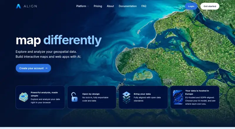
ALIGN is a cloud GIS platform for storing geospatial data, creating maps and GIS applications, and publishing them. Its browser-based Map Builder can visualize, edit, style, transform, analyze and publish spatial data without desktop installation. Supported formats include vector and raster data, WMS, WFS and GeoParquet. For 3D mapping, it works with LiDAR point clouds, Gaussian splatting scenes, 3D Tiles, city meshes, terrain and glTF models in the browser.
The App Builder provides templates, configurable widgets, AI assistance, live preview and MapLibre support. Team users can push projects to GitHub and deploy exported applications on their own infrastructure. Documented integrations include Supabase for managed PostgreSQL with PostGIS, as well as Mapillary, Google Street View, Mapbox, MapTiler and GitHub. ALIGN describes its documentation as intended for GIS-savvy people who are not developers, with no code required. The maker says data is stored and served from the European Union and that traffic is encrypted via TLS. Free, Pro and Team plans include community support and a feedback board.
Who it suits
ALIGN is aimed at GIS-savvy people who are not developers and want to build maps or GIS applications in a browser. Teams that need to export projects to GitHub and deploy them on their own infrastructure may also find the App Builder relevant.
What it does well
- Map Builder works in a browser without desktop installation.
- Supports vector, raster and other geospatial formats.
- Includes browser-based 3D mapping support.
- Team users can export projects to GitHub.
- Free plan includes community support and a feedback board.
What to know first
- Pro costs €39 per month, excluding VAT.
- Team costs €79 per editor licence monthly, excluding VAT.
- The listed enterprise plan is coming soon.
Limits
The Free plan includes one editor, 1 GB storage, 250 geocoding requests monthly, 1 GB of map traffic monthly, and up to three projects. Pro costs €39 per month excluding VAT and is limited to one editor, 10 GB storage, 5,000 monthly geocoding requests, 10 GB monthly map traffic, and up to 10 projects.
Plans
| Plan | Billed and limits | Price |
|---|---|---|
| Pro | €39 / month, excl. VAT · 1 editor · 200 AI credits/month · 10 GB storage · 5,000 geocoding requests/month · 10 GB/month map traffic · up to 10 projects | €39 a month |
| Team | €79 / editor licence / month, excl. VAT · 2–100 editor licences plus viewer licences · 1,000 AI credits/month for organization · 100 GB storage · 20,000 geocoding requests/month · 100 GB/month map traffic · unlimited projects | €79 a month |
| Free | One free month · 1 editor · 50 signup AI credits (one-shot) · 1 GB storage · 250 geocoding requests/month · 1 GB/month map traffic · up to 3 projects | On request |
| Enterprise | Coming soon · Custom usage limits · scalable editor and viewer licences · training and onboarding · invoice billing · dedicated manager · SSO, support, and enterprise options · tailored deployment needs | On request |
As aligngeo.com lists them, read 8 Oct 2026. The maker's own page has the final word.
Getting started
- Open the ALIGN website.
- Use the web-based Map Builder to work with geospatial data.
- Start with the Free plan, which includes one free month.
- Choose Pro at €39 per month, excluding VAT, for expanded limits.
- Choose Team at €79 per editor licence per month, excluding VAT, for team use and GitHub project export.
Verdict
ALIGN brings browser-based geospatial data work and app building together, with support for formats ranging from raster data to 3D scenes. Its plan details include a free option and paid Pro and Team tiers, with prices excluding VAT.
Questions
Is ALIGN free?
Yes. The Free plan is listed as one free month and includes one editor, 1 GB storage, and up to three projects.
What does Pro cost?
Pro costs €39 per month, billed monthly, excluding VAT.
Which platforms does ALIGN support?
ALIGN is available on the web.
Can ALIGN build 3D maps?
Its browser-based Map Builder supports LiDAR point clouds, Gaussian splatting scenes, 3D Tiles, city meshes, terrain, and glTF models.
What integrations are documented?
ALIGN documents Supabase for managed PostgreSQL with PostGIS, as well as Mapillary, Google Street View, Mapbox, MapTiler, and GitHub.
Can Team users deploy exported applications themselves?
Yes. Team users can push App Builder projects to GitHub and deploy the exported application on their own infrastructure.
Facts from ALIGN's own pages
- 3D mapping
- The Map Builder supports LiDAR point clouds, Gaussian splatting scenes, 3D Tiles, city meshes, terrain, and glTF models in the browser. · aligngeo.com, 8 Oct 2026
- AI data handling
- The Data Processing Agreement says customer personal data is not sold or used for advertising, ALIGN’s own purposes, or training machine learning models. · aligngeo.com, 8 Oct 2026
- App Builder
- The App Builder provides production-ready templates, configurable widgets, AI assistance, a live preview, and MapLibre support. · aligngeo.com, 8 Oct 2026
- Code export
- Team users can push App Builder projects to GitHub and deploy the exported application on their own infrastructure. · aligngeo.com, 8 Oct 2026
- Data formats
- The Map Builder supports vector and raster data, WMS, WFS, GeoParquet, and other geospatial formats. · aligngeo.com, 8 Oct 2026
- Data residency
- ALIGN states that customer data is stored and served from the European Union and that the service is GDPR-aligned; its Data Processing Agreement is included automatically without signing. · aligngeo.com, 8 Oct 2026
- Integrations
- ALIGN documents a Supabase connection for managed PostgreSQL with PostGIS; its docs also list Mapillary, Google Street View, Mapbox, MapTiler, and GitHub integrations. · aligngeo.com, 8 Oct 2026
- Intended users
- ALIGN describes its documentation as built for GIS-savvy people who are not developers, with no code required. · aligngeo.com, 8 Oct 2026
- Map Builder
- The browser-based Map Builder visualizes, edits, styles, transforms, analyzes, and publishes geospatial data without desktop installation. · aligngeo.com, 8 Oct 2026
- Purpose
- ALIGN is a cloud GIS platform for storing geospatial data, building maps and GIS applications, and publishing them. · aligngeo.com, 8 Oct 2026
- Security
- The maker states that traffic is encrypted via TLS, credentials are encrypted at rest with a key ALIGN does not hold, and uptime is monitored 24/7. · aligngeo.com, 8 Oct 2026
- Security roadmap
- SSO (SAML/OIDC), audit trail, customer-managed keys, ISO 27001 certification, and SOC 2 certification are listed as roadmap items. · aligngeo.com, 8 Oct 2026
- Support
- The pricing comparison includes community support and a feedback board on Free, Pro, and Team plans. · aligngeo.com, 8 Oct 2026
Where ALIGN stands on Freedom251
- GIS Software#11 of 64