OpenJUMP GIS
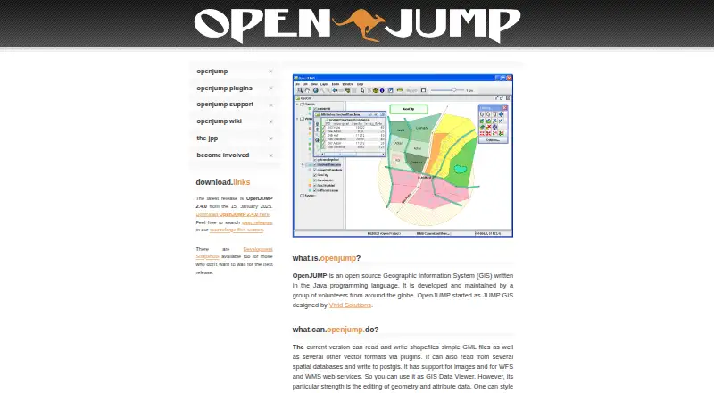
What OpenJUMP GIS is
OpenJUMP GIS is a free, open-source desktop geographic information system written in Java and maintained by volunteers. It runs on Linux, macOS, and Windows, and is designed for working with geometry and attribute data. The current version reads and writes shapefiles and simple GML files; plugins can add support for other vector formats. OpenJUMP can read from spatial databases, write to PostGIS, and work with WFS and WMS web services. For map work, it offers styling tools and lets users export a map view to SVG. Its vector analysis tools cover topology and overlay operations, while raster tools are available through extensions. The plugin ecosystem also includes database and format readers, printing, quality checks, charts, and GIS analysis tools. Extensions are added by placing a plugin JAR in the application's lib/ext folder and restarting OpenJUMP. The site lists version 2.4.0, dated January 15, 2025, as the latest release. Users can seek help through a forum or mailing list; developers have a separate mailing list, and bug reports and feature requests go through trackers. The project notes that OpenJUMP does not include every feature available in proprietary GIS software.
Who it suits
OpenJUMP suits desktop users in fields such as agriculture, government, nonprofits, and science or research who need to edit spatial data or perform vector analysis. Developers can also use it, with a separate mailing list and plugin extensions for additional capabilities.
What it does well
- Free, open-source desktop GIS.
- Runs on Linux, macOS, and Windows.
- Edits geometry and attribute data.
- Reads and writes shapefiles and simple GML.
- Works with spatial databases, PostGIS, WFS, and WMS.
- Supports topology and overlay analysis.
What to know first
- The project says it lacks some features found in proprietary GIS.
- There are no mobile apps.
- Other vector formats depend on plugins.
Limits
The free OpenJUMP plan is desktop software, and the project says it does not have all the features of proprietary GIS. Some additional vector formats and capabilities are available through plugins.
Plans
| Plan | Billed and limits | Price |
|---|---|---|
| OpenJUMP | Open source GIS; desktop software | Free |
As openjump.org lists them, read 8 Oct 2026. The maker's own page has the final word.
Getting started
- Visit https://openjump.org/ to find the project and its release information.
- Use OpenJUMP on a Linux, macOS, or Windows desktop.
- To add an extension, place its JAR file in OpenJUMP's lib/ext folder and restart the application.
- For questions, use the user forum or mailing list; developers can use the developer mailing list.
Verdict
Choose OpenJUMP if you need a free desktop GIS for spatial data editing, map styling, and vector analysis across Linux, macOS, or Windows. Look elsewhere if your work depends on features available only in proprietary GIS software or on a mobile app.
Questions
How much does OpenJUMP GIS cost?
The listed plan is free. It is open-source GIS desktop software.
Which operating systems does OpenJUMP support?
It runs on Linux, macOS, and Windows.
What data formats can OpenJUMP use?
The current version reads and writes shapefiles and simple GML files. Plugins add support for other vector formats.
Can OpenJUMP connect to databases and web services?
It can read from spatial databases, write to PostGIS, and work with WFS and WMS web services.
Is OpenJUMP open source, and who maintains it?
Yes. It is written in Java and maintained by volunteers around the globe.
How do I add a plugin?
Place the plugin JAR file in OpenJUMP's lib/ext folder, then restart the application.
Facts from OpenJUMP GIS's own pages
- Analysis
- The site describes vector analysis tools for topological analysis and overlay operations. · openjump.org, 8 Oct 2026
- Databases and services
- OpenJUMP can read from spatial databases, write to PostGIS, and work with WFS and WMS web services. · openjump.org, 8 Oct 2026
- Data editing
- It is designed for editing geometry and attribute data. · openjump.org, 8 Oct 2026
- Data formats
- The current version can read and write shapefiles and simple GML files, with support for other vector formats through plugins. · openjump.org, 8 Oct 2026
- Editing and analysis
- The site describes geometry and attribute editing, map styling, SVG export, and vector analysis tools for topology and overlay operations. · openjump.org, 8 Oct 2026
- Intended audience
- The SourceForge project page lists agriculture, developers, desktop end users, government, nonprofits, and science or research as intended audiences. · sourceforge.net, 8 Oct 2026
- Latest release
- The site lists OpenJUMP 2.4.0, dated January 15, 2025, as the latest release. · openjump.org, 8 Oct 2026
- Limitations
- The project says OpenJUMP does not have all the features of a proprietary GIS. · openjump.org, 8 Oct 2026
- Mapping and export
- Users can style map data and export the map view to SVG. · openjump.org, 8 Oct 2026
- Plugin examples
- Available plugin types include data format and database readers, print plugins, quality checks, chart visualization, GIS analysis, and raster tools. · openjump.org, 8 Oct 2026
- Plugin installation
- The plugin page says users can add an extension by placing its JAR file in OpenJUMP's lib/ext folder and restarting the application. · openjump.org, 8 Oct 2026
- Plugins
- Plugins include tools for additional data formats and databases, printing, quality checks, charts, GIS analysis, and raster operations. · openjump.org, 8 Oct 2026
- Plugin system
- Plugins and extensions add functionality outside the core; users install them by placing the JAR file in OpenJUMP's lib/ext folder and restarting the application. · openjump.org, 8 Oct 2026
- Product
- OpenJUMP is an open source Geographic Information System written in Java and maintained by volunteers around the globe. · openjump.org, 8 Oct 2026
- Professional support
- The support page says some companies offer professional support and custom development, and points to a support list on the wiki. · openjump.org, 8 Oct 2026
- Project limits
- The project says OpenJUMP does not have all the features of a proprietary GIS. · openjump.org, 8 Oct 2026
- Spatial databases
- It can read from several spatial databases and write to PostGIS. · openjump.org, 8 Oct 2026
- Support
- Users can ask questions in the user forum or mailing list, developers can use the developer mailing list, and users can report bugs or request features through trackers. · openjump.org, 8 Oct 2026
- Vector formats
- It can read and write shapefiles and simple GML files, with other vector formats available through plugins. · openjump.org, 8 Oct 2026
- Web services and imagery
- It supports images and WFS and WMS web services. · openjump.org, 8 Oct 2026
- Windows and Linux
- The SourceForge project page lists BSD, Linux, and Windows under operating systems. · sourceforge.net, 8 Oct 2026
Where OpenJUMP GIS stands on Freedom251
- GIS Software#17 of 64
- Geographic Information Systems#8 of 19