Some links on this page are affiliate links: if you buy through them we may earn a commission, at no extra cost to you.
India spans nearly 30 degrees of longitude—enough for about 117 minutes of difference in local solar time from west to east—yet its official clocks all show Indian Standard Time (IST), UTC+05:30. The map looks unusual because India chose one national civil-time standard rather than separate clocks that track the sun more closely in each region.
What the time-zone map is—and is not—showing
A world time-zone map shows the civil times governments use, not a precise map of where the sun rises or reaches its highest point in the sky. Time-zone boundaries are administrative choices: countries can follow geographic divisions, draw boundaries around political borders, or use one standard across a large area. A map’s colored bands are therefore useful for seeing which clock applies where, but they are not solar-time contours. Timeanddate’s time tools illustrate the distinction between zones and local time.
In India, the official clock is the same nationwide. That does not mean sunrise, sunset, or solar noon occurs at the same clock time everywhere. It means the country uses one shared civil-time standard.
What’s actually slowing this PC down?
Pick the symptom - the matching free tool is one click away.
Why India looks so wide on the map
India extends approximately from 68°07′E in the west to 97°25′E in the east, a span of about 29.3 degrees of longitude. Earth rotates 15 degrees per hour, or roughly four minutes per degree. So the approximate difference in local solar time between those extremes is:
#1 Best Overall

- 22.25 x 15.75 inches. Laminated. Flat map, tubed for shipping.
- A great reference to the world's time zones. A colourful, easy to read map showing the the time zones and country borders, naming most countries and a selection of cities around the world. Designed especially to work with any form of colour blindness this map is ideal for the classroom or office, as well as for the home. There is likely to be at least one child in every classroom that is colour blind.
- Scale 1: 72.500,000
29.3° × 4 minutes ≈ 117 minutes
That is nearly two hours. It is a difference in local solar time, not a two-hour difference between Indian clocks. Every region uses IST. The sun rises and reaches local noon earlier by the clock in the east than in the west, although the exact sunrise and sunset times also depend on latitude, season, terrain, and location. The longitude range and proposed time-zone arrangements are detailed in a 2018 Current Science paper by CSIR–National Physical Laboratory (NPL) researchers: the NPL study.
India’s one official time
India’s official standard is Indian Standard Time (IST), UTC+05:30. The CSIR–National Physical Laboratory, India’s national measurement institute, maintains and disseminates the standard. NPL’s IST metrology division describes that role, and its official clock display gives the current time standard. Microsoft’s Windows documentation also lists India Standard Time at UTC+05:30: Windows default time zones.
India does not make a nationwide daylight-saving-time change. The abbreviation IST can mean other standards in international contexts, including Irish or Israel Standard Time, so “Indian Standard Time” is clearest on first reference.
Free tools Windows power users keep installed
One-click scans. No signup required.
Rank #2
- 22.25 x 15.75 inches. Printed on paper. Flat map, tubed for shipping.
- A great reference to the world's time zones. A colourful, easy to read map showing the the time zones and country borders, naming most countries and a selection of cities around the world. Designed especially to work with any form of colour blindness this map is ideal for the classroom or office, as well as for the home. There is likely to be at least one child in every classroom that is colour blind.
- Scale 1: 72.500,000
A central meridian as a national compromise
India’s standard meridian is about 82°30′E, broadly near the country’s geographic center. It provides a common reference instead of requiring separate official clocks for regions far apart in longitude. A single standard can simplify coordination for railways, government, broadcasting, commerce, transport, and legal deadlines. Those practical considerations help explain the appeal of one national clock; they do not mean the clock is equally aligned with daylight in every region.
Using one time zone is a policy choice, not a geographic requirement. India’s clocks are internally consistent, even though the sun’s daily schedule varies substantially across the country.
Why the mismatch matters most in the east
Because eastern India lies farther from the standard meridian, daylight arrives earlier there relative to the official clock than it does in much of western India. In parts of the Northeast, sunrise and sunset can therefore feel early by the clock, and standard school, office, or transport schedules may not align as naturally with daylight as local residents would prefer.
Rank #3
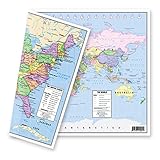
- TWO-SIDED MAP: One side features an attractive, political map of the United States in lively, pastel colors while the flip side reveals an equally attractive world map, providing accessible and functional use.
- UNITED STATES MAP: The United states map shows the clearly delineated fifty states (with Hawaii and Alaska as inserts), major cities, time zones and all state capitals marked in red stars.
- WORLD MAP: The world map presents nations of the world with an abundance of clear, concise and current geographical information. The Europe-inserted map provides a zoomed in map of Europe with a larger scale to clearly show this congested part of the world.
- MULTIPLE USES: The maps are an excellent reference source for home, office, and classroom uses. Students in all grades, teachers, and general adults could all benefit from the concise and clear presentation of US and World geographies.
- DURABLE THICK LAMINATION: The 5-mil double sided lamination provides protection and durability. DIMENSIONS: The exact dimensions are: 12-3/4" x 17-3/4". MADE in USA: The designs, printing, and lamination are all done in the United States by American Geographics.
There is no single daylight mismatch that applies equally to every eastern town or every season. Sunrise and sunset shift through the year, and latitude and local geography matter too. Communities and institutions may adapt routines informally, but official schedules remain on IST. The key distinction is: one national clock, different local daylight, and schedules that may or may not adapt to it.
The two-time-zone proposal
India has studied alternatives. In a 2018 paper, CSIR–NPL researchers proposed two zones: IST-I at UTC+05:30 and IST-II at UTC+06:30. The proposed boundary was near 89°52′E, around the West Bengal–Assam area, with IST-II intended for the far Northeast. The plan also considered separate timekeeping infrastructure and a boundary chosen partly with railway operations in mind. These were recommendations, not a change to current law or practice. Read the NPL proposal.
The researchers argued that a second zone could bring official working hours closer to daylight and better align daily routines with the light-dark cycle. A CSIR bulletin reported an estimate of about 20 million kilowatt-hours in annual electricity savings for states in the proposed second zone. That is a projected figure associated with the proposal, not a measured saving from a policy India has implemented. CSIR bulletin.
Rank #4

- 53.75 x 31.5 inches. Printed on paper. Flat map, tubed for shipping.
- Colorful yet informative map. Combined with a detailed political map of the world, contrasting colors are used to accurately depict the different time zones, both on land and in the oceans. Includes an additional map showing countries/states that adopt daylight saving hours.
- Scale 1:30,000,000
A separate bill introduced in the Lok Sabha in 2020 also reflected political interest in an additional time zone. It was an introduced bill, not proof that a second zone was enacted; its proposed geographic treatment also differed from the NPL study, including its treatment of the Andaman and Nicobar Islands. The introduced bill text.
Independent reader supportYour contribution helps us test, update, and keep practical guides available for everyone.Why a second clock is not a simple fix
Moving some regions an hour ahead could improve the fit between the clock and daylight, but it would also establish an internal time-zone boundary. Trains and other transport crossing it would need clear, reliable timetables. Broadcasters, government offices, businesses, and digital systems would have to handle two official times. People coordinating across states would need to account for the difference, and errors in schedules or records could create inconvenience or, in transport, safety concerns.
These are policy and implementation considerations, not a single documented explanation for why the proposal has not been adopted. A UTC+06:30 offset is technically possible—India already uses a half-hour UTC offset—but choosing it would still require decisions about the boundary, infrastructure, schedules, and whether anticipated benefits justify the coordination costs. The available official standard remains one nationwide time, UTC+05:30.
Best Value

- Express yourself with the design that fits your sense of humor, and political views, or promotes your cause and beliefs.
- Our high-quality bumper sticker is printed on durable 4mil vinyl with premium inks that resist the sun and elements, so your message will last for the long haul.
- These car decals are the perfect indulgence for your passion or make great novelty prank gifts for him or her.
- These car decals are the perfect indulgence for your passion or make great novelty prank gifts for him or her.
- Thoughtful Gift: Great for anyone who has a bumper, locker, skateboard, laptop, or any clean, smooth surface.
India is not the only country with one national clock
India is not the only geographically large country to use one official time nationwide: China is a prominent example. Russia, by contrast, uses multiple time zones. These comparisons show that a country’s size alone does not dictate its clock system. History, administrative choices, population distribution, transport, and governance all matter; another country’s arrangement is not automatically a suitable model for India. CSIR’s comparative discussion.
So is India in the “wrong” time zone?
No. A time zone is a legal and administrative standard, not a natural law requiring every place to follow its own solar time. India uses one official clock across a wide country, so the same clock reading corresponds to different positions of the sun in different regions. That makes the daylight mismatch real—especially in the east—but does not make India’s time standard incorrect.
The map is revealing an unusual trade-off: administrative uniformity in place of closer local alignment with the sun. A technically detailed two-zone alternative has been proposed, but India still officially operates on one nationwide time zone.
Quick Recap
Product prices and availability are accurate as of the date/time indicated and are subject to change. Any price and availability information displayed on Amazon at the time of purchase will apply.

